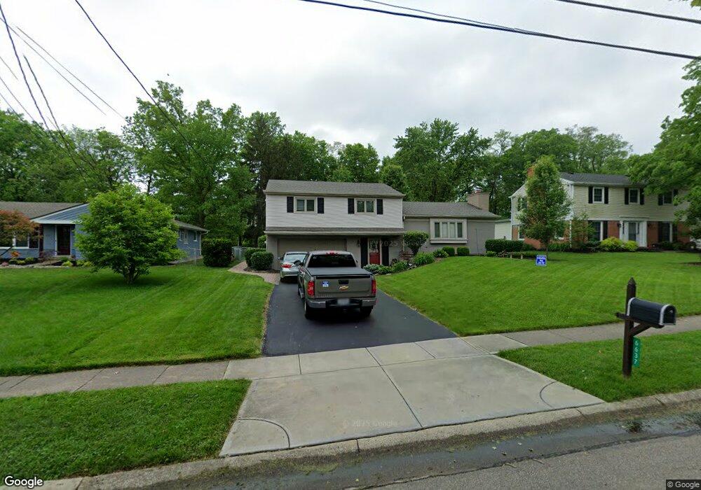
6637 Apache Cir Cincinnati, OH 45243
Estimated Value: $474,000 - $605,000
About This Home
This home is located at 6637 Apache Cir, Cincinnati, OH 45243 and is currently estimated at $518,925, approximately $279 per square foot. 6637 Apache Cir is a home located in Hamilton County with nearby schools including Madeira Elementary School, Madeira Middle School, and Madeira High School.
Ownership History
We collect this data history from publicly available records. To have your information removed, we recommend requesting removal directly through your county’s website.
Purchase Details
Home Financials for this Owner
Home Financials are based on the most recent Mortgage that was taken out on this home.Purchase Details
Home Financials for this Owner
Home Financials are based on the most recent Mortgage that was taken out on this home.Purchase Details
Home Financials for this Owner
Home Financials are based on the most recent Mortgage that was taken out on this home.Purchase Details
Home Financials for this Owner
Home Financials are based on the most recent Mortgage that was taken out on this home.Purchase Details
Home Financials for this Owner
Home Financials are based on the most recent Mortgage that was taken out on this home.Home Values in the Area
Average Home Value in this Area
Purchase History
We collect this data history from publicly available records. To have your information removed, we recommend requesting removal directly through your county’s website.
| Date | Buyer | Sale Price | Title Company |
|---|---|---|---|
| $200,000 | Stewart Title Company | ||
| $225,000 | Virtual Title Agency Inc | ||
| $224,000 | Technetitle Agency Inc | ||
| -- | -- | ||
| -- | -- |
Mortgage History
We collect this data history from publicly available records. To have your information removed, we recommend requesting removal directly through your county’s website.
| Date | Status | Borrower | Loan Amount |
|---|---|---|---|
| Open | $160,000 | ||
| Previous Owner | $180,000 | ||
| Previous Owner | $201,600 | ||
| Previous Owner | $110,800 | ||
| Previous Owner | $262,000 |
Tax History
We collect this data history from publicly available records. To have your information removed, we recommend requesting removal directly through your county’s website.
| Year | Tax Paid | Tax Assessment Tax Assessment Total Assessment is a certain percentage of the fair market value that is determined by local assessors to be the total taxable value of land and additions on the property. | Land | Improvement |
|---|---|---|---|---|
| 2025 | $7,486 | $127,320 | $48,741 | $78,579 |
| 2023 | $7,389 | $127,320 | $48,741 | $78,579 |
| 2022 | $5,373 | $75,650 | $37,132 | $38,518 |
| 2021 | $5,258 | $75,650 | $37,132 | $38,518 |
| 2020 | $4,865 | $75,650 | $37,132 | $38,518 |
| 2019 | $5,118 | $73,444 | $36,050 | $37,394 |
| 2018 | $5,159 | $73,444 | $36,050 | $37,394 |
| 2017 | $4,892 | $73,444 | $36,050 | $37,394 |
| 2016 | $4,796 | $67,900 | $15,946 | $51,954 |
| 2015 | $4,437 | $67,900 | $15,946 | $51,954 |
| 2014 | $4,462 | $67,900 | $15,946 | $51,954 |
| 2013 | $4,773 | $70,001 | $16,440 | $53,561 |
Map
- 6580 Minnewaukan Dr
- 6752 Rose Crest Ave
- 6761 Eleck Place
- 6453 Oldbarn Ct
- 7406 Dawson Rd
- 11 Camargo Canyon Dr
- 5995 Crabtree Ln
- 6866 Kenwood Rd
- 6847 Meadowdale Cir
- 7474 Dawson Rd
- 6041 Johnson St
- 7335 Demar Rd
- 7090 Euclid Ave
- 7112 Summit Ave
- 6420 Miami Rd
- 7317 Euclid Ave
- 6187 Lakota Dr
- 7708 Ahwenasa Ln
- 6807 Marvin Ave
- 6149 Saint Regis Dr
- 6643 Apache Cir
- 6639 Apache Cir
- 6649 Apache Cir
- 6653 Apache Cir
- 6644 Apache Cir
- 6650 Apache Cir
- 6640 Apache Cir
- 6629 Apache Cir
- 6659 Apache Cir
- 6634 Apache Cir
- 6654 Apache Cir
- 6746 Shawnee Run Rd
- 6724 Shawnee Run Rd
- 6770 Shawnee Run Rd
- 6626 Apache Cir
- 6660 Apache Cir
- 6663 Apache Cir
- 6623 Apache Cir
- 6700 Shawnee Run Rd
- 6555 Apache Cir
Ask me questions while you tour the home.