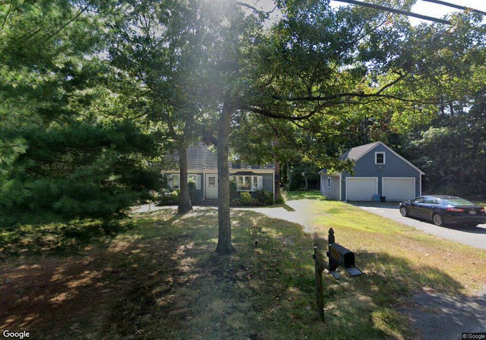
666 Santuit Rd Cotuit, MA 02635
Cotuit NeighborhoodEstimated Value: $448,000 - $851,000
3
Beds
2
Baths
1,589
Sq Ft
$438/Sq Ft
Est. Value
About This Home
This home is located at 666 Santuit Rd, Cotuit, MA 02635 and is currently estimated at $695,971, approximately $437 per square foot. 666 Santuit Rd is a home located in Barnstable County with nearby schools including West Villages Elementary School, Barnstable United Elementary School, and Barnstable Intermediate School.
Ownership History
Date
Name
Owned For
Owner Type
Purchase Details
Closed on
Dec 19, 2025
Sold by
Pontifex Ann M
Bought by
H2 Asset Solutions Inc
Current Estimated Value
Home Financials for this Owner
Home Financials are based on the most recent Mortgage that was taken out on this home.
Original Mortgage
$609,000
Outstanding Balance
$608,419
Interest Rate
6.22%
Mortgage Type
Purchase Money Mortgage
Estimated Equity
$87,552
Purchase Details
Closed on
Jan 15, 2019
Sold by
Furrer Stephen A and Crowell-Furrer Alicia N
Bought by
Pontifex James L and Pontifex Ann M
Purchase Details
Closed on
Nov 16, 2005
Sold by
Curran Linda R and Curran Thomas J
Bought by
Pontifex Ann M and Pontifex James L
Home Financials for this Owner
Home Financials are based on the most recent Mortgage that was taken out on this home.
Original Mortgage
$279,000
Interest Rate
6.07%
Mortgage Type
Purchase Money Mortgage
Create a Home Valuation Report for This Property
The Home Valuation Report is an in-depth analysis detailing your home's value as well as a comparison with similar homes in the area
Home Values in the Area
Average Home Value in this Area
Purchase History
| Date | Buyer | Sale Price | Title Company |
|---|---|---|---|
| H2 Asset Solutions Inc | $475,000 | -- | |
| Pontifex James L | -- | -- | |
| Pontifex Ann M | $429,000 | -- |
Source: Public Records
Mortgage History
| Date | Status | Borrower | Loan Amount |
|---|---|---|---|
| Open | H2 Asset Solutions Inc | $609,000 | |
| Previous Owner | Pontifex Ann M | $279,000 |
Source: Public Records
Tax History
| Year | Tax Paid | Tax Assessment Tax Assessment Total Assessment is a certain percentage of the fair market value that is determined by local assessors to be the total taxable value of land and additions on the property. | Land | Improvement |
|---|---|---|---|---|
| 2025 | $5,204 | $623,200 | $241,200 | $382,000 |
| 2024 | $4,741 | $601,700 | $241,200 | $360,500 |
| 2023 | $4,562 | $545,100 | $219,200 | $325,900 |
| 2022 | $4,429 | $428,300 | $150,800 | $277,500 |
| 2021 | $4,950 | $394,800 | $153,100 | $241,700 |
| 2020 | $4,480 | $382,600 | $153,100 | $229,500 |
| 2019 | $4,207 | $370,600 | $162,400 | $208,200 |
| 2018 | $3,360 | $371,300 | $189,300 | $182,000 |
| 2017 | $3,865 | $366,600 | $189,300 | $177,300 |
| 2016 | $4,160 | $361,400 | $184,100 | $177,300 |
| 2015 | $4,129 | $358,400 | $187,400 | $171,000 |
Source: Public Records
Map
Nearby Homes
- 640 Poponessett Rd
- 311 Waquoit Rd
- 640 Poponessett Rd
- 353 Simons Narrows Rd
- 85 Clamshell Cove Rd
- 28 Quaker Run Rd
- 11 Teal Cir
- 6 Cedar St
- 6 Cedar St
- 239 Clamshell Cove Rd
- 35 Spinnaker Dr W
- 15 Riverview Ave Unit D
- 15 Riverview Ave Unit D
- 11 Dry Hollow Ln
- 30 Wings Ln
- 1081 Main St
- 181 School St
- 183 Simons Narrows Rd
- 20 Mutiny Way
- 30 Pleasant Park Dr
- 694 Santuit Rd
- 35 Fullers Marsh Rd
- 10 Fullers Marsh Rd
- 685 Santuit Rd
- 595 Poponessett Rd
- 30 Fullers Marsh Rd
- 640 Santuit Rd
- 645 Santuit Rd
- 51 Fullers Marsh Rd
- 701 Santuit Rd
- 50 Fullers Marsh Rd
- 605 Poponessett Rd
- 312 Pine Ridge Rd
- 580 Poponessett Rd
- 663 Poponessett Rd
- 647 Poponessett Rd
- 562 Poponessett Rd
- 679 Poponessett Rd
- 724 Santuit Rd
- 625 Poponessett Rd
Your Personal Tour Guide
Ask me questions while you tour the home.