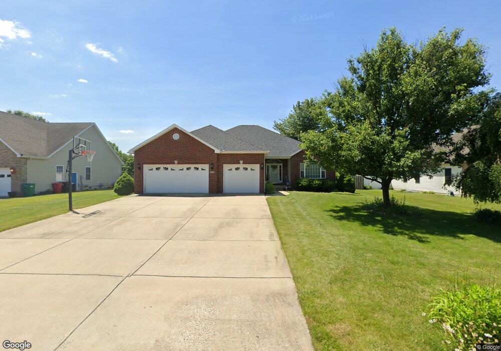
6675 Sherry Ct Decatur, IL 62521
Estimated Value: $333,626 - $405,000
5
Beds
3
Baths
2,524
Sq Ft
$147/Sq Ft
Est. Value
About This Home
This home is located at 6675 Sherry Ct, Decatur, IL 62521 and is currently estimated at $371,657, approximately $147 per square foot. 6675 Sherry Ct is a home located in Macon County with nearby schools including McGaughey Elementary School, Mt. Zion Intermediate School, and Mt. Zion Elementary School.
Ownership History
Date
Name
Owned For
Owner Type
Purchase Details
Closed on
Mar 28, 2011
Sold by
Robinson Michael L and Robinson Stacy L
Bought by
Schmidt Jerry and Perkins Shawn Y
Current Estimated Value
Home Financials for this Owner
Home Financials are based on the most recent Mortgage that was taken out on this home.
Original Mortgage
$203,600
Outstanding Balance
$141,707
Interest Rate
4.99%
Mortgage Type
New Conventional
Estimated Equity
$229,950
Purchase Details
Closed on
Sep 29, 2006
Sold by
Watson David E and Watson Jodi C
Bought by
Robinson Michael L and Robinson Stacy L
Home Financials for this Owner
Home Financials are based on the most recent Mortgage that was taken out on this home.
Original Mortgage
$208,800
Interest Rate
6.49%
Mortgage Type
New Conventional
Purchase Details
Closed on
Jan 1, 2004
Create a Home Valuation Report for This Property
The Home Valuation Report is an in-depth analysis detailing your home's value as well as a comparison with similar homes in the area
Purchase History
| Date | Buyer | Sale Price | Title Company |
|---|---|---|---|
| Schmidt Jerry | $254,500 | None Available | |
| Robinson Michael L | $261,000 | None Available | |
| -- | $20,000 | -- |
Source: Public Records
Mortgage History
| Date | Status | Borrower | Loan Amount |
|---|---|---|---|
| Open | Schmidt Jerry | $203,600 | |
| Previous Owner | Robinson Michael L | $208,800 |
Source: Public Records
Tax History
| Year | Tax Paid | Tax Assessment Tax Assessment Total Assessment is a certain percentage of the fair market value that is determined by local assessors to be the total taxable value of land and additions on the property. | Land | Improvement |
|---|---|---|---|---|
| 2024 | $6,178 | $104,251 | $12,540 | $91,711 |
| 2023 | $5,996 | $96,869 | $11,652 | $85,217 |
| 2022 | $5,635 | $91,081 | $10,956 | $80,125 |
| 2021 | $5,472 | $86,346 | $10,386 | $75,960 |
| 2020 | $5,261 | $82,523 | $9,926 | $72,597 |
| 2019 | $5,261 | $82,523 | $9,926 | $72,597 |
| 2018 | $5,131 | $80,715 | $9,709 | $71,006 |
| 2017 | $5,111 | $79,718 | $9,589 | $70,129 |
| 2016 | $5,109 | $79,670 | $9,583 | $70,087 |
| 2015 | $4,944 | $78,648 | $9,460 | $69,188 |
| 2014 | $4,799 | $78,648 | $9,460 | $69,188 |
| 2013 | $4,885 | $78,648 | $9,460 | $69,188 |
Source: Public Records
Map
Nearby Homes
- 6455 Birchwood Ln
- 5941 Monarch Rd
- 2420 Rolling Creek Ct
- 2312 Lot 24 Rolling Creek Dr
- 2276 Lot 26 Rolling Creek Dr
- 2258 Lot 27 Rolling Creek Dr
- 2347 Rolling Creek Dr
- 2405 Lot 14 Rolling Creek Ct
- 2415 Lot 15 Rolling Creek Ct
- 2331 Rolling Creek Dr
- 2311 Rolling Creek Dr
- 2295 Rolling Creek Dr
- 3335 S Mount Zion Rd
- 2277 Rolling Creek Dr
- 2261 Rolling Creek Dr
- 2243 Rolling Creek Dr
- 2235 Rolling Creek Dr
- Lot 31 Woodbine Park Prairie Estates
- Lot 32 Janine Way
- Lot 3 Fletcher Ln
- 6665 Sherry Ct
- 6685 Sherry Ct Unit CT62521
- 2901 S Long Creek Rd
- 6655 Sherry Ct
- 2775 S Long Creek Rd
- 2790 Day Dr
- 6705 Sherry Ct
- 6645 Sherry Ct
- 2765 S Long Creek Rd
- 2770 Day Dr
- 6707 Sherry Ct
- 6710 Sherry Ct
- 2760 S Long Creek Rd
- 6635 Sherry Ct
- 2735 S Long Creek Rd
- 2975 S Long Creek Rd
- 2740 S Long Creek Rd
- 2750 Day Dr
- 2902 S Widener Ave
- 2775 Day Dr
Your Personal Tour Guide
Ask me questions while you tour the home.