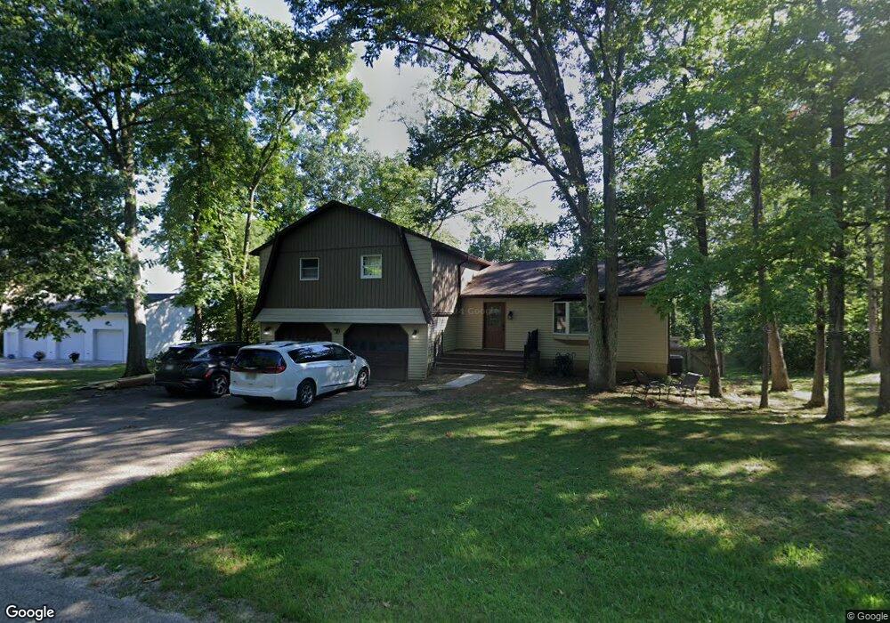
67 Forest Dr Chillicothe, OH 45601
Estimated Value: $298,000 - $304,000
About This Home
This home is located at 67 Forest Dr, Chillicothe, OH 45601 and is currently estimated at $301,094, approximately $130 per square foot. 67 Forest Dr is a home located in Ross County with nearby schools including Unioto Elementary School, Unioto Middle School, and Unioto High School.
Ownership History
We collect this data history from publicly available records. To have your information removed, we recommend requesting removal directly through your county’s website.
Purchase Details
Home Financials for this Owner
Home Financials are based on the most recent Mortgage that was taken out on this home.Purchase Details
Purchase History
We collect this data history from publicly available records. To have your information removed, we recommend requesting removal directly through your county’s website.
| Date | Buyer | Sale Price | Title Company |
|---|---|---|---|
| $144,000 | Title First Agency Inc | ||
| -- | Attorney |
Mortgage History
We collect this data history from publicly available records. To have your information removed, we recommend requesting removal directly through your county’s website.
| Date | Status | Borrower | Loan Amount |
|---|---|---|---|
| Closed | $145,136 |
Tax History
We collect this data history from publicly available records. To have your information removed, we recommend requesting removal directly through your county’s website.
| Year | Tax Paid | Tax Assessment Tax Assessment Total Assessment is a certain percentage of the fair market value that is determined by local assessors to be the total taxable value of land and additions on the property. | Land | Improvement |
|---|---|---|---|---|
| 2025 | $2,356 | $76,000 | $7,970 | $68,030 |
| 2024 | $2,023 | $58,640 | $7,210 | $51,430 |
| 2023 | $2,023 | $58,640 | $7,210 | $51,430 |
| 2022 | $2,067 | $58,640 | $7,210 | $51,430 |
| 2021 | $1,703 | $45,210 | $5,590 | $39,620 |
| 2020 | $1,712 | $45,210 | $5,590 | $39,620 |
| 2019 | $1,712 | $45,210 | $5,590 | $39,620 |
| 2018 | $1,766 | $45,690 | $5,500 | $40,190 |
| 2017 | $1,768 | $45,690 | $5,500 | $40,190 |
| 2016 | $1,723 | $45,690 | $5,500 | $40,190 |
| 2015 | $1,697 | $44,610 | $5,500 | $39,110 |
| 2014 | $1,656 | $44,610 | $5,500 | $39,110 |
| 2013 | $1,664 | $44,610 | $5,500 | $39,110 |
Map
- 3291 Cattail Rd
- 2045 Cattail Rd
- 549 Union Ln
- 4257 Egypt Pike
- 889 Old Elm Rd
- 1667 Stone Rd Unit Lot 59
- 1667 Stone Rd Unit LOT 15
- 3210 Egypt Pike
- 260 Vernon Dr
- 811 Biers Run Rd
- 2728 Egypt Pike
- 12 Gemini Ct
- 12321 Pleasant Valley Rd
- 8 Brown Ave
- 98 Wright St
- 52 Pickett Ct
- 141 Delano Rd
- 3791 Maple Grove Rd
- 0 Larrick Ln
- 14839 Westfall Rd Unit 4
Ask me questions while you tour the home.