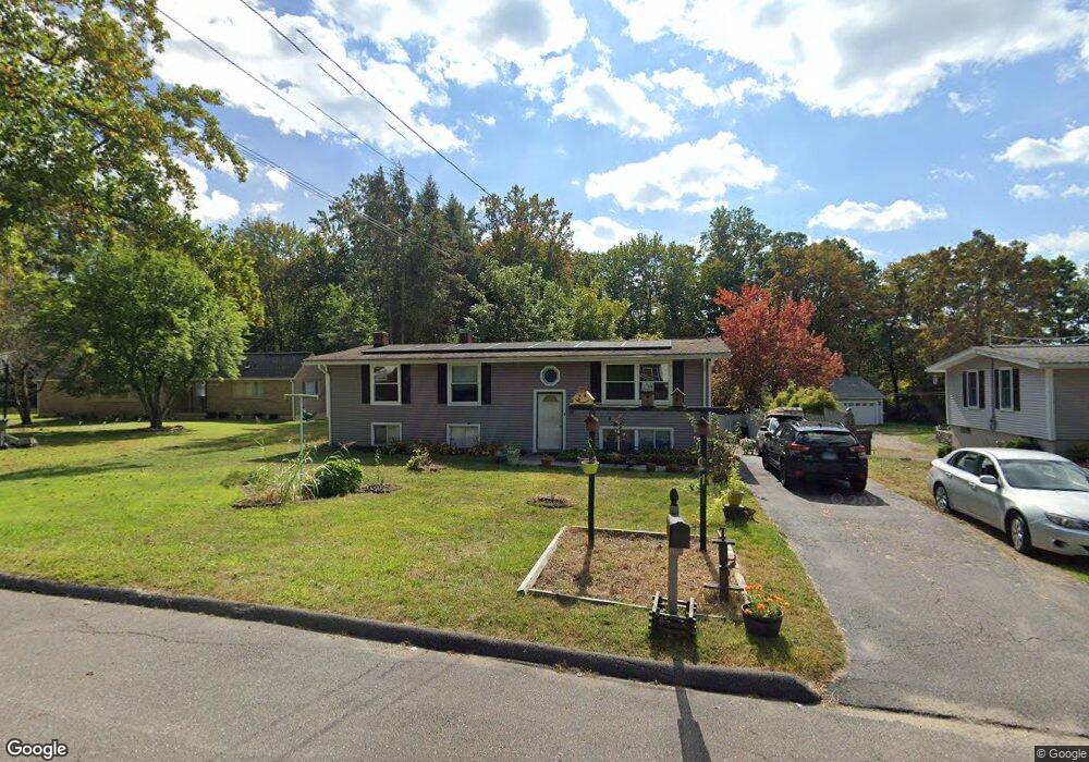
67 Forest St Naugatuck, CT 06770
Estimated Value: $314,000 - $356,311
3
Beds
2
Baths
1,152
Sq Ft
$294/Sq Ft
Est. Value
About This Home
This home is located at 67 Forest St, Naugatuck, CT 06770 and is currently estimated at $338,578, approximately $293 per square foot. 67 Forest St is a home located in New Haven County with nearby schools including City Hill Middle School and Naugatuck High School.
Ownership History
Date
Name
Owned For
Owner Type
Purchase Details
Closed on
Jul 31, 1998
Sold by
Nowik Andrew
Bought by
Tenbrink Robert and Tenbrink Ktherine
Current Estimated Value
Home Financials for this Owner
Home Financials are based on the most recent Mortgage that was taken out on this home.
Original Mortgage
$106,998
Interest Rate
6.92%
Mortgage Type
Purchase Money Mortgage
Purchase Details
Closed on
Jan 29, 1988
Sold by
Willis Eleanor
Bought by
Nowik Andrew
Home Financials for this Owner
Home Financials are based on the most recent Mortgage that was taken out on this home.
Original Mortgage
$68,000
Interest Rate
10.65%
Mortgage Type
Purchase Money Mortgage
Create a Home Valuation Report for This Property
The Home Valuation Report is an in-depth analysis detailing your home's value as well as a comparison with similar homes in the area
Home Values in the Area
Average Home Value in this Area
Purchase History
We collect this data history from publicly available records. To have your information removed, we recommend requesting removal directly through your county’s website.
| Date | Buyer | Sale Price | Title Company |
|---|---|---|---|
| Tenbrink Robert | $104,900 | -- | |
| Nowik Andrew | $128,000 | -- |
Source: Public Records
Mortgage History
We collect this data history from publicly available records. To have your information removed, we recommend requesting removal directly through your county’s website.
| Date | Status | Borrower | Loan Amount |
|---|---|---|---|
| Open | Nowik Andrew | $111,854 | |
| Closed | Nowik Andrew | $106,998 | |
| Previous Owner | Nowik Andrew | $70,000 | |
| Previous Owner | Nowik Andrew | $68,000 |
Source: Public Records
Tax History
| Year | Tax Paid | Tax Assessment Tax Assessment Total Assessment is a certain percentage of the fair market value that is determined by local assessors to be the total taxable value of land and additions on the property. | Land | Improvement |
|---|---|---|---|---|
| 2025 | $6,270 | $157,570 | $33,460 | $124,110 |
| 2024 | $6,585 | $157,570 | $33,460 | $124,110 |
| 2023 | $7,051 | $157,570 | $33,460 | $124,110 |
| 2022 | $5,437 | $113,860 | $35,830 | $78,030 |
| 2021 | $5,437 | $113,860 | $35,830 | $78,030 |
| 2020 | $5,437 | $113,860 | $35,830 | $78,030 |
| 2019 | $5,380 | $113,860 | $35,830 | $78,030 |
| 2018 | $5,218 | $107,930 | $43,110 | $64,820 |
| 2017 | $5,240 | $107,930 | $43,110 | $64,820 |
| 2016 | $5,145 | $107,930 | $43,110 | $64,820 |
| 2015 | $4,918 | $107,930 | $43,110 | $64,820 |
| 2014 | $4,863 | $107,930 | $43,110 | $64,820 |
| 2012 | $5,092 | $151,780 | $54,430 | $97,350 |
Source: Public Records
Map
Nearby Homes
- 120 May St
- 52 Phoenix Ave
- 109 Spruce Dr
- 363 High St
- 16 Hickory Rd
- 0 Wooster St Unit 24176176
- 231 N Main St
- 704 High St
- 57 Curtiss St
- 119 Prospect St
- 107 Celentano Dr
- 25 Tyler Hill Rd
- 21 Acushnet St
- 83 Meadow St
- 21 Stanley St
- 36 Longview Terrace
- 465 N Main St
- 130 Woodbine St
- 39 Hopkins Hill Rd
- 148 Hillside Ave
Your Personal Tour Guide
Ask me questions while you tour the home.