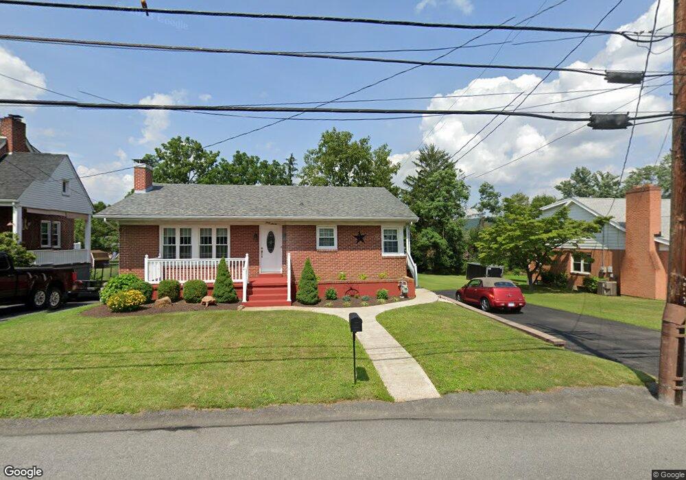
67 Lavale Blvd Cumberland, MD 21502
Estimated Value: $178,665 - $216,000
Studio
2
Baths
1,232
Sq Ft
$161/Sq Ft
Est. Value
About This Home
This home is located at 67 Lavale Blvd, Cumberland, MD 21502 and is currently estimated at $197,916, approximately $160 per square foot. 67 Lavale Blvd is a home located in Allegany County with nearby schools including Parkside Elementary School, Braddock Middle School, and Allegany High School.
Ownership History
Date
Name
Owned For
Owner Type
Purchase Details
Closed on
May 20, 2016
Sold by
Conrad Harold R and Conrad Stephen J
Bought by
Conrad Harold R and Conrad Donna L
Current Estimated Value
Purchase Details
Closed on
Sep 29, 1998
Sold by
Conrad Harold R and Conrad Dorothy W
Bought by
Conrad Harold R and Conrad Dorothy W
Purchase Details
Closed on
Jul 30, 1993
Sold by
Riley Ronald L-Kathy A
Bought by
Conrad Harold R-Dorothy W
Purchase Details
Closed on
Jun 25, 1991
Sold by
Hiatt Gordon A-June L
Bought by
Riley Ronald L-Kathy A
Home Financials for this Owner
Home Financials are based on the most recent Mortgage that was taken out on this home.
Original Mortgage
$52,800
Interest Rate
9.65%
Create a Home Valuation Report for This Property
The Home Valuation Report is an in-depth analysis detailing your home's value as well as a comparison with similar homes in the area
Home Values in the Area
Average Home Value in this Area
Purchase History
We collect this data history from publicly available records. To have your information removed, we recommend requesting removal directly through your county’s website.
| Date | Buyer | Sale Price | Title Company |
|---|---|---|---|
| Conrad Harold R | -- | Attorney | |
| Conrad Harold R | -- | -- | |
| Conrad Harold R-Dorothy W | $72,000 | -- | |
| Riley Ronald L-Kathy A | $66,000 | -- |
Source: Public Records
Mortgage History
We collect this data history from publicly available records. To have your information removed, we recommend requesting removal directly through your county’s website.
| Date | Status | Borrower | Loan Amount |
|---|---|---|---|
| Previous Owner | Riley Ronald L-Kathy A | $52,800 |
Source: Public Records
Tax History
| Year | Tax Paid | Tax Assessment Tax Assessment Total Assessment is a certain percentage of the fair market value that is determined by local assessors to be the total taxable value of land and additions on the property. | Land | Improvement |
|---|---|---|---|---|
| 2025 | $1,652 | $154,133 | $0 | $0 |
| 2024 | $1,558 | $143,500 | $17,200 | $126,300 |
| 2023 | $1,340 | $133,300 | $0 | $0 |
| 2022 | $1,429 | $123,100 | $0 | $0 |
| 2021 | $1,367 | $112,900 | $17,200 | $95,700 |
| 2020 | $1,344 | $110,000 | $0 | $0 |
| 2019 | $1,298 | $107,100 | $0 | $0 |
| 2018 | $1,252 | $104,200 | $17,200 | $87,000 |
| 2017 | $1,251 | $104,200 | $0 | $0 |
| 2016 | -- | $104,200 | $0 | $0 |
| 2015 | -- | $106,200 | $0 | $0 |
| 2014 | -- | $106,200 | $0 | $0 |
Source: Public Records
Map
Nearby Homes
- 20 Doris St
- 1009 National Hwy
- 1028 Weires Ave
- 806 Valley View Dr
- 23 Oaklawn Ave
- 887 Weires Ave
- 818 National Hwy
- 1105 Weires Ave
- 3 Glenview Dr
- 678 National Hwy
- 0 0 Sunset Drive Extended #2
- 0 Sunset View Extended
- 12400 Gramlich Rd SW
- 11 Linda Way
- 0 Mckenzie Rd
- 12511 Henry Dr SW
- 10004 Falcon Ct
- 14 Clubhouse Rd
- 1249 Braddock Rd
- LOT 2 Cherrywood Ave
Your Personal Tour Guide
Ask me questions while you tour the home.