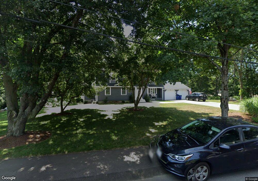
67 Mayflower Rd Braintree, MA 02184
East Braintree NeighborhoodEstimated Value: $969,000 - $1,186,000
3
Beds
4
Baths
3,315
Sq Ft
$323/Sq Ft
Est. Value
About This Home
This home is located at 67 Mayflower Rd, Braintree, MA 02184 and is currently estimated at $1,070,812, approximately $323 per square foot. 67 Mayflower Rd is a home located in Norfolk County with nearby schools including Braintree High School, Sacred Heart Elementary School, and South Shore Christian Academy.
Ownership History
Date
Name
Owned For
Owner Type
Purchase Details
Closed on
Nov 15, 2019
Sold by
Dawson James D
Bought by
Dawson James D and Dawson Rosangela
Current Estimated Value
Home Financials for this Owner
Home Financials are based on the most recent Mortgage that was taken out on this home.
Original Mortgage
$175,000
Outstanding Balance
$153,776
Interest Rate
3.65%
Mortgage Type
New Conventional
Estimated Equity
$917,036
Purchase Details
Closed on
Nov 14, 2019
Sold by
Dawson John D and Livington Beth D
Bought by
Dawson James D and Dawson Rosangela
Home Financials for this Owner
Home Financials are based on the most recent Mortgage that was taken out on this home.
Original Mortgage
$175,000
Outstanding Balance
$153,776
Interest Rate
3.65%
Mortgage Type
New Conventional
Estimated Equity
$917,036
Create a Home Valuation Report for This Property
The Home Valuation Report is an in-depth analysis detailing your home's value as well as a comparison with similar homes in the area
Home Values in the Area
Average Home Value in this Area
Purchase History
We collect this data history from publicly available records. To have your information removed, we recommend requesting removal directly through your county’s website.
| Date | Buyer | Sale Price | Title Company |
|---|---|---|---|
| Dawson James D | -- | -- | |
| Dawson James D | -- | -- | |
| Dawson James D | $350,000 | -- | |
| Dawson James D | $350,000 | -- |
Source: Public Records
Mortgage History
We collect this data history from publicly available records. To have your information removed, we recommend requesting removal directly through your county’s website.
| Date | Status | Borrower | Loan Amount |
|---|---|---|---|
| Open | Dawson James D | $175,000 | |
| Closed | Dawson James D | $175,000 |
Source: Public Records
Tax History
| Year | Tax Paid | Tax Assessment Tax Assessment Total Assessment is a certain percentage of the fair market value that is determined by local assessors to be the total taxable value of land and additions on the property. | Land | Improvement |
|---|---|---|---|---|
| 2025 | $9,094 | $911,200 | $476,600 | $434,600 |
| 2024 | $8,115 | $856,000 | $438,800 | $417,200 |
| 2023 | $7,774 | $796,500 | $401,300 | $395,200 |
| 2022 | $6,778 | $681,200 | $351,300 | $329,900 |
| 2021 | $6,258 | $628,900 | $317,600 | $311,300 |
| 2020 | $5,917 | $600,100 | $288,800 | $311,300 |
| 2019 | $5,850 | $579,800 | $288,800 | $291,000 |
| 2018 | $5,544 | $526,000 | $251,300 | $274,700 |
| 2017 | $5,389 | $501,800 | $238,800 | $263,000 |
| 2016 | $5,198 | $473,400 | $226,300 | $247,100 |
| 2015 | $5,077 | $458,600 | $221,300 | $237,300 |
| 2014 | $4,775 | $418,100 | $192,600 | $225,500 |
Source: Public Records
Map
Nearby Homes
- 115 Pilgrim Rd
- 99 Louise Rd
- 38 Stonewood Ln
- 9 Doris Rd
- 11 Roseen Ave
- 82 Lester Ln
- 51 Faxon St
- 48 Summer St
- 37 Lantern Ln
- 12 Franklin St
- 49 Brookside Rd
- 302 Commercial St Unit 21
- 296 Commercial St Unit 21
- 61 Broad St
- 377 Summer St
- 3 Harrison Ave
- 37 Tingley Rd
- 86 Cabot Ave
- 437 Summer St
- 21 Kendall Ave
- 77 Mayflower Rd
- 82 Mayflower Rd
- 66 Mayflower Rd
- 87 Mayflower Rd
- 215 Pilgrim Rd
- 56 Mayflower Rd
- 185 Pilgrim Rd
- 205 Pilgrim Rd
- 96 Mayflower Rd
- 220 Pilgrim Rd
- 165 Pilgrim Rd
- 97 Mayflower Rd
- 46 Mayflower Rd
- 106 Mayflower Rd
- 190 Pilgrim Rd
- 85 Whites Hill Dr
- 208 Pilgrim Rd
- 216 Pilgrim Rd
- 155 Pilgrim Rd
- 42 Mayflower Rd
Your Personal Tour Guide
Ask me questions while you tour the home.