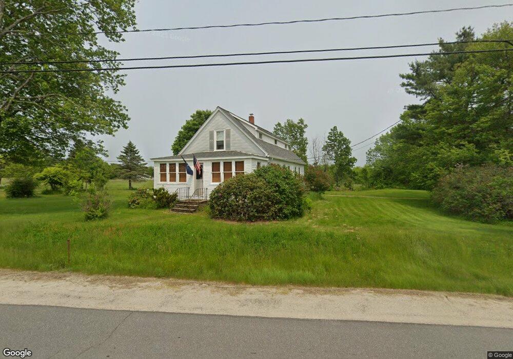
67 Post Rd Bowdoinham, ME 04008
Estimated Value: $246,000 - $381,000
2
Beds
1
Bath
1,512
Sq Ft
$224/Sq Ft
Est. Value
About This Home
This home is located at 67 Post Rd, Bowdoinham, ME 04008 and is currently estimated at $339,416, approximately $224 per square foot. 67 Post Rd is a home with nearby schools including Mt Ararat High School.
Create a Home Valuation Report for This Property
The Home Valuation Report is an in-depth analysis detailing your home's value as well as a comparison with similar homes in the area
Home Values in the Area
Average Home Value in this Area
Tax History
| Year | Tax Paid | Tax Assessment Tax Assessment Total Assessment is a certain percentage of the fair market value that is determined by local assessors to be the total taxable value of land and additions on the property. | Land | Improvement |
|---|---|---|---|---|
| 2025 | $4,838 | $218,800 | $86,700 | $132,100 |
| 2024 | $4,595 | $218,800 | $86,700 | $132,100 |
| 2023 | $4,267 | $218,800 | $86,700 | $132,100 |
| 2022 | $3,298 | $182,300 | $72,200 | $110,100 |
| 2021 | $3,094 | $182,300 | $72,200 | $110,100 |
| 2020 | $3,075 | $182,300 | $72,200 | $110,100 |
| 2019 | $3,002 | $182,300 | $72,200 | $110,100 |
| 2018 | $2,811 | $163,900 | $72,200 | $91,700 |
| 2017 | $2,762 | $163,900 | $72,200 | $91,700 |
| 2016 | $2,713 | $163,900 | $72,200 | $91,700 |
| 2015 | $2,696 | $163,900 | $72,200 | $91,700 |
| 2014 | $2,663 | $163,900 | $72,200 | $91,700 |
| 2013 | $2,524 | $163,900 | $72,200 | $91,700 |
Source: Public Records
Map
Nearby Homes
- 1 Cairn Hill Rd
- 10 Overlook Dr
- 83 Hemlock Hill Ln
- 0 White Rd
- 142 Deer Run Rd
- 467 Bay Rd
- 1524 Augusta Rd
- 83 Bowdoin Pines Rd Unit 83
- 36.5 Acres Augusta Rd
- 75 Adams Landing Rd
- 228 Carding MacHine Rd
- 17 Chestnut Dr
- 210 Augusta Rd
- 3 Chickadee Dr
- 00 Skillings Dr
- 258 Dingley Rd
- 28 Jade Dr
- 215 Ward Rd
- 9 Rocky Reach Rd
- 38 Meadow Rd
Your Personal Tour Guide
Ask me questions while you tour the home.