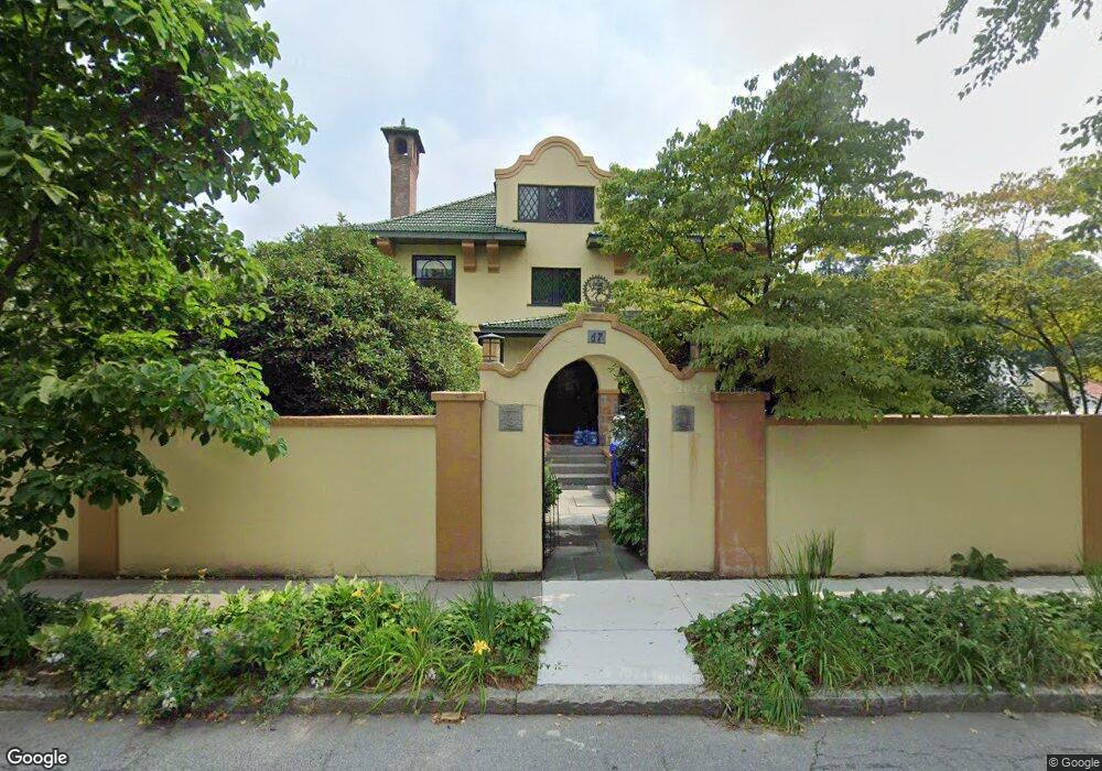
67 Powell St Brookline, MA 02446
Coolidge Corner NeighborhoodEstimated Value: $3,372,000 - $4,057,000
1
Bed
1
Bath
1,250
Sq Ft
$2,976/Sq Ft
Est. Value
About This Home
This home is located at 67 Powell St, Brookline, MA 02446 and is currently estimated at $3,719,986, approximately $2,975 per square foot. 67 Powell St is a home located in Norfolk County with nearby schools including Amos A. Lawrence School, Brookline High School, and Match Charter Public School.
Ownership History
Date
Name
Owned For
Owner Type
Purchase Details
Closed on
Apr 5, 2017
Sold by
Dhanda Raj K and Dhanda Neena
Bought by
67 Powell Street Rt
Current Estimated Value
Home Financials for this Owner
Home Financials are based on the most recent Mortgage that was taken out on this home.
Original Mortgage
$2,000,000
Outstanding Balance
$1,588,216
Interest Rate
3.25%
Mortgage Type
Adjustable Rate Mortgage/ARM
Estimated Equity
$2,131,770
Purchase Details
Closed on
Mar 20, 2017
Sold by
67 Powell Street Rt
Bought by
Dhanda Raj K and Dhanda Neena G
Home Financials for this Owner
Home Financials are based on the most recent Mortgage that was taken out on this home.
Original Mortgage
$2,000,000
Outstanding Balance
$1,588,216
Interest Rate
3.25%
Mortgage Type
Adjustable Rate Mortgage/ARM
Estimated Equity
$2,131,770
Create a Home Valuation Report for This Property
The Home Valuation Report is an in-depth analysis detailing your home's value as well as a comparison with similar homes in the area
Home Values in the Area
Average Home Value in this Area
Purchase History
| Date | Buyer | Sale Price | Title Company |
|---|---|---|---|
| 67 Powell Street Rt | -- | -- | |
| 67 Powell Street Rt | -- | -- | |
| Dhanda Raj K | -- | -- | |
| Dhanda Raj K | -- | -- |
Source: Public Records
Mortgage History
| Date | Status | Borrower | Loan Amount |
|---|---|---|---|
| Open | Dhanda Raj K | $2,000,000 |
Source: Public Records
Tax History
| Year | Tax Paid | Tax Assessment Tax Assessment Total Assessment is a certain percentage of the fair market value that is determined by local assessors to be the total taxable value of land and additions on the property. | Land | Improvement |
|---|---|---|---|---|
| 2025 | $29,478 | $2,986,600 | $1,441,400 | $1,545,200 |
| 2024 | $28,102 | $2,876,400 | $1,385,800 | $1,490,600 |
| 2023 | $27,401 | $2,748,300 | $1,281,900 | $1,466,400 |
| 2022 | $26,672 | $2,617,500 | $1,220,900 | $1,396,600 |
| 2021 | $24,664 | $2,516,700 | $1,173,900 | $1,342,800 |
| 2020 | $22,613 | $2,392,900 | $1,067,100 | $1,325,800 |
| 2019 | $21,354 | $2,279,000 | $1,016,300 | $1,262,700 |
| 2018 | $19,829 | $2,096,100 | $847,000 | $1,249,100 |
| 2017 | $19,538 | $1,977,500 | $799,000 | $1,178,500 |
| 2016 | $18,999 | $1,823,300 | $746,800 | $1,076,500 |
| 2015 | $18,199 | $1,704,000 | $697,900 | $1,006,100 |
| 2014 | $17,726 | $1,556,300 | $581,500 | $974,800 |
Source: Public Records
Map
Nearby Homes
- 178 Ivy St
- 180 Ivy St
- 7 Parkman St Unit 1
- 39 Worthington Rd
- 201 Freeman St Unit A7
- 80 Browne St Unit 2
- 221 Freeman St Unit 221
- 98 Carlton St
- 1064 Beacon St Unit 12A
- 157 Babcock St Unit 2
- 8 Euston St Unit 5
- 21 Crowninshield Rd Unit 21
- 95 Stedman St Unit 1
- 1002 Beacon St
- 20 John St Unit 3
- 36 Osborne Rd Unit 1
- 36 Osborne Rd
- 922 Beacon St Unit 24
- 50 Longwood Ave Unit 718
- 50 Longwood Ave Unit 712
- 67 Powell St Unit 1
- 67 Powell St Unit 2
- 65 Powell St
- 68 Amory St
- 74 Amory St
- 64 Amory St
- 72 Powell St
- 78 Powell St
- 63 Powell St
- 66 Powell St
- 60 Amory St
- 86 Powell St
- 135 Freeman St Unit 3A
- 135 Freeman St Unit 3
- 135 Freeman St Unit 2A
- 135 Freeman St Unit 2
- 135 Freeman St Unit 1A
- 135 Freeman St Unit 1
- 131 Freeman St Unit 3A
- 131 Freeman St Unit 3
Your Personal Tour Guide
Ask me questions while you tour the home.