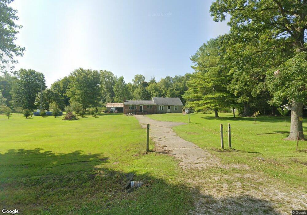
6709 Sparling Rd Kimball, MI 48074
Estimated Value: $150,000 - $221,000
4
Beds
1
Bath
1,754
Sq Ft
$106/Sq Ft
Est. Value
About This Home
This home is located at 6709 Sparling Rd, Kimball, MI 48074 and is currently estimated at $186,059, approximately $106 per square foot. 6709 Sparling Rd is a home located in St. Clair County with nearby schools including Kimball Elementary School, Central Middle School, and Port Huron High School.
Ownership History
Date
Name
Owned For
Owner Type
Purchase Details
Closed on
Dec 7, 2015
Sold by
Manning E Mark A
Bought by
Privett Steve and Privett Sherry L
Current Estimated Value
Home Financials for this Owner
Home Financials are based on the most recent Mortgage that was taken out on this home.
Original Mortgage
$59,000
Outstanding Balance
$46,391
Interest Rate
3.78%
Mortgage Type
New Conventional
Estimated Equity
$139,668
Purchase Details
Closed on
Nov 15, 2007
Sold by
Taylor Carol L
Bought by
Manning Mark Anthony
Create a Home Valuation Report for This Property
The Home Valuation Report is an in-depth analysis detailing your home's value as well as a comparison with similar homes in the area
Home Values in the Area
Average Home Value in this Area
Purchase History
| Date | Buyer | Sale Price | Title Company |
|---|---|---|---|
| Privett Steve | $50,000 | -- | |
| Privett Sherry L | $110,000 | -- | |
| Manning Mark Anthony | -- | None Available |
Source: Public Records
Mortgage History
| Date | Status | Borrower | Loan Amount |
|---|---|---|---|
| Open | Privett Sherry L | $59,000 |
Source: Public Records
Tax History
| Year | Tax Paid | Tax Assessment Tax Assessment Total Assessment is a certain percentage of the fair market value that is determined by local assessors to be the total taxable value of land and additions on the property. | Land | Improvement |
|---|---|---|---|---|
| 2025 | $1,378 | $54,100 | $0 | $0 |
| 2024 | $1,003 | $51,100 | $0 | $0 |
| 2023 | $939 | $47,500 | $0 | $0 |
| 2022 | $1,243 | $41,900 | $0 | $0 |
| 2020 | $1,122 | $29,700 | $5,700 | $24,000 |
| 2019 | $1,101 | $29,900 | $0 | $0 |
| 2018 | $1,076 | $25,300 | $0 | $0 |
| 2017 | $1,054 | $24,300 | $0 | $0 |
| 2016 | $781 | $24,300 | $0 | $0 |
| 2015 | -- | $49,800 | $49,800 | $0 |
| 2014 | -- | $48,000 | $48,000 | $0 |
| 2013 | -- | $54,200 | $0 | $0 |
Source: Public Records
Map
Nearby Homes
- 0 Sparling Rd Unit 2210034403
- 1900 Burns Rd
- I-69 vac Taylor Dr
- 0 Sparling & Mayer Rd Unit Lot- 4
- 00 Griswold Rd
- 6417 Dove Rd
- 6550 Lapeer Rd
- 2047 Edward Ln E
- 0000 Conrad Dr
- 2007 Edward Ln E
- 6312 Square Lake Dr
- 6154 Birch Creek Ct
- 6065 Lapeer Rd
- 0 Sparling Unit Lot-1
- 0 Sparling Unit Lot- 2
- 0 Sparling Unit Lot- 3
- 00000 Lapeer Rd
- 0 Richman Rd Unit 50197304
- 521 Bush Lake Ln
- 504 Bush Lake Ln
- 6709 Sparling Rd
- 6713 Sparling Rd
- 6725 Sparling Rd
- 6710 Sparling Rd
- 6690 Sparling Rd
- 6690 Sparling Rd
- 6622 Sparling Rd
- 6699 Sparling Rd
- 6824 Sparling Rd
- 6604 Sparling Rd
- 6828 Sparling Rd
- 6830 Sparling Rd
- 6835 Sparling Rd
- 6832 Sparling Rd
- 6837 Sparling Rd
- 6588 Sparling Rd
- 6588 Sparling Rd
- 6834 Sparling Rd
- 6565 Sparling Rd
- 6836 Sparling Rd
Your Personal Tour Guide
Ask me questions while you tour the home.