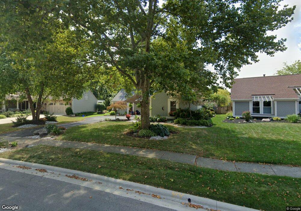
6721 Maplebrook Ln Columbus, OH 43235
Brookside Woods NeighborhoodEstimated Value: $442,712 - $538,000
3
Beds
2
Baths
1,771
Sq Ft
$282/Sq Ft
Est. Value
About This Home
This home is located at 6721 Maplebrook Ln, Columbus, OH 43235 and is currently estimated at $498,928, approximately $281 per square foot. 6721 Maplebrook Ln is a home located in Franklin County with nearby schools including Brookside Elementary School, McCord Middle School, and Worthington Kilbourne High School.
Ownership History
Date
Name
Owned For
Owner Type
Purchase Details
Closed on
Oct 18, 2001
Sold by
Boe George W and Boe Martina L
Bought by
Phillips Frank L and Phillips Cheryl A
Current Estimated Value
Purchase Details
Closed on
Mar 22, 1999
Sold by
Boe Martina L and Osterstock Martina L
Bought by
Boe George W
Purchase Details
Closed on
Mar 20, 1995
Sold by
Moran Thomas H
Bought by
Howey Clair E and Howey Maryann T
Home Financials for this Owner
Home Financials are based on the most recent Mortgage that was taken out on this home.
Original Mortgage
$124,800
Interest Rate
8.97%
Mortgage Type
New Conventional
Purchase Details
Closed on
Oct 1, 1986
Create a Home Valuation Report for This Property
The Home Valuation Report is an in-depth analysis detailing your home's value as well as a comparison with similar homes in the area
Home Values in the Area
Average Home Value in this Area
Purchase History
We collect this data history from publicly available records. To have your information removed, we recommend requesting removal directly through your county’s website.
| Date | Buyer | Sale Price | Title Company |
|---|---|---|---|
| Phillips Frank L | $197,000 | -- | |
| Boe George W | -- | Amerititle Agency Inc | |
| Howey Clair E | $156,000 | -- | |
| -- | $118,500 | -- |
Source: Public Records
Mortgage History
We collect this data history from publicly available records. To have your information removed, we recommend requesting removal directly through your county’s website.
| Date | Status | Borrower | Loan Amount |
|---|---|---|---|
| Closed | Howey Clair E | $124,800 |
Source: Public Records
Tax History
| Year | Tax Paid | Tax Assessment Tax Assessment Total Assessment is a certain percentage of the fair market value that is determined by local assessors to be the total taxable value of land and additions on the property. | Land | Improvement |
|---|---|---|---|---|
| 2025 | $7,547 | $122,920 | $34,300 | $88,620 |
| 2024 | $7,547 | $122,920 | $34,300 | $88,620 |
| 2023 | $7,217 | $122,920 | $34,300 | $88,620 |
| 2022 | $6,244 | $84,390 | $18,870 | $65,520 |
| 2021 | $5,760 | $84,390 | $18,870 | $65,520 |
| 2020 | $5,549 | $84,390 | $18,870 | $65,520 |
| 2019 | $5,256 | $72,140 | $16,420 | $55,720 |
| 2018 | $5,174 | $72,140 | $16,420 | $55,720 |
| 2017 | $4,983 | $72,140 | $16,420 | $55,720 |
| 2016 | $5,256 | $74,030 | $20,790 | $53,240 |
| 2015 | $5,257 | $74,030 | $20,790 | $53,240 |
| 2014 | $5,255 | $74,030 | $20,790 | $53,240 |
| 2013 | $2,614 | $74,025 | $20,790 | $53,235 |
Source: Public Records
Map
Nearby Homes
- 6886 Lakebrook Blvd
- 6729 Meadow Creek Dr Unit 102
- 6789 Meadow Creek Dr Unit 206
- 7060 Cloverdale Ln
- 2481 Timbers Edge Ln Unit 2481
- 2461 Timbers Edge Ln Unit 2461
- 6546 Reflections Dr Unit D
- 2097 Thistlewood Dr
- 2468 Timberside Dr
- 6550 Reflections Dr Unit C
- 6478 Reflections Dr Unit C
- 2546 Timberside Dr Unit 2546
- 6418 Reflections Dr Unit A
- 6831 Pine Bark Ln
- 6847 Mcvey Blvd
- 2428 Merbrook Rd
- 2701 Snouffer Rd
- 7406 Cimmaron Station Unit 7406
- 2942 Sawdust Ln Unit 2942
- 6741 Lakeside Cir W
- 6713 Maplebrook Ln
- 6729 Maplebrook Ln
- 6704 Amur Dr
- 6696 Amur Dr
- 6705 Maplebrook Ln
- 6737 Maplebrook Ln
- 6712 Amur Dr
- 6734 Maplebrook Ln
- 6688 Amur Dr
- 6720 Amur Dr
- 6693 Maplebrook Ln
- 6745 Maplebrook Ln
- 6746 Maplebrook Ln
- 6728 Amur Dr
- 6680 Amur Dr
- 6745 Oakfair Ave
- 6708 Maplebrook Ln
- 6711 Amur Dr
- 6758 Maplebrook Ln
- 6736 Amur Dr
Your Personal Tour Guide
Ask me questions while you tour the home.