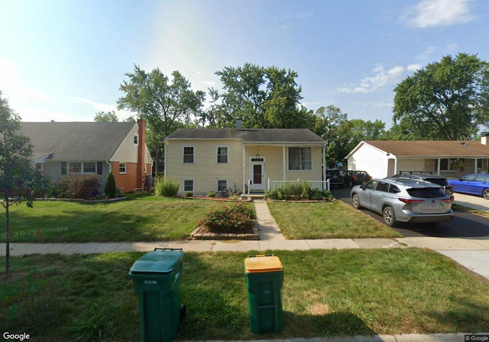
673 Maple Dr Buffalo Grove, IL 60089
South Buffalo Grove NeighborhoodEstimated Value: $330,000 - $359,000
2
Beds
1
Bath
999
Sq Ft
$347/Sq Ft
Est. Value
About This Home
This home is located at 673 Maple Dr, Buffalo Grove, IL 60089 and is currently estimated at $346,927, approximately $347 per square foot. 673 Maple Dr is a home located in Cook County with nearby schools including Henry W Longfellow Elementary School, Cooper Middle School, and Buffalo Grove High School.
Ownership History
Date
Name
Owned For
Owner Type
Purchase Details
Closed on
Feb 1, 2021
Sold by
Ray Douglas H and Ray Andrea C
Bought by
Ray Douglas H and Ray Andrea C
Current Estimated Value
Purchase Details
Closed on
Mar 31, 2004
Sold by
Olson Ronald and Olson Donna Faye
Bought by
Ray Douglas H and Ray Andrea C
Home Financials for this Owner
Home Financials are based on the most recent Mortgage that was taken out on this home.
Original Mortgage
$226,800
Outstanding Balance
$102,582
Interest Rate
5.65%
Mortgage Type
Unknown
Estimated Equity
$244,345
Purchase Details
Closed on
Mar 29, 2004
Sold by
Westphal Laura
Bought by
Olson Ronald and Olson Donna F
Home Financials for this Owner
Home Financials are based on the most recent Mortgage that was taken out on this home.
Original Mortgage
$226,800
Outstanding Balance
$102,582
Interest Rate
5.65%
Mortgage Type
Unknown
Estimated Equity
$244,345
Purchase Details
Closed on
Dec 14, 1999
Sold by
Livensparger Stuart A and Livensparger Deann M
Bought by
Arnett Daryl A
Home Financials for this Owner
Home Financials are based on the most recent Mortgage that was taken out on this home.
Original Mortgage
$186,200
Interest Rate
7.37%
Purchase Details
Closed on
Mar 12, 1999
Sold by
Knight Michael J
Bought by
Livensparger Stuart A and Livensparger Deann M
Home Financials for this Owner
Home Financials are based on the most recent Mortgage that was taken out on this home.
Original Mortgage
$188,000
Interest Rate
6.8%
Create a Home Valuation Report for This Property
The Home Valuation Report is an in-depth analysis detailing your home's value as well as a comparison with similar homes in the area
Home Values in the Area
Average Home Value in this Area
Purchase History
| Date | Buyer | Sale Price | Title Company |
|---|---|---|---|
| Ray Douglas H | -- | Attorney | |
| Ray Douglas H | $252,000 | -- | |
| Olson Ronald | -- | Multiple | |
| Arnett Daryl A | $196,000 | -- | |
| Livensparger Stuart A | $188,000 | Djh Title & Abstract |
Source: Public Records
Mortgage History
| Date | Status | Borrower | Loan Amount |
|---|---|---|---|
| Open | Ray Douglas H | $226,800 | |
| Previous Owner | Arnett Daryl A | $186,200 | |
| Previous Owner | Livensparger Stuart A | $188,000 |
Source: Public Records
Tax History
| Year | Tax Paid | Tax Assessment Tax Assessment Total Assessment is a certain percentage of the fair market value that is determined by local assessors to be the total taxable value of land and additions on the property. | Land | Improvement |
|---|---|---|---|---|
| 2025 | $7,581 | $30,000 | $7,560 | $22,440 |
| 2024 | $7,581 | $24,382 | $6,480 | $17,902 |
| 2023 | $7,261 | $27,000 | $6,480 | $20,520 |
| 2022 | $7,261 | $27,000 | $6,480 | $20,520 |
| 2021 | $6,667 | $22,200 | $4,140 | $18,060 |
| 2020 | $6,566 | $22,200 | $4,140 | $18,060 |
| 2019 | $6,559 | $24,613 | $4,140 | $20,473 |
| 2018 | $6,998 | $23,754 | $3,600 | $20,154 |
| 2017 | $6,889 | $23,754 | $3,600 | $20,154 |
| 2016 | $6,676 | $23,754 | $3,600 | $20,154 |
| 2015 | $6,247 | $21,011 | $3,060 | $17,951 |
| 2014 | $6,162 | $21,011 | $3,060 | $17,951 |
| 2013 | $5,677 | $21,011 | $3,060 | $17,951 |
Source: Public Records
Map
Nearby Homes
- 267 Timber Hill Rd
- 393 Indian Hill Dr
- 517 Longwood Dr
- 535 Weidner Rd
- 334 Stillwell Dr
- 462 Longwood Dr
- 222 Saint Marys Pkwy
- 496 Raupp Blvd
- 808 Old Checker Rd Unit C2
- 140 Manchester Dr Unit 408
- 170 Manchester Dr Unit 306
- 141 Manchester Ct
- 800 Weidner Rd Unit 208
- 1096 Beechwood Rd
- 671 Hapsfield Ln Unit 105
- 125 N Buffalo Grove Rd Unit 407
- 820 Weidner Rd Unit 4013
- 820 Weidner Rd Unit 409
- 621 Hapsfield Ln Unit 103
- 760 Weidner Rd Unit 107
Your Personal Tour Guide
Ask me questions while you tour the home.