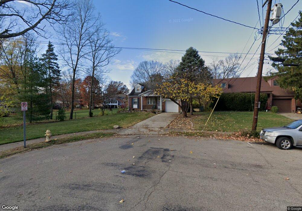
6749 Tarawa Dr Cincinnati, OH 45224
Estimated Value: $178,000 - $321,000
About This Home
This home is located at 6749 Tarawa Dr, Cincinnati, OH 45224 and is currently estimated at $226,874, approximately $114 per square foot. 6749 Tarawa Dr is a home located in Hamilton County with nearby schools including North College Hill Elementary School, North College Hill Middle School, and North College Hill High School.
Ownership History
We collect this data history from publicly available records. To have your information removed, we recommend requesting removal directly through your county’s website.
Purchase Details
Home Financials for this Owner
Home Financials are based on the most recent Mortgage that was taken out on this home.Purchase Details
Home Financials for this Owner
Home Financials are based on the most recent Mortgage that was taken out on this home.Purchase Details
Purchase Details
Home Financials for this Owner
Home Financials are based on the most recent Mortgage that was taken out on this home.Purchase Details
Purchase Details
Home Financials for this Owner
Home Financials are based on the most recent Mortgage that was taken out on this home.Home Values in the Area
Average Home Value in this Area
Purchase History
We collect this data history from publicly available records. To have your information removed, we recommend requesting removal directly through your county’s website.
| Date | Buyer | Sale Price | Title Company |
|---|---|---|---|
| $165,000 | None Listed On Document | ||
| $165,000 | None Listed On Document | ||
| $134,600 | None Listed On Document | ||
| $120,700 | -- | ||
| $117,600 | Title First Agency Inc | ||
| $94,000 | -- | ||
| $82,000 | -- |
Mortgage History
We collect this data history from publicly available records. To have your information removed, we recommend requesting removal directly through your county’s website.
| Date | Status | Borrower | Loan Amount |
|---|---|---|---|
| Open | $145,000 | ||
| Closed | $145,000 | ||
| Previous Owner | $114,410 | ||
| Previous Owner | $111,650 | ||
| Previous Owner | $63,600 | ||
| Closed | $0 | ||
| Closed | $5,000 |
Tax History
We collect this data history from publicly available records. To have your information removed, we recommend requesting removal directly through your county’s website.
| Year | Tax Paid | Tax Assessment Tax Assessment Total Assessment is a certain percentage of the fair market value that is determined by local assessors to be the total taxable value of land and additions on the property. | Land | Improvement |
|---|---|---|---|---|
| 2025 | $2,727 | $51,265 | $8,120 | $43,145 |
| 2024 | $2,726 | $51,265 | $8,120 | $43,145 |
| 2023 | $2,822 | $51,265 | $8,120 | $43,145 |
| 2022 | $2,354 | $32,925 | $6,864 | $26,061 |
| 2021 | $2,304 | $32,925 | $6,864 | $26,061 |
| 2020 | $2,021 | $32,925 | $6,864 | $26,061 |
| 2019 | $1,979 | $28,882 | $6,020 | $22,862 |
| 2018 | $1,980 | $28,882 | $6,020 | $22,862 |
| 2017 | $1,868 | $28,882 | $6,020 | $22,862 |
| 2016 | $1,979 | $32,375 | $7,798 | $24,577 |
| 2015 | $1,984 | $32,375 | $7,798 | $24,577 |
| 2014 | $1,982 | $32,375 | $7,798 | $24,577 |
| 2013 | $1,942 | $32,701 | $7,875 | $24,826 |
Map
- 6785 Marvin Ave
- 1533 Corcoran Place
- 6769 Richard Ave
- 6709 Devonwood Dr
- 6481 Devonwood Dr
- 6465 Loiswood Dr
- 6586 Parrish Ave
- 6440 Heitzler Ave
- 1586 W Galbraith Rd
- 6916 Kleindale Ave
- 1277 Brushwood Ave
- 1291 W Galbraith Rd
- 1631 Goodman Ave
- 6926 Kleindale Ave
- 1701 Goodman Ave
- 1581 Wittekind Terrace
- 6429 Aspen Way
- 1718 Waltham Ave
- 6414 Catalpa Ave
- 6390 Meis Ave
- 1510 Oak Knoll Dr
- 1514 Oak Knoll Dr
- 1506 Oak Knoll Dr
- 1518 Oak Knoll Dr
- 1505 Oak Knoll Dr
- 6618 Baybro Ct
- 6612 Baybro Ct
- 1504 Oak Knoll Dr
- 1522 Oak Knoll Dr
- 6574 Baywood Ln
- 6748 Tarawa Dr
- 1526 Oak Knoll Dr
- 6624 Baybro Ct
- 6570 Baywood Ln
- 6753 Tarawa Dr
- 6570 Baywood Dr
- 6752 Tarawa Dr
- 1501 Oak Knoll Dr
- 1500 Oak Knoll Dr
- 6757 Tarawa Dr
Ask me questions while you tour the home.