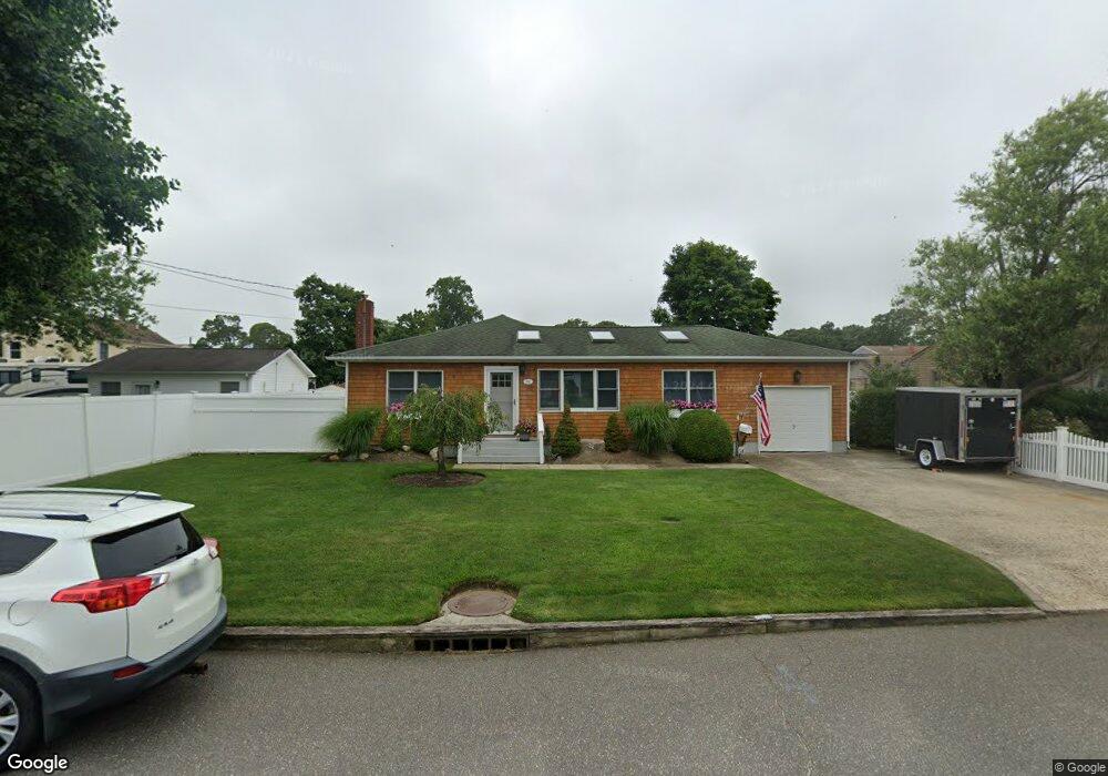
68 Barteau Ave Blue Point, NY 11715
Estimated Value: $521,000 - $780,000
3
Beds
1
Bath
1,096
Sq Ft
$583/Sq Ft
Est. Value
About This Home
This home is located at 68 Barteau Ave, Blue Point, NY 11715 and is currently estimated at $638,871, approximately $582 per square foot. 68 Barteau Ave is a home located in Suffolk County with nearby schools including James Wilson Young Middle School, Bayport Blue Point High School, and Holy Angels Regional School.
Ownership History
Date
Name
Owned For
Owner Type
Purchase Details
Closed on
Dec 8, 2022
Sold by
Carbone John J
Bought by
Carbone John J and Carbone Amy L
Current Estimated Value
Purchase Details
Closed on
May 2, 2001
Sold by
Carbone John J and Sundberg Joanne
Bought by
Carbone John J
Home Financials for this Owner
Home Financials are based on the most recent Mortgage that was taken out on this home.
Original Mortgage
$147,000
Interest Rate
7.09%
Mortgage Type
Purchase Money Mortgage
Create a Home Valuation Report for This Property
The Home Valuation Report is an in-depth analysis detailing your home's value as well as a comparison with similar homes in the area
Home Values in the Area
Average Home Value in this Area
Purchase History
| Date | Buyer | Sale Price | Title Company |
|---|---|---|---|
| Carbone John J | -- | None Available | |
| Carbone John J | -- | First American Title Ins Co |
Source: Public Records
Mortgage History
| Date | Status | Borrower | Loan Amount |
|---|---|---|---|
| Previous Owner | Carbone John J | $147,000 |
Source: Public Records
Tax History
| Year | Tax Paid | Tax Assessment Tax Assessment Total Assessment is a certain percentage of the fair market value that is determined by local assessors to be the total taxable value of land and additions on the property. | Land | Improvement |
|---|---|---|---|---|
| 2024 | $9,787 | $2,260 | $250 | $2,010 |
| 2023 | $9,787 | $2,260 | $250 | $2,010 |
| 2022 | $8,194 | $2,260 | $250 | $2,010 |
| 2021 | $8,194 | $2,260 | $250 | $2,010 |
| 2020 | $8,577 | $2,260 | $250 | $2,010 |
| 2019 | $8,577 | $0 | $0 | $0 |
| 2018 | $8,062 | $2,260 | $250 | $2,010 |
| 2017 | $8,062 | $2,260 | $250 | $2,010 |
| 2016 | $8,156 | $2,260 | $250 | $2,010 |
| 2015 | -- | $2,260 | $250 | $2,010 |
| 2014 | -- | $2,260 | $250 | $2,010 |
Source: Public Records
Map
Nearby Homes
- 92 Park St
- 55 Oyster Cove Ln
- 36 Atlantic Ave
- 325 Middle Rd
- 151 Fairharbor Dr Unit 151
- 6 Oyster Cove Ln
- 118 Fairharbor Dr
- 73 Fairharbor Dr
- 150 Fair Harbor Dr Unit 150
- 135 Fair Harbor Dr Unit 135
- 210 Fairharbor Dr Unit 210
- 230 Fairharbor Dr Unit 230
- 63 Fair Harbor Dr Unit 63
- 58 Fairharbor Dr Unit 58
- 43 Fair Harbor Dr Unit 43 Building 3
- 5 Fair Harbor Dr Unit 5
- 180 River Ave
- 16 Bransford St
- 134 Jackie Ct
- 123 Jackie Ct
Your Personal Tour Guide
Ask me questions while you tour the home.