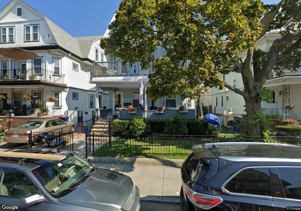
68 Saint Andrew Rd Boston, MA 02128
Harbor View-Orient Heights NeighborhoodEstimated Value: $949,000 - $1,454,938
8
Beds
4
Baths
3,415
Sq Ft
$348/Sq Ft
Est. Value
About This Home
This home is located at 68 Saint Andrew Rd, Boston, MA 02128 and is currently estimated at $1,187,985, approximately $347 per square foot. 68 Saint Andrew Rd is a home located in Suffolk County with nearby schools including Excel Academy East Boston, East Boston Montessori School, and Brooke Charter Schools East Boston.
Ownership History
Date
Name
Owned For
Owner Type
Purchase Details
Closed on
Jan 23, 2025
Sold by
Hamzeh Fouad M and Hamzeh Rima
Bought by
6-8 Andrew Rd Rt and Hamzeh
Current Estimated Value
Create a Home Valuation Report for This Property
The Home Valuation Report is an in-depth analysis detailing your home's value as well as a comparison with similar homes in the area
Home Values in the Area
Average Home Value in this Area
Purchase History
| Date | Buyer | Sale Price | Title Company |
|---|---|---|---|
| 6-8 Andrew Rd Rt | -- | None Available | |
| 6-8 Andrew Rd Rt | -- | None Available |
Source: Public Records
Tax History
| Year | Tax Paid | Tax Assessment Tax Assessment Total Assessment is a certain percentage of the fair market value that is determined by local assessors to be the total taxable value of land and additions on the property. | Land | Improvement |
|---|---|---|---|---|
| 2025 | $14,491 | $1,251,400 | $292,100 | $959,300 |
| 2024 | $12,601 | $1,156,100 | $260,700 | $895,400 |
| 2023 | $5,868 | $546,400 | $130,300 | $416,100 |
| 2022 | $9,652 | $887,100 | $245,900 | $641,200 |
| 2021 | $9,015 | $844,900 | $234,200 | $610,700 |
| 2020 | $7,617 | $721,300 | $235,400 | $485,900 |
| 2019 | $6,910 | $655,600 | $163,700 | $491,900 |
| 2018 | $6,303 | $601,400 | $163,700 | $437,700 |
| 2017 | $5,737 | $541,700 | $163,700 | $378,000 |
| 2016 | $5,518 | $501,600 | $163,700 | $337,900 |
| 2015 | $4,861 | $401,400 | $128,800 | $272,600 |
| 2014 | $4,451 | $353,800 | $128,800 | $225,000 |
Source: Public Records
Map
Nearby Homes
- 70 Shawsheen Unit PH5
- 1048 Saratoga St Unit 3
- 1044 Saratoga St Unit 1
- 20 Nancia St
- 1030 Bennington St Unit 15
- 180 Leyden St
- 2 Ford St
- 10 Ford St
- 10 Ford St Unit 1
- 3 Walley St
- 970 Saratoga St
- 16 Boardman St Unit 105
- 124 Leyden St
- 36A Leyden St
- 34 Whitby St
- 946 Saratoga St Unit 303
- 49 Faywood Ave
- 873 Saratoga St
- 56 Main St
- 9 Crestway Rd
- 68 Saint Andrew Rd
- 68 Saint Andrew Rd Unit 1
- 68 Saint Andrew Rd
- 70 Saint Andrew Rd
- 66 Saint Andrew Rd
- 70 St Andrew Rd Unit 2
- 72 Saint Andrew Rd
- 64 Saint Andrew Rd
- 1111 Saratoga St
- 1109 Saratoga St
- 1115 Saratoga St
- 1105 Saratoga St Unit 1
- 1105 Saratoga St
- 1105 Saratoga St Unit 2
- 74 Saint Andrew Rd Unit 1
- 74 Saint Andrew Rd
- 76 Saint Andrew Rd Unit 1
- 76 Saint Andrew Rd Unit ANDREW
- 61 Saint Andrew Rd
- 63 Saint Andrew Rd
Your Personal Tour Guide
Ask me questions while you tour the home.