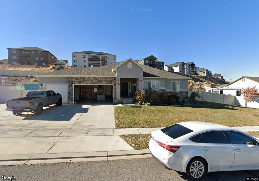
680 Crest Dale Ln Santaquin, UT 84655
Estimated Value: $668,000 - $832,000
About This Home
This home is located at 680 Crest Dale Ln, Santaquin, UT 84655 and is currently estimated at $739,808, approximately $169 per square foot. 680 Crest Dale Ln is a home located in Utah County with nearby schools including Santaquin Elementary School, Payson Junior High School, and Mt. Nebo Middle.
Ownership History
We collect this data history from publicly available records. To have your information removed, we recommend requesting removal directly through your county’s website.
Purchase Details
Home Financials for this Owner
Home Financials are based on the most recent Mortgage that was taken out on this home.Purchase Details
Home Financials for this Owner
Home Financials are based on the most recent Mortgage that was taken out on this home.Purchase Details
Home Financials for this Owner
Home Financials are based on the most recent Mortgage that was taken out on this home.Purchase Details
Home Values in the Area
Average Home Value in this Area
Purchase History
We collect this data history from publicly available records. To have your information removed, we recommend requesting removal directly through your county’s website.
| Date | Buyer | Sale Price | Title Company |
|---|---|---|---|
| -- | Inwest Title | ||
| -- | Gt Title Services | ||
| -- | Gt Title Services | ||
| -- | None Available |
Mortgage History
We collect this data history from publicly available records. To have your information removed, we recommend requesting removal directly through your county’s website.
| Date | Status | Borrower | Loan Amount |
|---|---|---|---|
| Open | $400,000 | ||
| Previous Owner | $283,546 | ||
| Previous Owner | $207,900 |
Tax History
We collect this data history from publicly available records. To have your information removed, we recommend requesting removal directly through your county’s website.
| Year | Tax Paid | Tax Assessment Tax Assessment Total Assessment is a certain percentage of the fair market value that is determined by local assessors to be the total taxable value of land and additions on the property. | Land | Improvement |
|---|---|---|---|---|
| 2025 | $3,375 | $394,350 | -- | -- |
| 2024 | $3,375 | $336,105 | $0 | $0 |
| 2023 | $3,420 | $341,660 | $0 | $0 |
| 2022 | $3,088 | $318,175 | $0 | $0 |
| 2021 | $2,701 | $431,500 | $107,700 | $323,800 |
| 2020 | $2,508 | $388,200 | $76,900 | $311,300 |
| 2019 | $2,170 | $343,500 | $72,800 | $270,700 |
| 2018 | $2,005 | $302,600 | $67,200 | $235,400 |
| 2017 | $1,949 | $157,190 | $0 | $0 |
| 2016 | $656 | $51,800 | $0 | $0 |
| 2015 | $627 | $48,600 | $0 | $0 |
| 2014 | $575 | $44,500 | $0 | $0 |
Map
- 636 Summit Trail
- 503 Firestone Dr
- 894 Crest Dale Ln
- 895 Crest Dale Ln
- 651 River Rock Dr
- 673 Stonebrook Ln
- 912 Crest Dale Ln
- 907 Crest Dale Ln
- 926 S Tanner Rd
- 942 S Tanner Rd
- 370 Stone Hollow Dr
- 343 Red Rock Dr
- 1024 S Tanner Rd
- 1040 S Tanner Rd
- 1043 Valley View Dr
- 1105 Valley View Dr Unit 132
- 1134 Vista Ridge Dr
- 1186 S Vista Ridge Dr
- 1858 W View Cove
- 1263 Crest Dale Ln
- 657 Summit Trails
- 657 Summit Trails Way Unit 8
- 675 Summit Trails
- 675 Summit Trails Unit 9
- 641 Summit Trail Unit 7
- 660 Crest Dale Ln
- 680 Crest Dale Ln Unit CALDWE
- 640 Crest Dale Ln Unit MORRIS
- 652 Summit Trail
- 691 Summit Trail
- 691 Summit Trail Unit CLDWL
- 625 Summit Trail Unit 6
- 691 Summit Trails
- 691 Summit Trails Unit 10
- 530 Crest Dale Ln
- 530 Crest Dale Ln
- 678 Summit Trail Unit 104
- 702 Crest Dale Ln
- 622 Crest Dale Ln
- 618 Summit Trail Unit 107
Ask me questions while you tour the home.