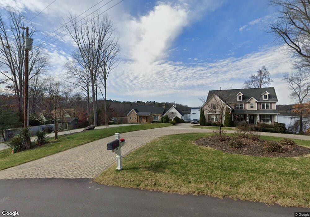
680 Normandy Rd Mooresville, NC 28117
Estimated Value: $1,055,000 - $2,962,440
4
Beds
5
Baths
3,624
Sq Ft
$544/Sq Ft
Est. Value
About This Home
This home is located at 680 Normandy Rd, Mooresville, NC 28117 and is currently estimated at $1,972,110, approximately $544 per square foot. 680 Normandy Rd is a home with nearby schools including Lakeshore Elementary School, Lakeshore Middle School, and Lake Norman High School.
Ownership History
Date
Name
Owned For
Owner Type
Purchase Details
Closed on
Aug 29, 2011
Sold by
Irvin Carolyn J
Bought by
Suther John M and Suther Bonnie N
Current Estimated Value
Home Financials for this Owner
Home Financials are based on the most recent Mortgage that was taken out on this home.
Original Mortgage
$175,000
Interest Rate
4.54%
Mortgage Type
Seller Take Back
Purchase Details
Closed on
Jul 1, 1996
Bought by
Irvin Carolyn J
Purchase Details
Closed on
Nov 1, 1991
Create a Home Valuation Report for This Property
The Home Valuation Report is an in-depth analysis detailing your home's value as well as a comparison with similar homes in the area
Home Values in the Area
Average Home Value in this Area
Purchase History
| Date | Buyer | Sale Price | Title Company |
|---|---|---|---|
| Suther John M | $385,000 | Chicago Title Insurance Co | |
| Irvin Carolyn J | $100,000 | -- | |
| -- | -- | -- |
Source: Public Records
Mortgage History
| Date | Status | Borrower | Loan Amount |
|---|---|---|---|
| Closed | Suther John M | $175,000 |
Source: Public Records
Tax History
| Year | Tax Paid | Tax Assessment Tax Assessment Total Assessment is a certain percentage of the fair market value that is determined by local assessors to be the total taxable value of land and additions on the property. | Land | Improvement |
|---|---|---|---|---|
| 2025 | $14,368 | $2,425,040 | $630,000 | $1,795,040 |
| 2024 | $14,368 | $2,425,040 | $630,000 | $1,795,040 |
| 2023 | $14,368 | $2,425,040 | $630,000 | $1,795,040 |
| 2022 | $10,496 | $1,663,180 | $341,250 | $1,321,930 |
| 2021 | $10,492 | $1,663,180 | $341,250 | $1,321,930 |
| 2020 | $10,492 | $1,663,180 | $341,250 | $1,321,930 |
| 2019 | $9,919 | $1,650,630 | $341,250 | $1,309,380 |
| 2018 | $7,768 | $1,291,300 | $315,000 | $976,300 |
| 2017 | $6,064 | $1,006,260 | $315,000 | $691,260 |
| 2016 | $2,011 | $327,840 | $315,000 | $12,840 |
| 2015 | $2,011 | $327,840 | $315,000 | $12,840 |
| 2014 | $1,855 | $324,880 | $315,000 | $9,880 |
Source: Public Records
Map
Nearby Homes
- 480 Robinson Rd
- 644 Normandy Rd
- 623 Normandy Rd
- 390 Robinson Rd
- 127 Melrose Ln
- 578 Normandy Rd
- 125 Melrose Ln
- 121 Rustic Way Ln
- 117 Doolittle Ln
- 157 Ross Rd
- Lot 3 Rutan Ct Unit 3
- 00 Rutan Ct
- 176 Broadview Cir
- 182 Broadview Cir
- 164 Normandy Rd
- 630 Kenway Loop
- 128 Audrey Ln
- 626 Kenway Loop
- 669 Kenway Loop
- 131 Normandy Rd
- 678 Normandy Rd
- 684 Normandy Rd
- 674 Normandy Rd
- 690 Normandy Rd
- 690 Normandy Rd Unit NULL
- 675 Normandy Rd
- 687 Normandy Rd
- 670 Normandy Rd
- 667 Normandy Rd
- 693 Normandy Rd
- 471 Robinson Rd
- 657 Normandy Rd
- 666 Normandy Rd
- 479 Robinson Rd
- 473 Robinson Rd
- 485 Robinson Rd
- 697 Normandy Rd
- 651 Normandy Rd
- 491 Robinson Rd
- 664 Normandy Rd
Your Personal Tour Guide
Ask me questions while you tour the home.