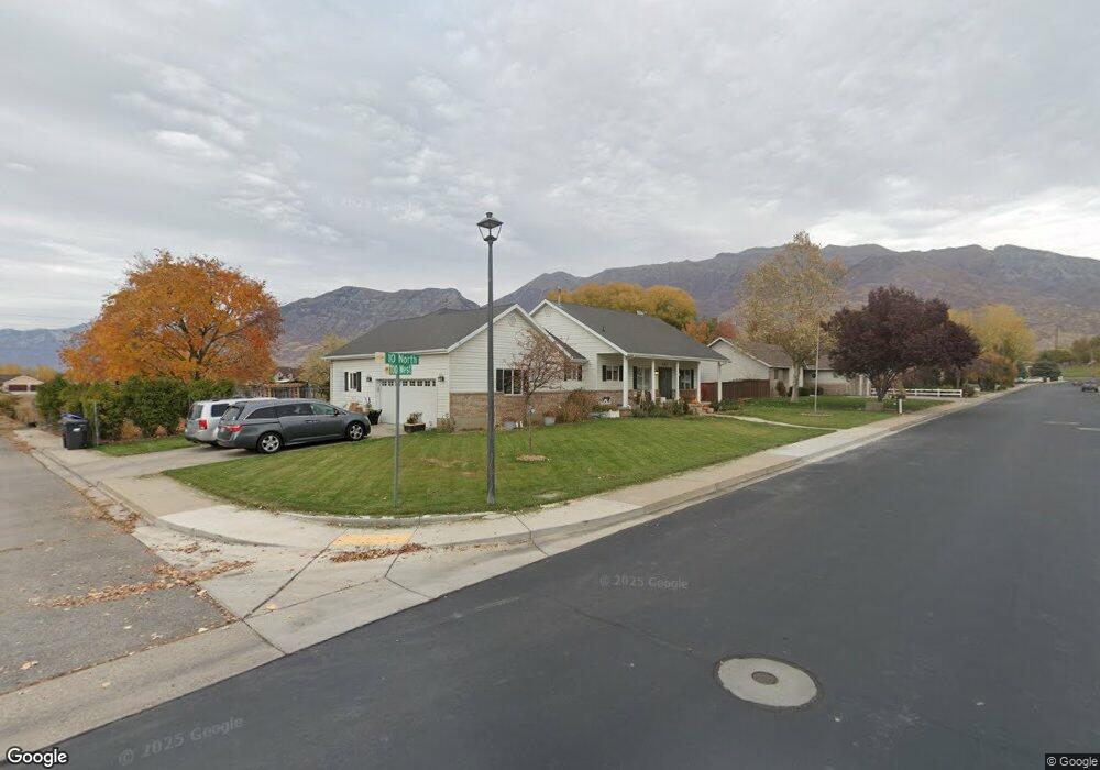
680 W 10 N Lindon, UT 84042
Estimated Value: $688,000 - $844,000
6
Beds
3
Baths
3,476
Sq Ft
$216/Sq Ft
Est. Value
About This Home
This home is located at 680 W 10 N, Lindon, UT 84042 and is currently estimated at $749,920, approximately $215 per square foot. 680 W 10 N is a home located in Utah County with nearby schools including Aspen Elementary School, Oak Canyon Junior High School, and Pleasant Grove High School.
Ownership History
Date
Name
Owned For
Owner Type
Purchase Details
Closed on
Jun 29, 2022
Sold by
Ruse Living Trust
Bought by
Black Melinda
Current Estimated Value
Home Financials for this Owner
Home Financials are based on the most recent Mortgage that was taken out on this home.
Original Mortgage
$439,000
Outstanding Balance
$417,658
Interest Rate
5.09%
Mortgage Type
New Conventional
Estimated Equity
$332,262
Purchase Details
Closed on
Sep 6, 2013
Sold by
Ruse C Kelsey C and Ruse Debra A
Bought by
Ruse Charles Kelsey and Ruse Debra Ann
Create a Home Valuation Report for This Property
The Home Valuation Report is an in-depth analysis detailing your home's value as well as a comparison with similar homes in the area
Home Values in the Area
Average Home Value in this Area
Purchase History
We collect this data history from publicly available records. To have your information removed, we recommend requesting removal directly through your county’s website.
| Date | Buyer | Sale Price | Title Company |
|---|---|---|---|
| Black Melinda | -- | Real Advantage Title | |
| Ruse Charles Kelsey | -- | None Available |
Source: Public Records
Mortgage History
We collect this data history from publicly available records. To have your information removed, we recommend requesting removal directly through your county’s website.
| Date | Status | Borrower | Loan Amount |
|---|---|---|---|
| Open | Black Melinda | $439,000 |
Source: Public Records
Tax History
| Year | Tax Paid | Tax Assessment Tax Assessment Total Assessment is a certain percentage of the fair market value that is determined by local assessors to be the total taxable value of land and additions on the property. | Land | Improvement |
|---|---|---|---|---|
| 2025 | $2,597 | $344,245 | -- | -- |
| 2024 | $2,597 | $320,155 | $0 | $0 |
| 2023 | $2,390 | $316,415 | $0 | $0 |
| 2022 | $2,376 | $303,875 | $0 | $0 |
| 2021 | $2,187 | $421,800 | $150,300 | $271,500 |
| 2020 | $2,033 | $386,000 | $139,200 | $246,800 |
| 2019 | $1,743 | $345,300 | $130,700 | $214,600 |
| 2018 | $1,737 | $324,400 | $122,300 | $202,100 |
| 2017 | $1,736 | $173,800 | $0 | $0 |
| 2016 | $1,877 | $173,800 | $0 | $0 |
| 2015 | $1,805 | $158,070 | $0 | $0 |
| 2014 | $1,689 | $146,465 | $0 | $0 |
Source: Public Records
Map
Nearby Homes
- 648 W 250 N
- 497 W 490 N
- 481 W 490 N
- 469 W 490 N
- 465 W 490 N
- 461 W 490 N
- 357 S 320 W
- 341 W 600 N
- 1022 W 1770 N
- 190 E 800 N Unit 4
- 150 E 800 N Unit 2
- 170 E 800 N Unit 3
- 130 E 800 N Unit 1
- 433 N Locust Ave
- 1917 N 860 W
- 1227 W Sweet Corn Ln
- 560 N Buffalo Grass Ln
- 556 N Buffalo Grass Ln
- 572 N Buffalo Grass Ln
- 554 N Buffalo Grass Ln
Your Personal Tour Guide
Ask me questions while you tour the home.