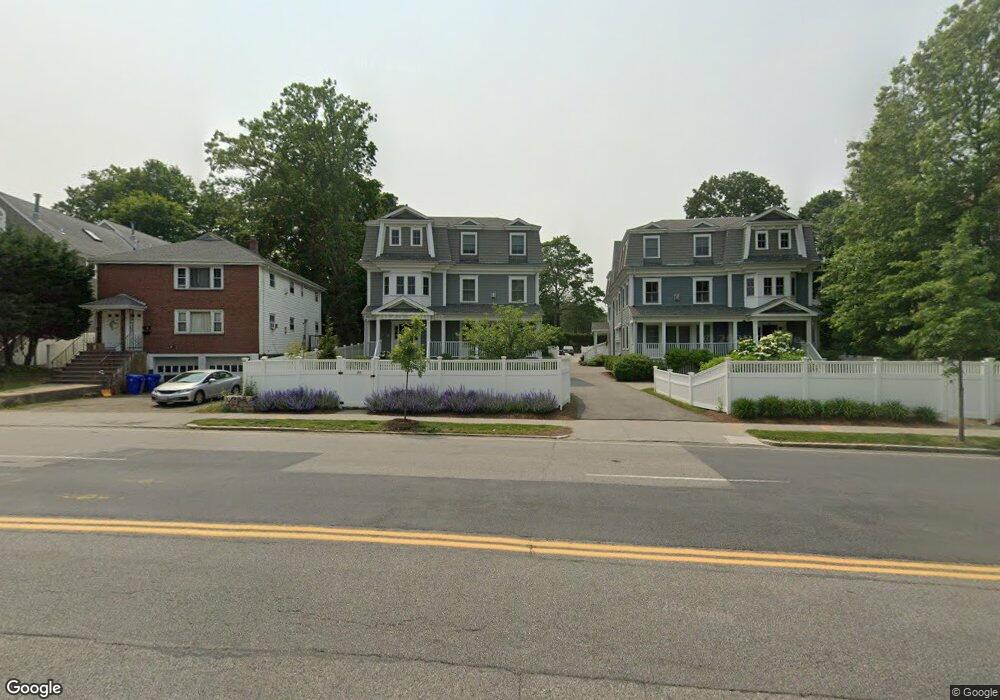
683 Hammond St Unit B Chestnut Hill, MA 02467
Chestnut Hill NeighborhoodEstimated Value: $1,900,000 - $2,185,000
Studio
4
Baths
3,226
Sq Ft
$639/Sq Ft
Est. Value
About This Home
This home is located at 683 Hammond St Unit B, Chestnut Hill, MA 02467 and is currently estimated at $2,062,521, approximately $639 per square foot. 683 Hammond St Unit B is a home located in Norfolk County with nearby schools including Baker School, Brookline High School, and Mount Alvernia Academy.
Ownership History
Date
Name
Owned For
Owner Type
Purchase Details
Closed on
May 4, 2023
Sold by
Berman Henry and Berman Carole
Bought by
Henry L Berman and Henry Berman
Current Estimated Value
Purchase Details
Closed on
May 19, 2022
Sold by
H Thomas Aretz 2005 Ret and Aretz
Bought by
Berman Carole and Berman Henry L
Home Financials for this Owner
Home Financials are based on the most recent Mortgage that was taken out on this home.
Original Mortgage
$675,000
Interest Rate
4.72%
Mortgage Type
Purchase Money Mortgage
Purchase Details
Closed on
Jan 28, 2022
Sold by
Aretz Thomas
Bought by
H Thomas Aretz 2005 Ret and Aretz
Purchase Details
Closed on
Apr 11, 2019
Sold by
Plainfield Development
Bought by
Whitmore Erika and Thomas Aretz H
Home Financials for this Owner
Home Financials are based on the most recent Mortgage that was taken out on this home.
Original Mortgage
$1,440,750
Interest Rate
4.3%
Mortgage Type
Purchase Money Mortgage
Create a Home Valuation Report for This Property
The Home Valuation Report is an in-depth analysis detailing your home's value as well as a comparison with similar homes in the area
Home Values in the Area
Average Home Value in this Area
Purchase History
We collect this data history from publicly available records. To have your information removed, we recommend requesting removal directly through your county’s website.
| Date | Buyer | Sale Price | Title Company |
|---|---|---|---|
| Henry L Berman | -- | None Available | |
| Berman Carole | $1,960,000 | None Available | |
| H Thomas Aretz 2005 Ret | -- | None Available | |
| Whitmore Erika | $1,695,000 | -- |
Source: Public Records
Mortgage History
We collect this data history from publicly available records. To have your information removed, we recommend requesting removal directly through your county’s website.
| Date | Status | Borrower | Loan Amount |
|---|---|---|---|
| Previous Owner | Berman Carole | $675,000 | |
| Previous Owner | Whitmore Erika | $1,440,750 |
Source: Public Records
Tax History
| Year | Tax Paid | Tax Assessment Tax Assessment Total Assessment is a certain percentage of the fair market value that is determined by local assessors to be the total taxable value of land and additions on the property. | Land | Improvement |
|---|---|---|---|---|
| 2025 | $18,742 | $1,898,900 | $0 | $1,898,900 |
| 2024 | $18,189 | $1,861,700 | $0 | $1,861,700 |
| 2023 | $18,349 | $1,840,400 | $0 | $1,840,400 |
| 2022 | $18,209 | $1,786,900 | $0 | $1,786,900 |
| 2021 | $17,338 | $1,769,200 | $0 | $1,769,200 |
| 2020 | $16,555 | $1,751,800 | $0 | $1,751,800 |
| 2019 | $15,632 | $1,668,300 | $0 | $1,668,300 |
Source: Public Records
Map
Nearby Homes
- 629 Hammond St Unit E205
- 25 Holly Ln Unit 1D
- 3 Glenoe Rd
- 0 Glenoe Rd
- 1148 Boylston St
- 460 Heath St
- 764 Hammond St
- 401 Heath St
- 100 Boylston St Unit 1
- 21 Hammond Pond Pkwy Unit 2
- 96 Boylston St Unit 3
- 321 Hammond Pond Pkwy Unit 103
- 321 Hammond Pond Pkwy Unit 106
- 1014 Boylston St
- 331 Heath St
- 310 Hammond Pond Pkwy Unit 301
- 310 Hammond Pond Pkwy Unit 401
- 809-811 Heath St Unit 811
- 811 Heath St
- 8 Heathwood Ln
- 675A Hammond St
- 675 Hammond St Unit 2
- 681 Hammond St
- 681 Hammond St Unit A
- 681 Hammond St Unit B
- 677 Hammond St
- 677 Hammond St
- 677 Hammond St Unit 677
- 673 Hammond St
- 675 Hammond St Unit 1
- 675 Hammond St Unit 2
- 675 Hammond St
- 675 Hammond St Unit 3 675
- 671 Hammond St
- 671 Hammond St Unit 2,671
- 671 Hammond St Unit 2
- 671 Hammond St Unit 1
- 679 Hammond St
- 663 Hammond St
- 663 Hammond St
Your Personal Tour Guide
Ask me questions while you tour the home.