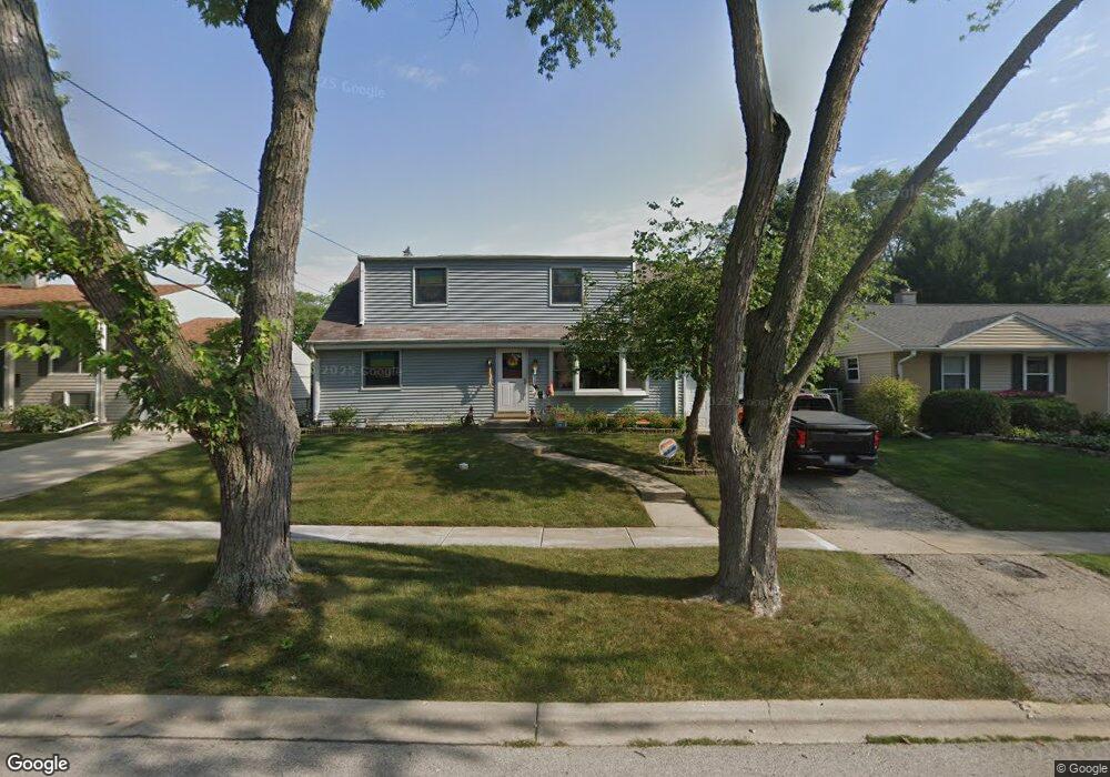
684 Maple Dr Buffalo Grove, IL 60089
South Buffalo Grove NeighborhoodEstimated Value: $388,000 - $452,000
4
Beds
2
Baths
1,963
Sq Ft
$217/Sq Ft
Est. Value
About This Home
This home is located at 684 Maple Dr, Buffalo Grove, IL 60089 and is currently estimated at $425,735, approximately $216 per square foot. 684 Maple Dr is a home located in Cook County with nearby schools including Henry W Longfellow Elementary School, Cooper Middle School, and Buffalo Grove High School.
Ownership History
Date
Name
Owned For
Owner Type
Purchase Details
Closed on
Apr 9, 1997
Sold by
Anderson Harriet W
Bought by
Dickinson Paul A and Dickinson Phyllis
Current Estimated Value
Home Financials for this Owner
Home Financials are based on the most recent Mortgage that was taken out on this home.
Original Mortgage
$153,000
Outstanding Balance
$16,596
Interest Rate
7.74%
Estimated Equity
$409,139
Purchase Details
Closed on
Sep 12, 1995
Sold by
Anderson Harriet W
Bought by
Anderson Harriet W and Harriet Anderson Revocable Trust Of 1995
Create a Home Valuation Report for This Property
The Home Valuation Report is an in-depth analysis detailing your home's value as well as a comparison with similar homes in the area
Home Values in the Area
Average Home Value in this Area
Purchase History
| Date | Buyer | Sale Price | Title Company |
|---|---|---|---|
| Dickinson Paul A | $170,000 | -- | |
| Anderson Harriet W | -- | -- |
Source: Public Records
Mortgage History
| Date | Status | Borrower | Loan Amount |
|---|---|---|---|
| Open | Dickinson Paul A | $153,000 |
Source: Public Records
Tax History
| Year | Tax Paid | Tax Assessment Tax Assessment Total Assessment is a certain percentage of the fair market value that is determined by local assessors to be the total taxable value of land and additions on the property. | Land | Improvement |
|---|---|---|---|---|
| 2025 | $8,332 | $42,000 | $7,560 | $34,440 |
| 2024 | $8,332 | $32,000 | $6,480 | $25,520 |
| 2023 | $7,958 | $32,000 | $6,480 | $25,520 |
| 2022 | $7,958 | $32,000 | $6,480 | $25,520 |
| 2021 | $7,764 | $27,971 | $4,140 | $23,831 |
| 2020 | $7,697 | $27,971 | $4,140 | $23,831 |
| 2019 | $8,222 | $32,729 | $4,140 | $28,589 |
| 2018 | $7,331 | $27,470 | $3,600 | $23,870 |
| 2017 | $8,168 | $30,237 | $3,600 | $26,637 |
| 2016 | $8,152 | $30,237 | $3,600 | $26,637 |
| 2015 | $7,467 | $24,603 | $3,060 | $21,543 |
| 2014 | $7,362 | $24,603 | $3,060 | $21,543 |
| 2013 | $6,787 | $24,603 | $3,060 | $21,543 |
Source: Public Records
Map
Nearby Homes
- 267 Timber Hill Rd
- 393 Indian Hill Dr
- 517 Longwood Dr
- 535 Weidner Rd
- 462 Longwood Dr
- 808 Old Checker Rd Unit C2
- 140 Manchester Dr Unit 408
- 222 Saint Marys Pkwy
- 170 Manchester Dr Unit 306
- 496 Raupp Blvd
- 141 Manchester Ct
- 125 N Buffalo Grove Rd Unit 407
- 1096 Beechwood Rd
- 800 Weidner Rd Unit 208
- 671 Hapsfield Ln Unit 105
- 820 Weidner Rd Unit 4013
- 820 Weidner Rd Unit 409
- 621 Hapsfield Ln Unit 103
- 4 Burnt Ember Ct
- 760 Weidner Rd Unit 107
- 692 Maple Dr
- 674 Maple Dr
- 662 Maple Dr
- 683 Saint Marys Pkwy
- 171 Cherrywood Rd
- 691 Saint Marys Pkwy
- 673 Saint Marys Pkwy Unit 6
- 663 Saint Marys Pkwy
- 151 Cherrywood Rd
- 685 Maple Dr
- 652 Maple Dr
- 691 Maple Dr
- 673 Maple Dr
- 199 Cherrywood Rd
- 661 Maple Dr
- 653 Saint Marys Pkwy
- 644 Maple Dr
- 653 Maple Dr Unit 6
- 643 Saint Marys Pkwy
- 180 Cherrywood Rd
Your Personal Tour Guide
Ask me questions while you tour the home.