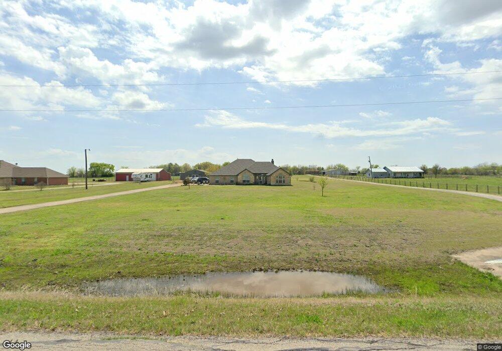
6885 Michael Rd Sanger, TX 76266
Estimated Value: $403,000 - $576,000
3
Beds
3
Baths
2,016
Sq Ft
$252/Sq Ft
Est. Value
About This Home
This home is located at 6885 Michael Rd, Sanger, TX 76266 and is currently estimated at $507,168, approximately $251 per square foot. 6885 Michael Rd is a home located in Denton County with nearby schools including Chisholm Trail Elementary School, Clear Creek Intermediate School, and Sanger Sixth Grade Campus.
Ownership History
Date
Name
Owned For
Owner Type
Purchase Details
Closed on
Aug 26, 2015
Sold by
Montgomery Carolyn
Bought by
Melson Angela R and Melson Thomas H
Current Estimated Value
Home Financials for this Owner
Home Financials are based on the most recent Mortgage that was taken out on this home.
Original Mortgage
$195,000
Outstanding Balance
$154,249
Interest Rate
4.12%
Mortgage Type
New Conventional
Estimated Equity
$352,919
Purchase Details
Closed on
Oct 7, 2008
Sold by
Timarian Custom Homes Inc
Bought by
Montgomery Carolyn
Home Financials for this Owner
Home Financials are based on the most recent Mortgage that was taken out on this home.
Original Mortgage
$176,250
Interest Rate
6.46%
Mortgage Type
Purchase Money Mortgage
Create a Home Valuation Report for This Property
The Home Valuation Report is an in-depth analysis detailing your home's value as well as a comparison with similar homes in the area
Home Values in the Area
Average Home Value in this Area
Purchase History
| Date | Buyer | Sale Price | Title Company |
|---|---|---|---|
| Melson Angela R | -- | None Available | |
| Montgomery Carolyn | -- | Fatco |
Source: Public Records
Mortgage History
| Date | Status | Borrower | Loan Amount |
|---|---|---|---|
| Open | Melson Angela R | $195,000 | |
| Previous Owner | Montgomery Carolyn | $176,250 |
Source: Public Records
Tax History
| Year | Tax Paid | Tax Assessment Tax Assessment Total Assessment is a certain percentage of the fair market value that is determined by local assessors to be the total taxable value of land and additions on the property. | Land | Improvement |
|---|---|---|---|---|
| 2025 | $5,288 | $516,090 | $198,263 | $317,827 |
| 2024 | $6,442 | $474,612 | $0 | $0 |
| 2023 | $4,686 | $428,148 | $198,263 | $360,119 |
| 2022 | $6,580 | $396,713 | $89,226 | $320,385 |
| 2021 | $5,265 | $360,824 | $82,078 | $278,746 |
| 2020 | $5,493 | $349,600 | $82,078 | $267,522 |
| 2019 | $5,387 | $329,133 | $82,078 | $266,838 |
| 2018 | $4,946 | $299,939 | $66,112 | $240,815 |
| 2017 | $4,541 | $273,465 | $66,112 | $228,327 |
| 2016 | $4,166 | $249,725 | $42,711 | $207,014 |
| 2015 | $2,855 | $224,256 | $42,711 | $190,836 |
| 2014 | $2,855 | $203,784 | $42,711 | $161,073 |
| 2013 | -- | $202,316 | $42,711 | $159,605 |
Source: Public Records
Map
Nearby Homes
- 6958 Michael Rd
- 7140 Davidson Rd
- 6044 Mango Dr
- TBD Michael Rd
- 6037 Amber Dr
- 6033 Mango Dr
- 14158 Crest View Rd
- . Fm 2450 & Indian Trail
- 8875 Fm 2450
- 6009 Amber Dr
- 6713 Mustang Trail
- 6210 Deer Run Rd
- 6221 Deer Run Rd
- 8774 Kassandra Dr
- 8797 Kassandra Dr
- 6807 Sam Bass Rd
- 9061 Crow Wright Rd
- 7196 Hawkeye Rd
- TBD Hawkeye Rd
- 7739 Borth Rd
- 6825 Michael Rd
- 6717 Michael Rd
- 6898 Michael Rd
- 6943 Michael Rd
- 6687 Michael Rd
- 6790 Michael Rd
- 6784 Michael Rd
- 2102 Bowie St
- 6979 Michael Rd
- 2090 Bowie St
- 7024 Michael Rd
- 6720 Michael Rd
- 6657 Michael Rd
- 6686 Michael Rd
- 7341 Sheridan Ct
- 6811 Michael Rd
- 6530 Ridgerock Dr
- 2035 Bowie St
- 2020 Bowie St
- 7077 Michael Rd
Your Personal Tour Guide
Ask me questions while you tour the home.