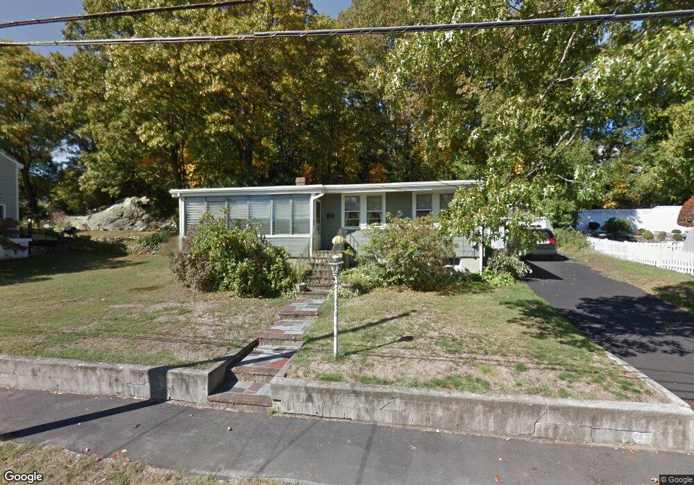
69 Bonham Rd Dedham, MA 02026
The Manor NeighborhoodEstimated Value: $629,000 - $741,000
3
Beds
1
Bath
1,390
Sq Ft
$492/Sq Ft
Est. Value
About This Home
This home is located at 69 Bonham Rd, Dedham, MA 02026 and is currently estimated at $683,921, approximately $492 per square foot. 69 Bonham Rd is a home located in Norfolk County with nearby schools including Greenlodge Elementary School, Dedham Middle School, and Dedham High School.
Create a Home Valuation Report for This Property
The Home Valuation Report is an in-depth analysis detailing your home's value as well as a comparison with similar homes in the area
Home Values in the Area
Average Home Value in this Area
Tax History
| Year | Tax Paid | Tax Assessment Tax Assessment Total Assessment is a certain percentage of the fair market value that is determined by local assessors to be the total taxable value of land and additions on the property. | Land | Improvement |
|---|---|---|---|---|
| 2025 | $7,498 | $594,100 | $357,100 | $237,000 |
| 2024 | $6,950 | $556,000 | $324,000 | $232,000 |
| 2023 | $6,682 | $520,400 | $293,400 | $227,000 |
| 2022 | $6,328 | $474,000 | $275,400 | $198,600 |
| 2021 | $6,011 | $439,700 | $255,100 | $184,600 |
| 2020 | $5,930 | $432,200 | $255,100 | $177,100 |
| 2019 | $5,637 | $398,400 | $221,800 | $176,600 |
| 2018 | $5,215 | $358,400 | $194,400 | $164,000 |
| 2017 | $5,114 | $346,500 | $182,500 | $164,000 |
| 2016 | $5,195 | $335,400 | $169,000 | $166,400 |
| 2015 | $5,170 | $325,800 | $166,900 | $158,900 |
| 2014 | $4,937 | $307,000 | $163,800 | $143,200 |
Source: Public Records
Map
Nearby Homes
- 391 Sprague St
- 397 Sprague St
- 18 Greensboro Rd
- 86 Durham Rd
- 94 Durham Rd
- 2 Leominster Rd
- 51 Lancaster Rd
- 93 Alden St
- 22 Azalea Cir
- 72 Crane St
- 68 Reed St
- 50 Sprague St
- 24 Prescott St Unit 3
- 24 Prescott St Unit 1
- 13 W Milton Place
- 12 Blossom St
- 45 Como Rd
- 989 East St Unit 402
- 000 Danny Rd
- 105 Oakdale Ave
Your Personal Tour Guide
Ask me questions while you tour the home.