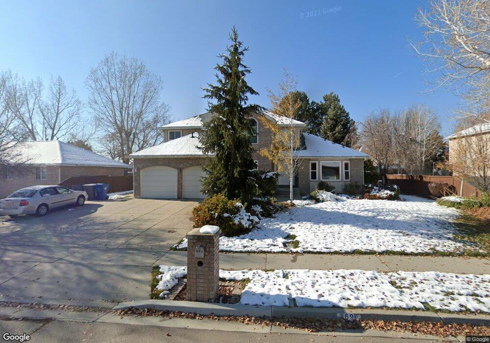
69 N 960 E American Fork, UT 84003
Estimated Value: $627,000 - $710,000
3
Beds
4
Baths
2,649
Sq Ft
$255/Sq Ft
Est. Value
About This Home
This home is located at 69 N 960 E, American Fork, UT 84003 and is currently estimated at $674,636, approximately $254 per square foot. 69 N 960 E is a home located in Utah County with nearby schools including Barratt Elementary School, American Fork Junior High School, and American Fork High School.
Ownership History
Date
Name
Owned For
Owner Type
Purchase Details
Closed on
Jan 31, 2025
Sold by
Merkley Christopher O and Merkley Amy G
Bought by
Christopher And Amy Merkley Living Trust and Merkley
Current Estimated Value
Purchase Details
Closed on
Dec 29, 2006
Sold by
Wagner Michael R and Wagner Kenna H
Bought by
Merkley Christopher O and Merkley Amy G
Home Financials for this Owner
Home Financials are based on the most recent Mortgage that was taken out on this home.
Original Mortgage
$114,000
Interest Rate
6.22%
Mortgage Type
Purchase Money Mortgage
Create a Home Valuation Report for This Property
The Home Valuation Report is an in-depth analysis detailing your home's value as well as a comparison with similar homes in the area
Home Values in the Area
Average Home Value in this Area
Purchase History
| Date | Buyer | Sale Price | Title Company |
|---|---|---|---|
| Christopher And Amy Merkley Living Trust | -- | None Listed On Document | |
| Merkley Christopher O | -- | Equity Title Orem Blvd |
Source: Public Records
Mortgage History
| Date | Status | Borrower | Loan Amount |
|---|---|---|---|
| Previous Owner | Merkley Christopher O | $114,000 |
Source: Public Records
Tax History
| Year | Tax Paid | Tax Assessment Tax Assessment Total Assessment is a certain percentage of the fair market value that is determined by local assessors to be the total taxable value of land and additions on the property. | Land | Improvement |
|---|---|---|---|---|
| 2025 | $3,046 | $351,835 | -- | -- |
| 2024 | $3,046 | $338,470 | $0 | $0 |
| 2023 | $2,872 | $338,360 | $0 | $0 |
| 2022 | $3,166 | $368,060 | $0 | $0 |
| 2021 | $2,726 | $495,000 | $154,900 | $340,100 |
| 2020 | $2,557 | $450,300 | $138,300 | $312,000 |
| 2019 | $2,418 | $440,500 | $128,500 | $312,000 |
| 2018 | $2,404 | $418,700 | $120,900 | $297,800 |
| 2017 | $2,331 | $219,065 | $0 | $0 |
| 2016 | $2,321 | $202,730 | $0 | $0 |
| 2015 | $2,446 | $202,730 | $0 | $0 |
| 2014 | $2,191 | $179,135 | $0 | $0 |
Source: Public Records
Map
Nearby Homes
Your Personal Tour Guide
Ask me questions while you tour the home.