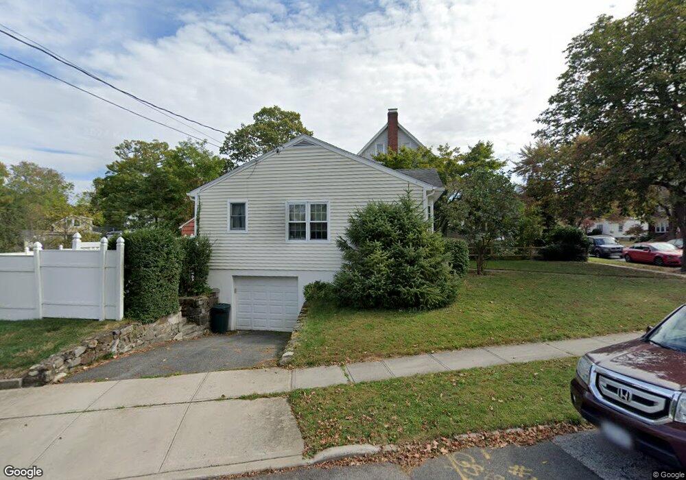
69 Stone Ave Ossining, NY 10562
Estimated Value: $509,523 - $584,000
2
Beds
1
Bath
936
Sq Ft
$583/Sq Ft
Est. Value
About This Home
This home is located at 69 Stone Ave, Ossining, NY 10562 and is currently estimated at $545,881, approximately $583 per square foot. 69 Stone Ave is a home located in Westchester County with nearby schools including Park School, Roosevelt Elementary School, and Brookside Elementary School.
Ownership History
Date
Name
Owned For
Owner Type
Purchase Details
Closed on
Jun 25, 2010
Sold by
Clifford Kevin and Clifford Kim
Bought by
Sindaco Sandra J
Current Estimated Value
Home Financials for this Owner
Home Financials are based on the most recent Mortgage that was taken out on this home.
Original Mortgage
$319,020
Outstanding Balance
$195,482
Interest Rate
3.75%
Mortgage Type
FHA
Estimated Equity
$350,399
Purchase Details
Closed on
Oct 20, 2004
Sold by
Hiltsley Dorothy
Bought by
Clifford Kevin and Clifford Kim
Home Financials for this Owner
Home Financials are based on the most recent Mortgage that was taken out on this home.
Original Mortgage
$250,000
Interest Rate
5.71%
Mortgage Type
Purchase Money Mortgage
Create a Home Valuation Report for This Property
The Home Valuation Report is an in-depth analysis detailing your home's value as well as a comparison with similar homes in the area
Home Values in the Area
Average Home Value in this Area
Purchase History
| Date | Buyer | Sale Price | Title Company |
|---|---|---|---|
| Sindaco Sandra J | $325,000 | All New York Title Agency In | |
| Clifford Kevin | $315,000 | -- |
Source: Public Records
Mortgage History
| Date | Status | Borrower | Loan Amount |
|---|---|---|---|
| Open | Sindaco Sandra J | $319,020 | |
| Previous Owner | Clifford Kevin | $250,000 |
Source: Public Records
Tax History
| Year | Tax Paid | Tax Assessment Tax Assessment Total Assessment is a certain percentage of the fair market value that is determined by local assessors to be the total taxable value of land and additions on the property. | Land | Improvement |
|---|---|---|---|---|
| 2024 | $10,778 | $385,900 | $157,600 | $228,300 |
| 2023 | $10,396 | $363,600 | $157,600 | $206,000 |
| 2022 | $10,074 | $333,800 | $157,600 | $176,200 |
| 2021 | $8,589 | $298,000 | $157,600 | $140,400 |
| 2020 | $9,855 | $298,000 | $157,600 | $140,400 |
| 2019 | $9,695 | $281,900 | $157,600 | $124,300 |
| 2018 | $9,514 | $281,900 | $157,600 | $124,300 |
| 2017 | $4,895 | $276,500 | $157,600 | $118,900 |
| 2016 | $88,634 | $271,100 | $157,600 | $113,500 |
| 2015 | $6,532 | $15,100 | $5,300 | $9,800 |
| 2014 | $6,532 | $15,100 | $5,300 | $9,800 |
| 2013 | $6,532 | $15,100 | $5,300 | $9,800 |
Source: Public Records
Map
Nearby Homes
Your Personal Tour Guide
Ask me questions while you tour the home.