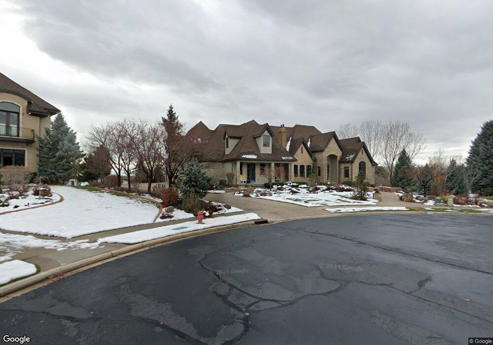
690 S Pheasant Ridge Cir Alpine, UT 84004
Estimated Value: $2,766,000 - $3,839,000
6
Beds
6
Baths
8,435
Sq Ft
$391/Sq Ft
Est. Value
About This Home
This home is located at 690 S Pheasant Ridge Cir, Alpine, UT 84004 and is currently estimated at $3,294,778, approximately $390 per square foot. 690 S Pheasant Ridge Cir is a home located in Utah County with nearby schools including Westfield School, Timberline Middle School, and Lone Peak High School.
Ownership History
Date
Name
Owned For
Owner Type
Purchase Details
Closed on
Mar 30, 2023
Sold by
Johnson R Rick
Bought by
Sgb Ventures Llc
Current Estimated Value
Purchase Details
Closed on
Jan 19, 2011
Sold by
Johnson R Rick and Johnson Kimberly D
Bought by
Johnson R Rick and Johnson Kim
Purchase Details
Closed on
May 26, 2009
Sold by
Johnson R Rick and Johnson Kim
Bought by
Johnson R Rick and Johnson Kimberly D
Home Financials for this Owner
Home Financials are based on the most recent Mortgage that was taken out on this home.
Original Mortgage
$417,000
Interest Rate
4.8%
Mortgage Type
New Conventional
Purchase Details
Closed on
Jul 25, 2006
Sold by
Johnson R Rick
Bought by
Johnson R Rick and Johnson Kimberly D
Home Financials for this Owner
Home Financials are based on the most recent Mortgage that was taken out on this home.
Original Mortgage
$999,000
Interest Rate
6.57%
Mortgage Type
Construction
Purchase Details
Closed on
Jun 30, 2004
Sold by
Sundance Homes Llc
Bought by
Johnson R Rick
Create a Home Valuation Report for This Property
The Home Valuation Report is an in-depth analysis detailing your home's value as well as a comparison with similar homes in the area
Home Values in the Area
Average Home Value in this Area
Purchase History
We collect this data history from publicly available records. To have your information removed, we recommend requesting removal directly through your county’s website.
| Date | Buyer | Sale Price | Title Company |
|---|---|---|---|
| Sgb Ventures Llc | -- | Sutherland Title | |
| Johnson R Rick | -- | Eagle Pointe Title Insuranc | |
| Johnson R Rick | -- | Eagle Pointe Title Insuranc | |
| Johnson R Rick | -- | Eagle Pointe Title Insuranc | |
| Johnson R Rick | -- | Backman | |
| Johnson R Rick | -- | Signature Title Insurance A | |
| Sundance Homes Llc | -- | Signature Title Insurance A |
Source: Public Records
Mortgage History
We collect this data history from publicly available records. To have your information removed, we recommend requesting removal directly through your county’s website.
| Date | Status | Borrower | Loan Amount |
|---|---|---|---|
| Previous Owner | Johnson R Rick | $417,000 | |
| Previous Owner | Johnson R Rick | $230,000 | |
| Previous Owner | Johnson R Rick | $999,000 |
Source: Public Records
Tax History
| Year | Tax Paid | Tax Assessment Tax Assessment Total Assessment is a certain percentage of the fair market value that is determined by local assessors to be the total taxable value of land and additions on the property. | Land | Improvement |
|---|---|---|---|---|
| 2025 | $11,330 | $1,458,105 | -- | -- |
| 2024 | $11,330 | $1,320,495 | $0 | $0 |
| 2023 | $10,872 | $1,360,315 | $0 | $0 |
| 2022 | $9,800 | $1,190,915 | $0 | $0 |
| 2021 | $7,947 | $1,500,200 | $431,600 | $1,068,600 |
| 2020 | $7,909 | $1,461,000 | $392,400 | $1,068,600 |
| 2019 | $7,576 | $1,461,000 | $392,400 | $1,068,600 |
| 2018 | $7,386 | $1,407,400 | $392,400 | $1,015,000 |
| 2017 | $7,125 | $722,480 | $0 | $0 |
| 2016 | $7,528 | $711,645 | $0 | $0 |
| 2015 | $7,187 | $642,730 | $0 | $0 |
| 2014 | $7,030 | $621,995 | $0 | $0 |
Source: Public Records
Map
Nearby Homes
- 690 S High Ridge Dr
- 811 S High Ridge Dr
- 596 S Cascade Ct
- 355 Wood Dr
- 4848 W Sampson Ct
- 682 Healey Blvd
- 5046 W Jonathon Rd Unit 10
- 130 Sunset Dr
- 802 S East Mountain Cir
- 202 E Alpine Dr
- 868 S Braddock Ln
- 815 E Alpine Dr
- 4739 W Snowflake Dr
- 250 S Main St Unit 25
- 250 S Main St Unit 24
- 250 S Main St Unit 9
- 250 S Main St Unit 7
- 243 W Conrad Ct
- 11107 Manor Dr Unit 1
- 259 Twin River Loop
- 690 S Pheasant Ridge Cir Unit 11
- 658 S Pheasant Ridge Cir Unit 10
- 681 S Pheasant Ridge Cir
- 653 S Pheasant Ridge Cir
- 653 S Pheasant Ridge Cir Unit 15
- 376 Carlisle Ave
- 626 S Pheasant Ridge Cir
- 626 S Pheasant Ridge Cir Unit 6
- 626 S Pheasant Ridge
- 378 E Pheasant Ridge Dr
- 378 E Pheasant Ridge Dr Unit 7
- 661 S Pheasant Ridge Ct
- 661 S Pheasant Ridge Ct Unit 9
- 661 S Pheasant Ridge Ct Unit 9
- 781 S David Ct
- 340 Carlisle Ave
- 619 S Pheasant Ridge Cir
- 629 S Pheasant Ridge Ct
- 629 S Pheasant Ridge Ct Unit 8
- 629 S Pheasant Ridge Ct
Your Personal Tour Guide
Ask me questions while you tour the home.