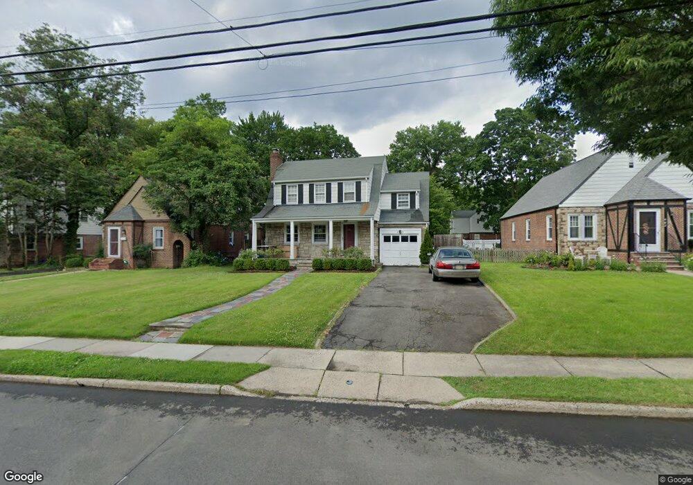
691 Ramapo Rd Teaneck, NJ 07666
Estimated Value: $632,000 - $739,985
Studio
--
Bath
1,512
Sq Ft
$457/Sq Ft
Est. Value
About This Home
This home is located at 691 Ramapo Rd, Teaneck, NJ 07666 and is currently estimated at $691,246, approximately $457 per square foot. 691 Ramapo Rd is a home located in Bergen County with nearby schools including Teaneck Senior High School, Teaneck Community Charter School, and Grace Lutheran School.
Ownership History
Date
Name
Owned For
Owner Type
Purchase Details
Closed on
Dec 1, 2004
Current Estimated Value
Purchase Details
Closed on
Sep 13, 2000
Sold by
Mars Harvey S
Bought by
Slabosevicius Paul and Wilson Laura
Home Financials for this Owner
Home Financials are based on the most recent Mortgage that was taken out on this home.
Original Mortgage
$187,200
Interest Rate
7.94%
Purchase Details
Closed on
Jun 18, 1996
Sold by
Burns Dennis and Burns Debra
Bought by
Mars Harvey and Mars Judith
Home Financials for this Owner
Home Financials are based on the most recent Mortgage that was taken out on this home.
Original Mortgage
$150,000
Interest Rate
8.05%
Purchase Details
Closed on
Apr 27, 1994
Sold by
Davis Thomas
Bought by
Burns Dennis and Burns Debra
Home Financials for this Owner
Home Financials are based on the most recent Mortgage that was taken out on this home.
Original Mortgage
$144,000
Interest Rate
8.4%
Create a Home Valuation Report for This Property
The Home Valuation Report is an in-depth analysis detailing your home's value as well as a comparison with similar homes in the area
Home Values in the Area
Average Home Value in this Area
Purchase History
| Date | Buyer | Sale Price | Title Company |
|---|---|---|---|
| -- | $404,000 | -- | |
| Slabosevicius Paul | $234,000 | -- | |
| Mars Harvey | $188,000 | -- | |
| Burns Dennis | $179,900 | -- |
Source: Public Records
Mortgage History
| Date | Status | Borrower | Loan Amount |
|---|---|---|---|
| Previous Owner | Slabosevicius Paul | $187,200 | |
| Previous Owner | Mars Harvey | $150,000 | |
| Previous Owner | Burns Dennis | $144,000 |
Source: Public Records
Tax History
| Year | Tax Paid | Tax Assessment Tax Assessment Total Assessment is a certain percentage of the fair market value that is determined by local assessors to be the total taxable value of land and additions on the property. | Land | Improvement |
|---|---|---|---|---|
| 2025 | $12,995 | $595,000 | $317,700 | $277,300 |
| 2024 | $11,673 | $595,000 | $317,700 | $277,300 |
| 2023 | $11,443 | $353,500 | $192,600 | $160,900 |
| 2022 | $11,443 | $353,500 | $192,600 | $160,900 |
| 2021 | $11,510 | $353,500 | $192,600 | $160,900 |
| 2020 | $11,432 | $353,500 | $192,600 | $160,900 |
| 2019 | $11,301 | $353,500 | $192,600 | $160,900 |
| 2018 | $11,217 | $353,500 | $192,600 | $160,900 |
| 2017 | $11,111 | $353,500 | $192,600 | $160,900 |
| 2016 | $10,944 | $353,500 | $192,600 | $160,900 |
| 2015 | $10,771 | $353,500 | $192,600 | $160,900 |
| 2014 | $10,557 | $410,600 | $261,800 | $148,800 |
Source: Public Records
Map
Nearby Homes
- 700 Ramapo Rd
- 669 Ramapo Rd
- 624 Ramapo Rd
- 609 Wyndham Rd
- 657 Martense Ave
- 528 Wyndham Rd
- 633 Wilmerding Ave
- 711 Camperdown Rd
- 489 Maple Ave
- 506 Sunderland Rd
- 971 Garrison Ave
- 712 Cedar Ln Unit 2
- 26 van Orden Place
- 1087 Lambert Rd
- 1284 Wellington Ave
- 597 Penn Ave
- 857 Garrison Ave
- 735 Elm Ave Unit 5F
- 590 North St
- 659 River Rd
Your Personal Tour Guide
Ask me questions while you tour the home.