6912 Sutherland Ave Saint Louis, MO 63109
Lindenwood Park NeighborhoodEstimated Value: $121,000 - $168,000
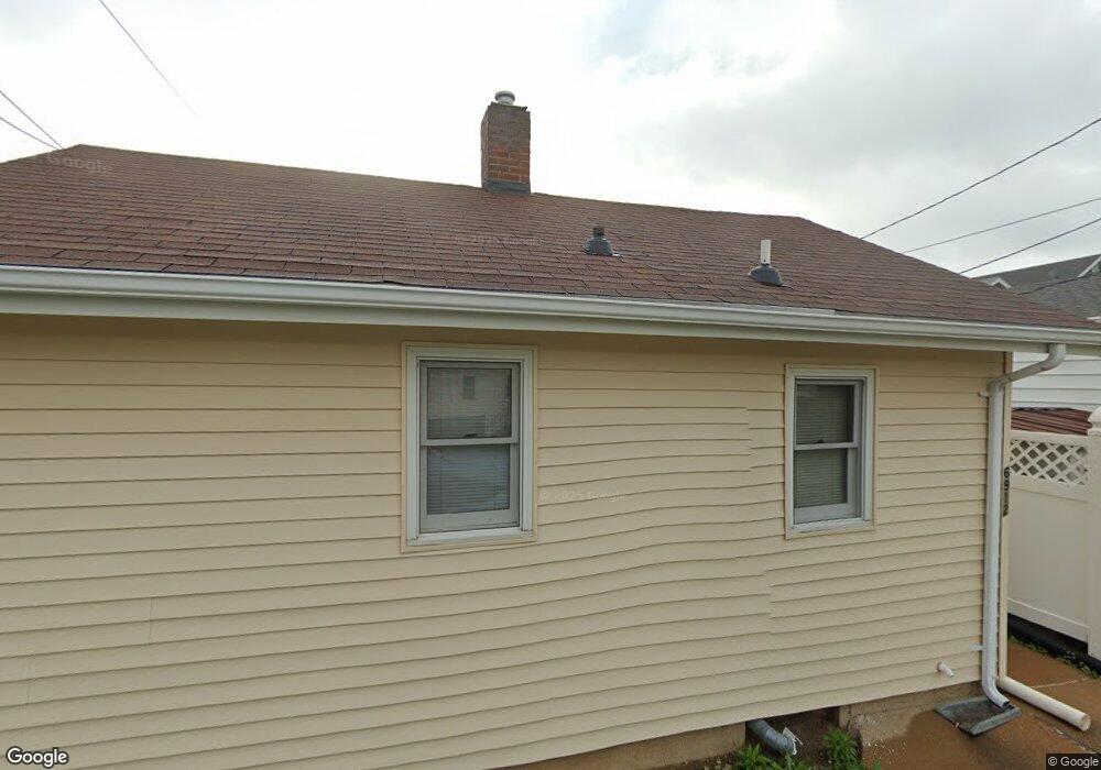
About This Home
This home is located at 6912 Sutherland Ave, Saint Louis, MO 63109 and is currently estimated at $146,049, approximately $101 per square foot. 6912 Sutherland Ave is a home located in St. Louis City with nearby schools including Mason Elementary School, Long International Middle School, and Roosevelt High School.
Ownership History
We collect this data history from publicly available records. To have your information removed, we recommend requesting removal directly through your county’s website.
Purchase Details
Home Financials for this Owner
Home Financials are based on the most recent Mortgage that was taken out on this home.Purchase Details
Home Values in the Area
Average Home Value in this Area
Purchase History
We collect this data history from publicly available records. To have your information removed, we recommend requesting removal directly through your county’s website.
| Date | Buyer | Sale Price | Title Company |
|---|---|---|---|
| -- | None Listed On Document | ||
| -- | -- |
Mortgage History
We collect this data history from publicly available records. To have your information removed, we recommend requesting removal directly through your county’s website.
| Date | Status | Borrower | Loan Amount |
|---|---|---|---|
| Closed | $93,750 |
Tax History
We collect this data history from publicly available records. To have your information removed, we recommend requesting removal directly through your county’s website.
| Year | Tax Paid | Tax Assessment Tax Assessment Total Assessment is a certain percentage of the fair market value that is determined by local assessors to be the total taxable value of land and additions on the property. | Land | Improvement |
|---|---|---|---|---|
| 2026 | $1,291 | $15,430 | $910 | $14,520 |
| 2025 | $1,291 | $15,430 | $910 | $14,520 |
| 2024 | $2,129 | $10,940 | $910 | $10,030 |
| 2023 | $2,129 | $27,280 | $2,200 | $25,080 |
| 2022 | $2,129 | $25,420 | $2,200 | $23,220 |
| 2021 | $2,126 | $25,420 | $2,200 | $23,220 |
| 2020 | $2,198 | $26,490 | $2,200 | $24,290 |
| 2019 | $2,190 | $26,480 | $2,200 | $24,280 |
| 2018 | $1,955 | $22,870 | $2,010 | $20,860 |
| 2017 | $1,921 | $22,880 | $2,010 | $20,860 |
| 2016 | $1,845 | $21,680 | $2,010 | $19,670 |
| 2015 | $1,673 | $21,680 | $2,010 | $19,670 |
| 2014 | $1,634 | $21,680 | $2,010 | $19,670 |
| 2013 | -- | $21,160 | $2,010 | $19,150 |
Map
- 4313 Jamieson Ave
- 6962 Sutherland Ave
- 7032 Lansdowne Ave
- 6663 Devonshire Ave
- 6993 Hillsland Ave
- 7075 Lansdowne Ave
- 6600 Devonshire Ave Unit 9
- 7078 Lindenwood Place
- 6980 Tholozan Ave
- 6531 Bancroft Ave
- 6546 Winnebago St
- 7071 Mardel Ave
- 7101 Lindenwood Place
- 7068 Tholozan Ave
- 6551 Itaska St
- 7038 Pernod Ave
- 6414 Lansdowne Ave
- 7146 Mardel Ave
- 6609 Pernod Ave
- 7161 Lindenwood Place
- 4401 Jamieson Ave
- 4405 Jamieson Ave
- 4409 Jamieson Ave
- 6916 Sutherland Ave
- 4325 Jamieson Ave
- 4413 Jamieson Ave
- 6920 Sutherland Ave
- 4415 Jamieson Ave
- 4321 Jamieson Ave
- 6922 Sutherland Ave
- 6915 Sutherland Ave
- 4317 Jamieson Ave
- 6919 Sutherland Ave
- 6915 Lansdowne Ave
- 6927 Lansdowne Ave
- 6926 Sutherland Ave
- 6923 Sutherland Ave
- 4400 Jamieson Ave
- 6923 Lansdowne Ave
- 4404 Jamieson Ave
Ask me questions while you tour the home.