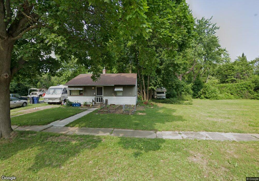
6917 Daniel Dr Flint, MI 48505
Northeast Village NeighborhoodEstimated Value: $38,000
2
Beds
1
Bath
742
Sq Ft
$51/Sq Ft
Est. Value
About This Home
This home is located at 6917 Daniel Dr, Flint, MI 48505 and is currently estimated at $38,000, approximately $51 per square foot. 6917 Daniel Dr is a home located in Genesee County with nearby schools including Brownell STEM Academy, The New Standard Academy, and St. Mark Lutheran School.
Ownership History
Date
Name
Owned For
Owner Type
Purchase Details
Closed on
May 8, 2025
Sold by
Genesee County Land Bank Authority
Bought by
Ketzbeau Kelvin
Current Estimated Value
Purchase Details
Closed on
Dec 17, 2015
Sold by
Genesee County
Bought by
Genesee County Land Bank
Purchase Details
Closed on
Jun 1, 2013
Sold by
Landon Karter
Bought by
Usa Home Buyer Inc
Purchase Details
Closed on
Nov 8, 2001
Sold by
Landon Karter
Bought by
Bossman Investments Inc
Create a Home Valuation Report for This Property
The Home Valuation Report is an in-depth analysis detailing your home's value as well as a comparison with similar homes in the area
Home Values in the Area
Average Home Value in this Area
Purchase History
| Date | Buyer | Sale Price | Title Company |
|---|---|---|---|
| Ketzbeau Kelvin | -- | None Listed On Document | |
| Genesee County Land Bank | -- | None Available | |
| Usa Home Buyer Inc | -- | None Available | |
| Bossman Investments Inc | -- | First American Title Ins Co |
Source: Public Records
Tax History
| Year | Tax Paid | Tax Assessment Tax Assessment Total Assessment is a certain percentage of the fair market value that is determined by local assessors to be the total taxable value of land and additions on the property. | Land | Improvement |
|---|---|---|---|---|
| 2025 | -- | $0 | $0 | $0 |
| 2024 | -- | $0 | $0 | $0 |
| 2023 | -- | $0 | $0 | $0 |
| 2022 | $0 | $0 | $0 | $0 |
| 2021 | $0 | $0 | $0 | $0 |
| 2020 | $0 | $0 | $0 | $0 |
| 2019 | $0 | $0 | $0 | $0 |
| 2018 | $0 | $0 | $0 | $0 |
| 2017 | $0 | $0 | $0 | $0 |
| 2016 | $0 | $0 | $0 | $0 |
| 2015 | -- | $0 | $0 | $0 |
| 2014 | -- | $0 | $0 | $0 |
| 2012 | -- | $4,300 | $0 | $0 |
Source: Public Records
Map
Nearby Homes
- 1704 E Webster Rd
- 5910 N Dort Hwy
- E E Carpenter Rd
- 5919 Western Rd
- 1218 E Piper Ave
- 1206 E Home Ave
- 6101 Selby St
- 2727 Eaton Place
- 2825 Eaton Place
- 2909 E Pierson Rd
- 5190 Branch Rd
- 802 E Russell Ave
- 1151 E Cornell Ave
- 1023 E Princeton Ave
- 4907 Delta Dr
- 418 E Foss Ave
- 1080 E Cornell Ave
- 2135 E Coldwater Rd
- 638 E Foss Ave
- 1062 Tremont Ave
Your Personal Tour Guide
Ask me questions while you tour the home.