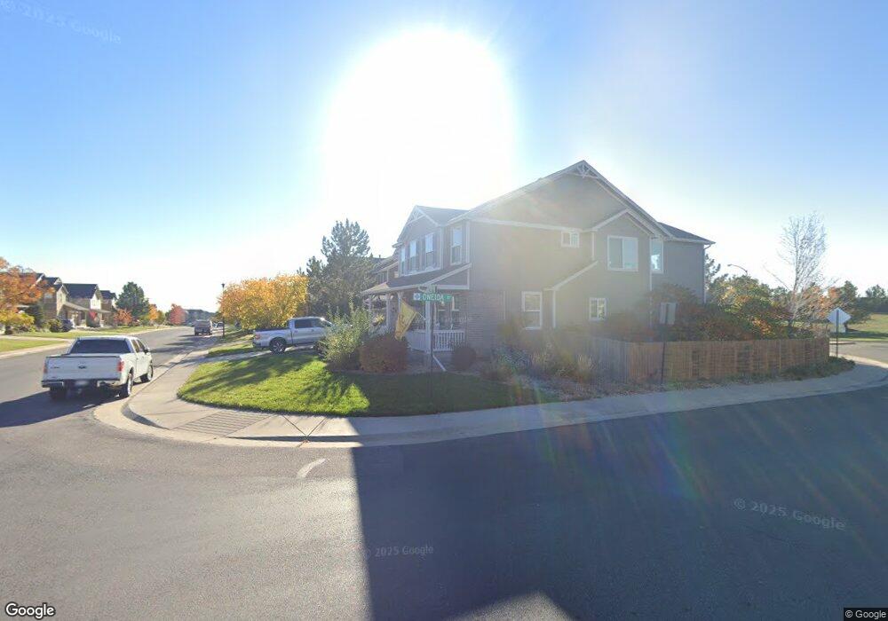
6926 E 131st Way Thornton, CO 80602
Estimated Value: $680,000 - $759,641
About This Home
This home is located at 6926 E 131st Way, Thornton, CO 80602 and is currently estimated at $736,160, approximately $164 per square foot. 6926 E 131st Way is a home located in Adams County with nearby schools including West Ridge Elementary School, Rodger Quist Middle School, and Riverdale Ridge High School.
Ownership History
We collect this data history from publicly available records. To have your information removed, we recommend requesting removal directly through your county’s website.
Purchase Details
Home Financials for this Owner
Home Financials are based on the most recent Mortgage that was taken out on this home.Purchase Details
Purchase Details
Home Financials for this Owner
Home Financials are based on the most recent Mortgage that was taken out on this home.Purchase Details
Home Financials for this Owner
Home Financials are based on the most recent Mortgage that was taken out on this home.Purchase Details
Purchase Details
Purchase History
We collect this data history from publicly available records. To have your information removed, we recommend requesting removal directly through your county’s website.
| Date | Buyer | Sale Price | Title Company |
|---|---|---|---|
| $685,000 | Heritage Title Co | ||
| -- | None Available | ||
| $395,000 | Homestead Title | ||
| -- | Land Title Guarantee Company | ||
| -- | None Available | ||
| $354,059 | Land Title Guarantee Company |
Mortgage History
We collect this data history from publicly available records. To have your information removed, we recommend requesting removal directly through your county’s website.
| Date | Status | Borrower | Loan Amount |
|---|---|---|---|
| Open | $480,000 | ||
| Previous Owner | $316,000 | ||
| Previous Owner | $155,000 |
Tax History
We collect this data history from publicly available records. To have your information removed, we recommend requesting removal directly through your county’s website.
| Year | Tax Paid | Tax Assessment Tax Assessment Total Assessment is a certain percentage of the fair market value that is determined by local assessors to be the total taxable value of land and additions on the property. | Land | Improvement |
|---|---|---|---|---|
| 2025 | $4,631 | $48,890 | $8,910 | $39,980 |
| 2024 | $4,631 | $44,940 | $8,190 | $36,750 |
| 2023 | $4,608 | $51,210 | $7,440 | $43,770 |
| 2022 | $3,317 | $33,820 | $7,300 | $26,520 |
| 2021 | $3,195 | $33,820 | $7,300 | $26,520 |
| 2020 | $3,064 | $33,850 | $7,870 | $25,980 |
| 2019 | $3,067 | $33,850 | $7,870 | $25,980 |
| 2018 | $2,867 | $31,630 | $6,840 | $24,790 |
| 2017 | $2,863 | $31,630 | $6,840 | $24,790 |
| 2016 | $2,544 | $28,000 | $4,940 | $23,060 |
| 2015 | $2,538 | $28,000 | $4,940 | $23,060 |
| 2014 | $2,199 | $24,640 | $4,220 | $20,420 |
Map
- 7183 E 131st Dr
- 6825 E 131st Dr
- 13003 Niagara St
- 13010 Niagara Way
- 12970 Quebec St
- 12808 Newport Way
- 6883 E 132nd Place
- 6875 E 133rd Ave
- 12840 Jasmine St Unit D
- 13350 Monaco Ct
- 12896 Syracuse St
- 12822 Jasmine St Unit E
- 12753 Leyden St Unit A
- 12876 Jasmine St Unit E
- 12852 Jasmine St Unit E
- 12759 Tamarac St
- 12693 Tamarac St
- 12833 Tamarac Way
- 13090 Tamarac St
- 12520 Poplar St
- 6952 E 131st Way
- 6902 E 131st Way
- 6976 E 131st Way
- 6913 E 131st Way
- 6937 E 131st Way
- 6959 E 131st Way
- 6998 E 131st Way
- 6898 E 131st Way
- 6991 E 131st Way
- 6910 E 131st Dr
- 6928 E 131st Dr
- 7006 E 131st Way
- 6885 E 131st Way
- 6954 E 131st Dr
- 6886 E 131st Way
- 7005 E 131st Way
- 6980 E 131st Dr
- 7056 E 131st Way
- 6872 E 131st Way
- 7190 E 131st Way
Ask me questions while you tour the home.