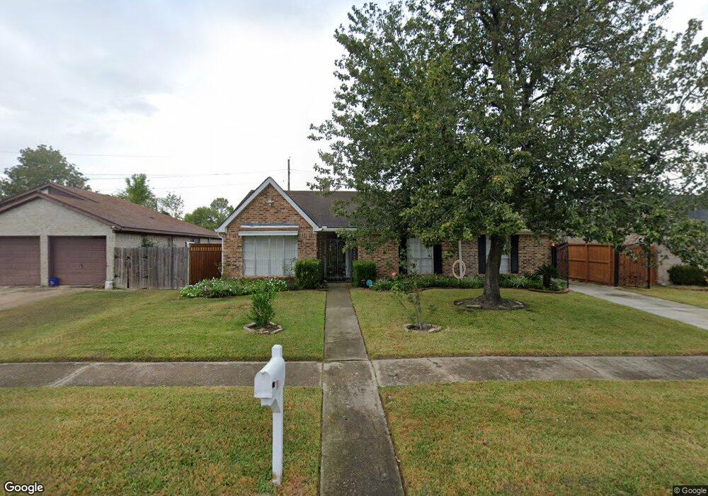
6926 Northleaf Dr Houston, TX 77086
North Houston NeighborhoodEstimated Value: $222,000 - $240,000
4
Beds
2
Baths
1,788
Sq Ft
$127/Sq Ft
Est. Value
About This Home
This home is located at 6926 Northleaf Dr, Houston, TX 77086 and is currently estimated at $227,262, approximately $127 per square foot. 6926 Northleaf Dr is a home located in Harris County with nearby schools including Kujawa EC/Pre-K/K School, Carmichael Elementary School, and Shotwell Middle School.
Ownership History
Date
Name
Owned For
Owner Type
Purchase Details
Closed on
Mar 22, 1996
Sold by
Lewis David R and Lewis De Ann
Bought by
Mandujano Roberto and Vasquez Angelina
Current Estimated Value
Home Financials for this Owner
Home Financials are based on the most recent Mortgage that was taken out on this home.
Original Mortgage
$63,548
Outstanding Balance
$2,466
Interest Rate
6.92%
Mortgage Type
FHA
Estimated Equity
$224,796
Create a Home Valuation Report for This Property
The Home Valuation Report is an in-depth analysis detailing your home's value as well as a comparison with similar homes in the area
Home Values in the Area
Average Home Value in this Area
Purchase History
| Date | Buyer | Sale Price | Title Company |
|---|---|---|---|
| Mandujano Roberto | -- | -- |
Source: Public Records
Mortgage History
| Date | Status | Borrower | Loan Amount |
|---|---|---|---|
| Open | Mandujano Roberto | $63,548 |
Source: Public Records
Tax History
| Year | Tax Paid | Tax Assessment Tax Assessment Total Assessment is a certain percentage of the fair market value that is determined by local assessors to be the total taxable value of land and additions on the property. | Land | Improvement |
|---|---|---|---|---|
| 2025 | $3,201 | $226,582 | $39,283 | $187,299 |
| 2024 | $3,201 | $229,988 | $39,283 | $190,705 |
| 2023 | $3,201 | $234,349 | $39,283 | $195,066 |
| 2022 | $3,904 | $197,078 | $33,291 | $163,787 |
| 2021 | $3,540 | $163,769 | $33,291 | $130,478 |
| 2020 | $3,578 | $154,893 | $33,291 | $121,602 |
| 2019 | $3,382 | $148,849 | $16,974 | $131,875 |
| 2018 | $1,214 | $140,852 | $16,974 | $123,878 |
| 2017 | $2,695 | $132,014 | $15,242 | $116,772 |
| 2016 | $2,450 | $119,515 | $15,242 | $104,273 |
| 2015 | $1,734 | $111,034 | $15,242 | $95,792 |
| 2014 | $1,734 | $83,429 | $15,242 | $68,187 |
Source: Public Records
Map
Nearby Homes
- 11007 Tobasa Ct
- 11018 Tobasa Ct
- 6911 Winding Trace Dr
- 7222 Northleaf Dr
- 7030 Sandswept Ln
- 7023 Sandswept Ln
- 6630 Brownie Campbell Rd
- 7211 Sandswept Ln
- 11019 Longtom Ct
- 10603 Mackenzie Dr
- 5103 Dartmoor Ridge Trail
- 10307 Bammel North Houston Rd
- 5010 Dartmoor Ridge Trail
- 10522 Northview Dr
- 6502 Trail Valley Way
- 5205 Dauntless Dr
- 10203 Heather Hill Dr
- 11532 Champions Green Dr
- 13509 Kaltenbrun Rd
- 10306 Jillana Kaye Dr
- 6922 Northleaf Dr
- 6930 Northleaf Dr
- 6918 Northleaf Dr
- 6934 Northleaf Dr
- 6927 Northleaf Dr
- 6914 Northleaf Dr
- 6938 Northleaf Dr
- 6931 Northleaf Dr
- 6923 Northleaf Dr
- 6935 Northleaf Dr
- 6919 Northleaf Dr
- 6929 Greenyard Dr
- 6927 Greenyard Dr
- 6931 Greenyard Dr
- 6910 Northleaf Dr
- 6942 Northleaf Dr
- 6933 Greenyard Dr
- 6923 Greenyard Dr
- 6925 Greenyard Dr
- 6915 Northleaf Dr
Your Personal Tour Guide
Ask me questions while you tour the home.