Estimated Value: $300,874 - $350,000
3
Beds
2
Baths
1,476
Sq Ft
$220/Sq Ft
Est. Value
About This Home
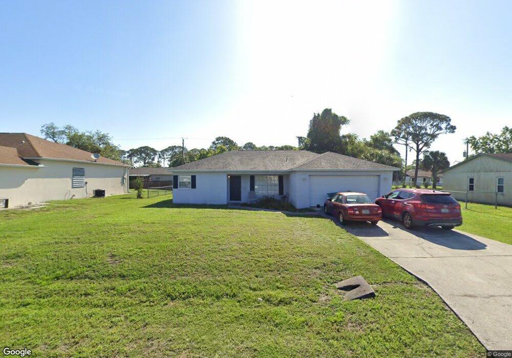
This home is located at 6933 Bryant Rd, Cocoa, FL 32927 and is currently estimated at $324,469, approximately $219 per square foot. 6933 Bryant Rd is a home located in Brevard County with nearby schools including Enterprise Elementary School, Space Coast Junior/Senior High School, and Sculptor Charter School.
Ownership History
Date
Name
Owned For
Owner Type
Purchase Details
Closed on
Jan 24, 1997
Sold by
Mark D Derman Bldg Cont Inc
Bought by
Davis Dale M and Davis Vivianne E
Current Estimated Value
Home Financials for this Owner
Home Financials are based on the most recent Mortgage that was taken out on this home.
Original Mortgage
$78,425
Outstanding Balance
$9,034
Interest Rate
7.77%
Estimated Equity
$315,435
Purchase Details
Closed on
Sep 27, 1996
Sold by
Pancho Domingo A and Pancho Reveria V
Bought by
Mark D Derman Bldg Cont Inc
Create a Home Valuation Report for This Property
The Home Valuation Report is an in-depth analysis detailing your home's value as well as a comparison with similar homes in the area
Home Values in the Area
Average Home Value in this Area
Purchase History
We collect this data history from publicly available records. To have your information removed, we recommend requesting removal directly through your county’s website.
| Date | Buyer | Sale Price | Title Company |
|---|---|---|---|
| Davis Dale M | $78,800 | -- | |
| Mark D Derman Bldg Cont Inc | $11,000 | -- |
Source: Public Records
Mortgage History
We collect this data history from publicly available records. To have your information removed, we recommend requesting removal directly through your county’s website.
| Date | Status | Borrower | Loan Amount |
|---|---|---|---|
| Open | Davis Dale M | $78,425 |
Source: Public Records
Tax History
| Year | Tax Paid | Tax Assessment Tax Assessment Total Assessment is a certain percentage of the fair market value that is determined by local assessors to be the total taxable value of land and additions on the property. | Land | Improvement |
|---|---|---|---|---|
| 2025 | $1,241 | $88,730 | -- | -- |
| 2024 | $1,204 | $86,230 | -- | -- |
| 2023 | $1,204 | $83,720 | $0 | $0 |
| 2022 | $1,121 | $81,290 | $0 | $0 |
| 2021 | $1,109 | $78,930 | $0 | $0 |
| 2020 | $1,044 | $77,850 | $0 | $0 |
| 2019 | $977 | $76,100 | $0 | $0 |
| 2018 | $969 | $74,690 | $0 | $0 |
| 2017 | $970 | $73,160 | $0 | $0 |
| 2016 | $979 | $71,660 | $18,000 | $53,660 |
| 2015 | $989 | $71,170 | $15,000 | $56,170 |
| 2014 | $993 | $70,610 | $11,000 | $59,610 |
Source: Public Records
Map
Nearby Homes
- 5155 Mayflower St
- 5145 Carter St
- 5165 Patricia St
- 6815 Bryant Rd
- 6813 Cecil Rd
- 5555 Brandon St
- 5075 Carter St
- 6965 Hundred Acre Dr
- 5170 Andover St
- 5070 Curtis Blvd
- 7200 Oakwood Ave
- 6615 Dock Ave
- 6601 Cedar Ave
- 5145 Everett St
- 6990 Marvin Ave
- 6643 Emil Ave
- 6581 Bancroft Ave
- 5350 Cinnamon Fern Blvd
- 00 Unknown
- 6570 Bancroft Ave
Your Personal Tour Guide
Ask me questions while you tour the home.