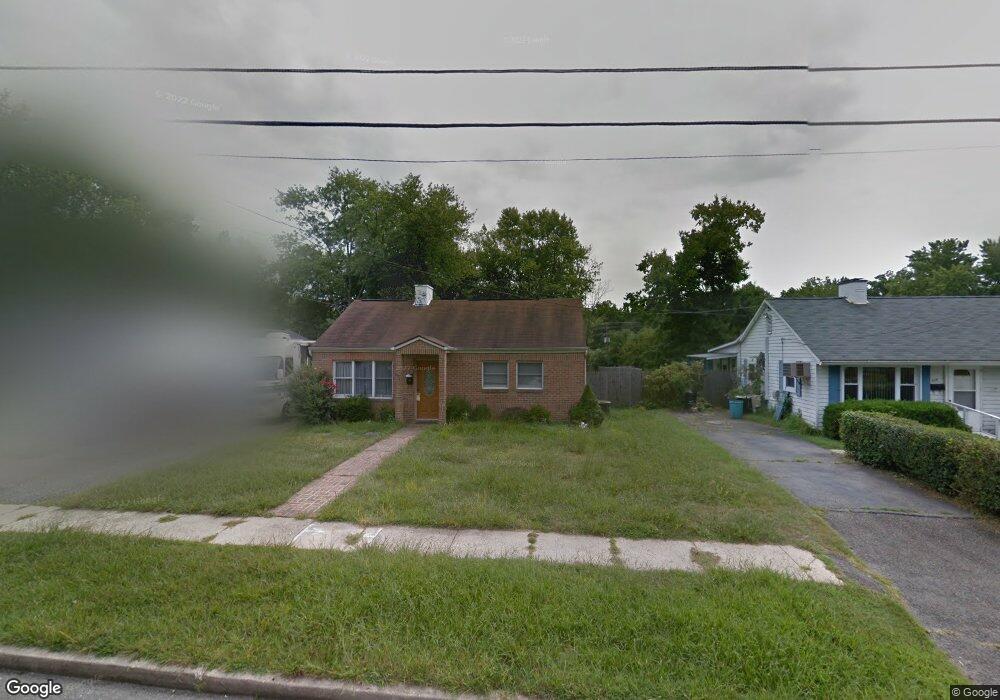
694 Custis St Aberdeen, MD 21001
Estimated Value: $216,181 - $289,000
Studio
1
Bath
1,328
Sq Ft
$191/Sq Ft
Est. Value
About This Home
This home is located at 694 Custis St, Aberdeen, MD 21001 and is currently estimated at $253,795, approximately $191 per square foot. 694 Custis St is a home located in Harford County with nearby schools including Bakerfield Elementary School, Aberdeen Middle School, and Aberdeen High School.
Ownership History
Date
Name
Owned For
Owner Type
Purchase Details
Closed on
Aug 31, 2015
Sold by
Mumpower John M and Mumpower Janice
Bought by
Nationstar Mortgage Llc
Current Estimated Value
Purchase Details
Closed on
May 8, 2009
Sold by
Mumpower John M
Bought by
Mumpower John M and Mumpower Janice
Purchase Details
Closed on
May 17, 2000
Sold by
Lane Oscar L and Lane Wf
Bought by
Mumpower John M
Create a Home Valuation Report for This Property
The Home Valuation Report is an in-depth analysis detailing your home's value as well as a comparison with similar homes in the area
Home Values in the Area
Average Home Value in this Area
Purchase History
| Date | Buyer | Sale Price | Title Company |
|---|---|---|---|
| Nationstar Mortgage Llc | $79,120 | None Available | |
| Mumpower John M | -- | -- | |
| Mumpower John M | $70,000 | -- |
Source: Public Records
Mortgage History
| Date | Status | Borrower | Loan Amount |
|---|---|---|---|
| Closed | Mumpower John M | -- |
Source: Public Records
Tax History
| Year | Tax Paid | Tax Assessment Tax Assessment Total Assessment is a certain percentage of the fair market value that is determined by local assessors to be the total taxable value of land and additions on the property. | Land | Improvement |
|---|---|---|---|---|
| 2025 | $1,507 | $167,433 | $0 | $0 |
| 2024 | $1,507 | $158,067 | $0 | $0 |
| 2023 | $1,418 | $148,700 | $50,900 | $97,800 |
| 2022 | $1,411 | $148,000 | $0 | $0 |
| 2021 | $1,474 | $147,300 | $0 | $0 |
| 2020 | $1,474 | $146,600 | $50,900 | $95,700 |
| 2019 | $1,465 | $145,700 | $0 | $0 |
| 2018 | $1,443 | $144,800 | $0 | $0 |
| 2017 | $1,434 | $143,900 | $0 | $0 |
| 2016 | -- | $143,900 | $0 | $0 |
| 2015 | $1,373 | $143,900 | $0 | $0 |
| 2014 | $1,373 | $150,000 | $0 | $0 |
Source: Public Records
Map
Nearby Homes
- 21 Gunnison Dr
- 631 W Bel Air Ave
- 337 Woodland Green Ct
- 740 Bur Oak Ct Unit 78
- 722 Bur Oak Ct Unit 77
- 0 Arthur Rd Unit MDHR2050208
- 137 Baltimore St
- 0 Harford St Unit MDHR2039982
- 302 Graceford Dr
- 25 Baker St
- 109 Edmund St
- 301 Custis St
- 69 Baker St
- 45 Mount Royal Ave
- 403 Edmund St
- 339 Edmund St
- 517 Edmund St
- 321 S Law St
- 449 S Law St
- 535 Walker St
Your Personal Tour Guide
Ask me questions while you tour the home.