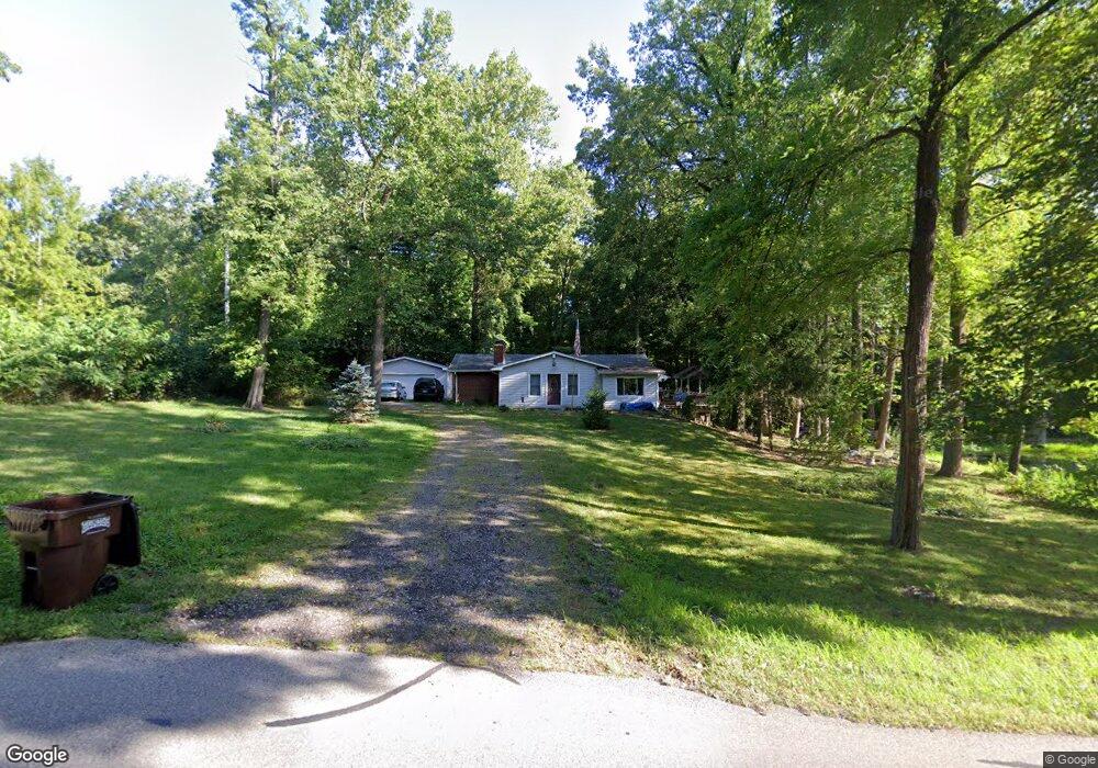
6940 Coonpath Rd Carroll, OH 43112
Bloom NeighborhoodEstimated Value: $271,000 - $320,000
3
Beds
2
Baths
1,016
Sq Ft
$286/Sq Ft
Est. Value
About This Home
This home is located at 6940 Coonpath Rd, Carroll, OH 43112 and is currently estimated at $290,088, approximately $285 per square foot. 6940 Coonpath Rd is a home located in Fairfield County with nearby schools including Bloom Carroll Primary School, Bloom Carroll Intermediate School, and Bloom-Carroll Middle School.
Ownership History
Date
Name
Owned For
Owner Type
Purchase Details
Closed on
Mar 8, 2024
Sold by
Evans Kathy
Bought by
Enderle Michael
Current Estimated Value
Purchase Details
Closed on
May 28, 2003
Sold by
Veach Herbert E and Veach Herb
Bought by
Enderle Douglas J
Home Financials for this Owner
Home Financials are based on the most recent Mortgage that was taken out on this home.
Original Mortgage
$123,600
Outstanding Balance
$50,341
Interest Rate
5.4%
Mortgage Type
VA
Estimated Equity
$239,747
Create a Home Valuation Report for This Property
The Home Valuation Report is an in-depth analysis detailing your home's value as well as a comparison with similar homes in the area
Home Values in the Area
Average Home Value in this Area
Purchase History
We collect this data history from publicly available records. To have your information removed, we recommend requesting removal directly through your county’s website.
| Date | Buyer | Sale Price | Title Company |
|---|---|---|---|
| Enderle Michael | $225,000 | None Listed On Document | |
| Enderle Douglas J | $120,000 | Real Living Title |
Source: Public Records
Mortgage History
We collect this data history from publicly available records. To have your information removed, we recommend requesting removal directly through your county’s website.
| Date | Status | Borrower | Loan Amount |
|---|---|---|---|
| Open | Enderle Douglas J | $123,600 |
Source: Public Records
Tax History
| Year | Tax Paid | Tax Assessment Tax Assessment Total Assessment is a certain percentage of the fair market value that is determined by local assessors to be the total taxable value of land and additions on the property. | Land | Improvement |
|---|---|---|---|---|
| 2025 | $6,825 | $91,970 | $37,140 | $54,830 |
| 2024 | $6,825 | $82,830 | $23,580 | $59,250 |
| 2023 | $3,508 | $82,830 | $23,580 | $59,250 |
| 2022 | $3,162 | $82,830 | $23,580 | $59,250 |
| 2021 | $2,433 | $60,280 | $18,870 | $41,410 |
| 2020 | $2,250 | $60,280 | $18,870 | $41,410 |
| 2019 | $2,886 | $60,280 | $18,870 | $41,410 |
| 2018 | $2,191 | $47,060 | $15,850 | $31,210 |
| 2017 | $2,065 | $46,300 | $15,090 | $31,210 |
| 2016 | $2,033 | $46,300 | $15,090 | $31,210 |
| 2015 | $1,970 | $43,600 | $15,090 | $28,510 |
| 2014 | $1,890 | $43,600 | $15,090 | $28,510 |
| 2013 | $1,890 | $43,600 | $15,090 | $28,510 |
Source: Public Records
Map
Nearby Homes
- 7207 Coonpath Rd NW
- 3325 Kauffman Rd NW
- 3510 Kauffman Rd NW
- 3759 Kauffman Rd NW
- 5795 Coonpath Rd NW
- 4180 Stone Hill Dr E Unit NW (LOT 26)
- 4254 Stone Hill Dr E
- 1995 Pickerington Rd
- 6261 Lithopolis Rd NW
- 6210 Lithopolis Rd NW
- 8620 Lithopolis Rd NW
- 1938 W Glenhurst Dr NW
- 6790 Winchester Rd NW
- 8322 Benson Rd
- 1809 W Glenhurst Dr NW
- 1691 E Glenhurst Dr NW
- 6025 Winchester Rd NW
- 8547 Heather Lake Dr NW
- 8890 Lithopolis Rd NW
- 5511 Plum Rd NW
- 6996 Coonpath Rd
- 6880 Coonpath Rd
- 7000 Coonpath Rd NW
- 7007 Coonpath Rd
- 7000 Coonpath Rd
- 6840 Coonpath Rd
- 6840 Coonpath Rd
- 7110 Coonpath Rd
- 7105 Coonpath Rd
- 6740 Coonpath Rd
- 6730 Coonpath Rd
- 7204 Coonpath Rd
- 7205 Coonpath Rd
- 7153 Coonpath Rd
- 7131 Coonpath Rd
- 7207 Coonpath Rd
- 7207 Coonpath Rd
- 7255 Coonpath Rd
- 6679 Coonpath Rd
- 6649 Coonpath Rd
Your Personal Tour Guide
Ask me questions while you tour the home.