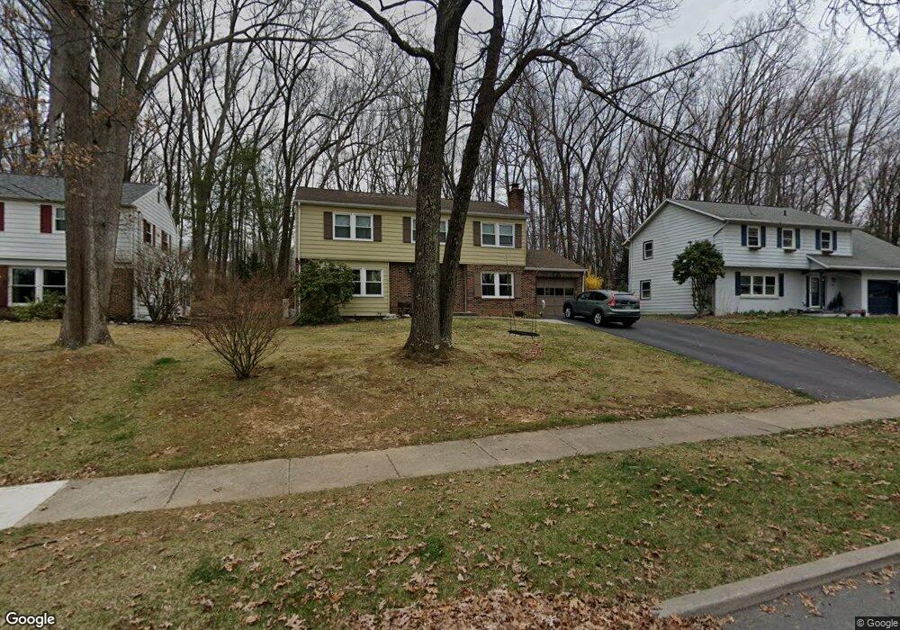
697 Devonshire Dr State College, PA 16803
Estimated Value: $437,314 - $486,000
4
Beds
3
Baths
2,777
Sq Ft
$169/Sq Ft
Est. Value
About This Home
This home is located at 697 Devonshire Dr, State College, PA 16803 and is currently estimated at $468,829, approximately $168 per square foot. 697 Devonshire Dr is a home located in Centre County with nearby schools including Park Forest Elementary School, Park Forest Middle School, and State College Area High School.
Ownership History
Date
Name
Owned For
Owner Type
Purchase Details
Closed on
Apr 17, 2008
Sold by
Wallize Courtney L and Caswell Cameron L
Bought by
Carr Derek R and Carr Michelle L
Current Estimated Value
Home Financials for this Owner
Home Financials are based on the most recent Mortgage that was taken out on this home.
Original Mortgage
$174,750
Outstanding Balance
$107,465
Interest Rate
5.93%
Mortgage Type
Purchase Money Mortgage
Estimated Equity
$361,364
Create a Home Valuation Report for This Property
The Home Valuation Report is an in-depth analysis detailing your home's value as well as a comparison with similar homes in the area
Home Values in the Area
Average Home Value in this Area
Purchase History
We collect this data history from publicly available records. To have your information removed, we recommend requesting removal directly through your county’s website.
| Date | Buyer | Sale Price | Title Company |
|---|---|---|---|
| Carr Derek R | $235,000 | None Available |
Source: Public Records
Mortgage History
We collect this data history from publicly available records. To have your information removed, we recommend requesting removal directly through your county’s website.
| Date | Status | Borrower | Loan Amount |
|---|---|---|---|
| Open | Carr Derek R | $174,750 |
Source: Public Records
Tax History
| Year | Tax Paid | Tax Assessment Tax Assessment Total Assessment is a certain percentage of the fair market value that is determined by local assessors to be the total taxable value of land and additions on the property. | Land | Improvement |
|---|---|---|---|---|
| 2026 | $4,738 | $74,065 | $13,530 | $60,535 |
| 2025 | $4,587 | $74,065 | $13,530 | $60,535 |
| 2024 | $4,289 | $74,065 | $13,530 | $60,535 |
| 2023 | $4,289 | $74,065 | $13,530 | $60,535 |
| 2022 | $4,174 | $74,065 | $13,530 | $60,535 |
| 2021 | $4,174 | $74,065 | $13,530 | $60,535 |
| 2020 | $4,174 | $74,065 | $13,530 | $60,535 |
| 2019 | $3,491 | $74,065 | $13,530 | $60,535 |
| 2018 | $4,030 | $74,065 | $13,530 | $60,535 |
| 2017 | $3,980 | $74,065 | $13,530 | $60,535 |
| 2016 | -- | $74,065 | $13,530 | $60,535 |
| 2015 | -- | $74,065 | $13,530 | $60,535 |
| 2014 | -- | $74,065 | $13,530 | $60,535 |
Source: Public Records
Map
Nearby Homes
- 679 Devonshire Dr
- 773 Cornwall Rd
- 681 Stoneledge Rd
- 618 Berkshire Dr
- 655 Belmont Cir
- 1628 N Cherry Hill Rd
- 836 W Aaron Dr
- 834 W Aaron Dr
- 419 Canterbury Dr
- 424 Canterbury Dr
- 151 Rushcliffe St
- 2107 N Oak Ln
- 366 Strouse Ave
- 207 Canterbury Dr
- 2107 Circleville Rd
- 576 E Shadow Ln
- 2120 N Oak Ln
- 2092 Mary Ellen Ln Unit 2092
- 2372 Corinna Ct
- 153 W Clearview Ave
- 703 Devonshire Dr
- 691 Devonshire Dr
- 709 Devonshire Dr
- 685 Devonshire Dr
- 766 Cornwall Rd
- 760 Cornwall Rd
- 715 Devonshire Dr
- 754 Cornwall Rd
- 772 Cornwall Rd
- 708 Devonshire Dr
- 714 Devonshire Dr
- 702 Devonshire Dr
- 696 Devonshire Dr
- 685 Wiltshire Dr
- 720 Devonshire Dr
- 778 Cornwall Rd
- 726 Devonshire Dr
- 691 Wiltshire Dr
- 727 Devonshire Dr
- 748 Cornwall Rd
Your Personal Tour Guide
Ask me questions while you tour the home.