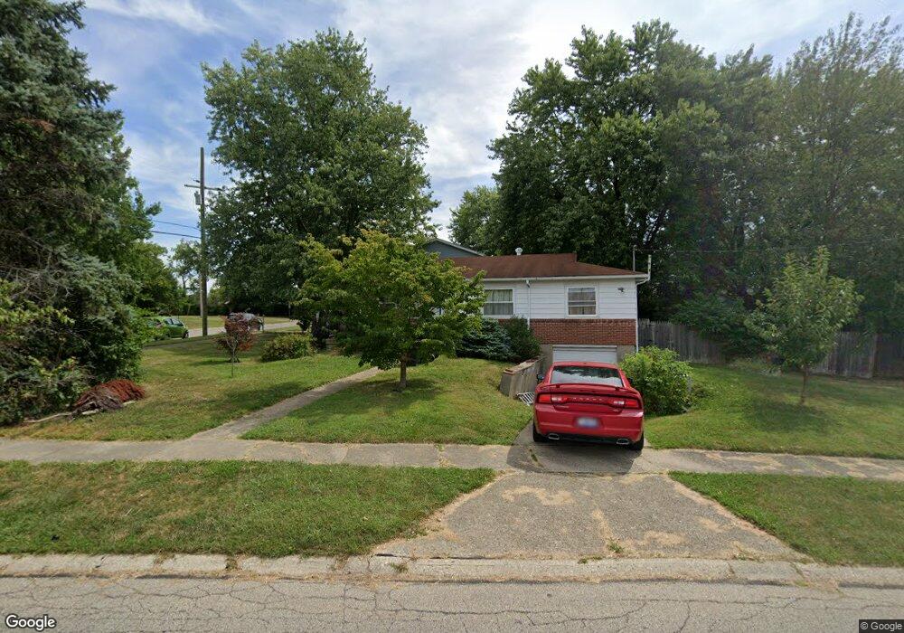
6970 Memory Ln Cincinnati, OH 45239
Estimated Value: $166,000 - $185,000
About This Home
This home is located at 6970 Memory Ln, Cincinnati, OH 45239 and is currently estimated at $174,895, approximately $168 per square foot. 6970 Memory Ln is a home located in Hamilton County with nearby schools including White Oak Middle School, Colerain High School, and Cincinnati Achievement Academy.
Ownership History
We collect this data history from publicly available records. To have your information removed, we recommend requesting removal directly through your county’s website.
Purchase Details
Home Financials for this Owner
Home Financials are based on the most recent Mortgage that was taken out on this home.Purchase Details
Home Values in the Area
Average Home Value in this Area
Purchase History
We collect this data history from publicly available records. To have your information removed, we recommend requesting removal directly through your county’s website.
| Date | Buyer | Sale Price | Title Company |
|---|---|---|---|
| $72,500 | -- | ||
| -- | -- |
Mortgage History
We collect this data history from publicly available records. To have your information removed, we recommend requesting removal directly through your county’s website.
| Date | Status | Borrower | Loan Amount |
|---|---|---|---|
| Open | $68,800 |
Tax History
We collect this data history from publicly available records. To have your information removed, we recommend requesting removal directly through your county’s website.
| Year | Tax Paid | Tax Assessment Tax Assessment Total Assessment is a certain percentage of the fair market value that is determined by local assessors to be the total taxable value of land and additions on the property. | Land | Improvement |
|---|---|---|---|---|
| 2025 | $2,247 | $39,012 | $8,607 | $30,405 |
| 2023 | $2,096 | $39,012 | $8,607 | $30,405 |
| 2022 | $1,487 | $22,537 | $6,727 | $15,810 |
| 2021 | $1,474 | $22,537 | $6,727 | $15,810 |
| 2020 | $1,489 | $22,537 | $6,727 | $15,810 |
| 2019 | $1,352 | $19,100 | $5,702 | $13,398 |
| 2018 | $1,213 | $19,100 | $5,702 | $13,398 |
| 2017 | $1,149 | $19,100 | $5,702 | $13,398 |
| 2016 | $1,499 | $24,616 | $7,851 | $16,765 |
| 2015 | $1,513 | $24,616 | $7,851 | $16,765 |
| 2014 | $1,516 | $24,616 | $7,851 | $16,765 |
| 2013 | $1,567 | $26,758 | $8,533 | $18,225 |
Map
- 2576 Banning Rd
- 6764 Fath Ct
- 2465 Amelia Ct
- 2427 Crosley Meadow
- 7240 Longwood Ct
- 2692 Breezy Way
- 2505 Byrneside Dr
- 7560 Pippin Rd
- 2677 Altura Dr
- 2290 Deblin Dr
- 2525 Flanigan Ct
- 2342 Banning Rd
- 7761 Pippin Rd
- 2505 Rack Ct
- 2503 Rack Ct
- 6627 Flagstone Ct
- 2609 Chesterfield Ct
- 2613 Chesterfield Ct
- 2460 Kipling Ave
- 3131 Preserve Ln
- 2595 Sandhurst Dr
- 6942 Memory Ln
- 6943 Grange Ct
- 2610 Sandhurst Dr
- 2627 Sandhurst Dr
- 6917 Grange Ct
- 6951 Memory Ln
- 6912 Memory Ln
- 7054 Memory Ln
- 2592 Sandhurst Dr
- 7011 Memory Ln
- 6970 Grange Ct
- 6931 Memory Ln
- 6942 Grange Ct
- 6891 Grange Ct
- 7068 Memory Ln
- 6884 Memory Ln
- 2636 Sandhurst Dr
- 6913 Memory Ln
- 6916 Grange Ct
Ask me questions while you tour the home.