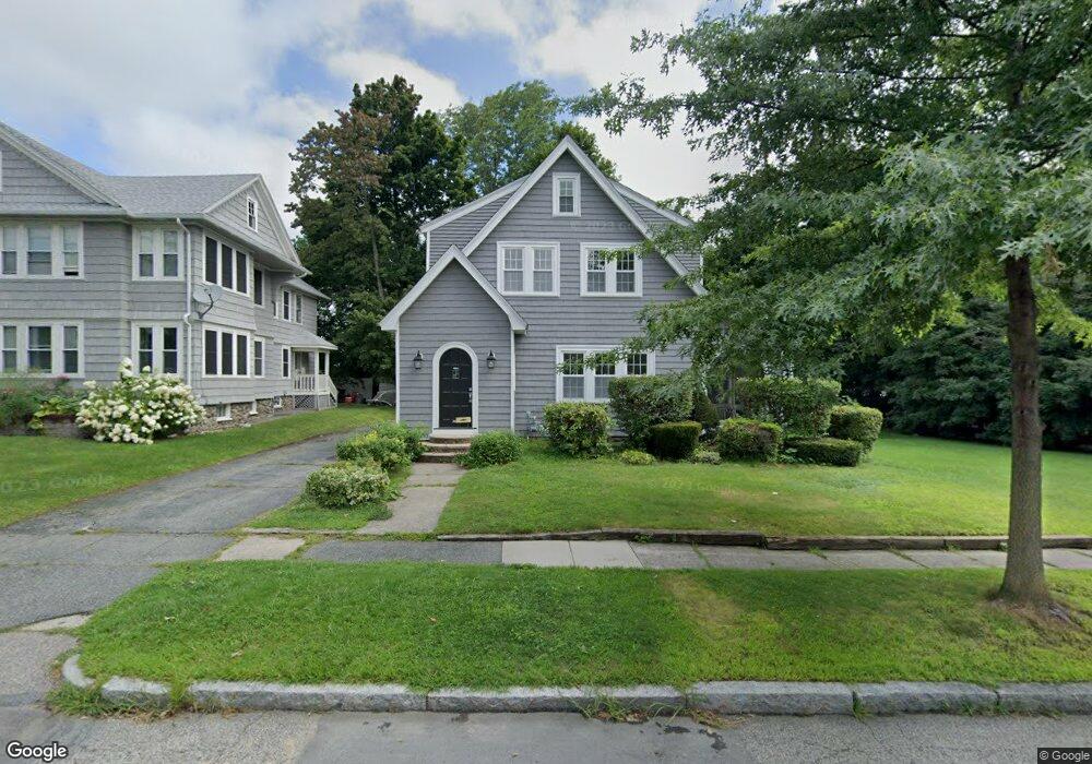
7 Bay State Rd Worcester, MA 01606
Burncoat NeighborhoodEstimated Value: $498,207 - $536,000
3
Beds
2
Baths
1,929
Sq Ft
$266/Sq Ft
Est. Value
About This Home
This home is located at 7 Bay State Rd, Worcester, MA 01606 and is currently estimated at $512,802, approximately $265 per square foot. 7 Bay State Rd is a home located in Worcester County with nearby schools including Jacob Hiatt Magnet School, Chandler Magnet, and Thorndyke Road School.
Ownership History
Date
Name
Owned For
Owner Type
Purchase Details
Closed on
Oct 15, 2019
Sold by
Obrien Ann T Est
Bought by
Fallon Colleen
Current Estimated Value
Create a Home Valuation Report for This Property
The Home Valuation Report is an in-depth analysis detailing your home's value as well as a comparison with similar homes in the area
Home Values in the Area
Average Home Value in this Area
Purchase History
We collect this data history from publicly available records. To have your information removed, we recommend requesting removal directly through your county’s website.
| Date | Buyer | Sale Price | Title Company |
|---|---|---|---|
| Fallon Colleen | $263,200 | -- |
Source: Public Records
Tax History
| Year | Tax Paid | Tax Assessment Tax Assessment Total Assessment is a certain percentage of the fair market value that is determined by local assessors to be the total taxable value of land and additions on the property. | Land | Improvement |
|---|---|---|---|---|
| 2025 | $5,776 | $437,900 | $118,900 | $319,000 |
| 2024 | $5,528 | $402,000 | $118,900 | $283,100 |
| 2023 | $5,332 | $371,800 | $103,400 | $268,400 |
| 2022 | $4,943 | $325,000 | $82,700 | $242,300 |
| 2021 | $4,982 | $306,000 | $66,200 | $239,800 |
| 2020 | $4,741 | $278,900 | $66,200 | $212,700 |
| 2019 | $4,662 | $254,100 | $59,600 | $194,500 |
| 2018 | $4,567 | $241,500 | $59,600 | $181,900 |
| 2017 | $4,373 | $227,500 | $59,600 | $167,900 |
| 2016 | $4,400 | $213,500 | $44,200 | $169,300 |
| 2015 | $4,285 | $213,500 | $44,200 | $169,300 |
| 2014 | $4,172 | $213,500 | $44,200 | $169,300 |
Source: Public Records
Map
Nearby Homes
- 11 Bay State Rd
- 10 Longmeadow Ave
- 8 Longmeadow Ave
- 12 Longmeadow Ave
- 3 Bay State Rd
- 13 Bay State Rd
- 6 Longmeadow Ave
- 14 Longmeadow Ave
- 22 Bay State Rd
- 10 Bay State Rd
- 15 Bay State Rd
- 34 Clark St
- 1 Bay State Rd
- 1 Bay State Rd Unit A
- 1 Bay State Rd Unit B
- 1 Bay State Rd Unit 2
- 12 Bay State Rd
- 12 Bay State Rd Unit 2
- 25 Devens Rd Unit 25 devens rd Worcest
- 25 Devens Rd
Your Personal Tour Guide
Ask me questions while you tour the home.