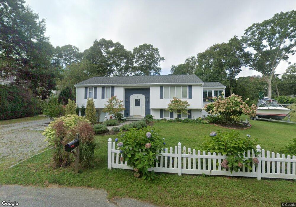
7 Farnum Rd Bourne, MA 2532
Estimated Value: $593,000 - $692,000
3
Beds
2
Baths
1,996
Sq Ft
$329/Sq Ft
Est. Value
About This Home
This home is located at 7 Farnum Rd, Bourne, MA 2532 and is currently estimated at $657,078, approximately $329 per square foot. 7 Farnum Rd is a home located in Barnstable County with nearby schools including Bourne High School, St Margaret Regional School, and Cadence Academy Preschool - Bourne.
Ownership History
Date
Name
Owned For
Owner Type
Purchase Details
Closed on
Sep 1, 2017
Sold by
Ambrosi Roberta and Ambrosi Filippo
Bought by
Stonionis Christopher and Stonionis Regina
Current Estimated Value
Home Financials for this Owner
Home Financials are based on the most recent Mortgage that was taken out on this home.
Original Mortgage
$260,000
Outstanding Balance
$213,808
Interest Rate
3.96%
Mortgage Type
New Conventional
Estimated Equity
$443,270
Purchase Details
Closed on
Oct 19, 2004
Sold by
Hsieh Rosemarie
Bought by
Ambrosi Filippo and Ambrosi Roberta
Home Financials for this Owner
Home Financials are based on the most recent Mortgage that was taken out on this home.
Original Mortgage
$300,000
Interest Rate
5.8%
Mortgage Type
Purchase Money Mortgage
Purchase Details
Closed on
Aug 13, 2001
Sold by
Callagee Francis and Callagee Stella A
Bought by
Hsieh Rosemarie
Create a Home Valuation Report for This Property
The Home Valuation Report is an in-depth analysis detailing your home's value as well as a comparison with similar homes in the area
Purchase History
We collect this data history from publicly available records. To have your information removed, we recommend requesting removal directly through your county’s website.
| Date | Buyer | Sale Price | Title Company |
|---|---|---|---|
| Stonionis Christopher | $280,000 | -- | |
| Stonionis Christopher | $280,000 | -- | |
| Ambrosi Filippo | $385,000 | -- | |
| Ambrosi Filippo | $385,000 | -- | |
| Ambrosi Filippo | $385,000 | -- | |
| Hsieh Rosemarie | $255,000 | -- | |
| Hsieh Rosemarie | $255,000 | -- |
Source: Public Records
Mortgage History
We collect this data history from publicly available records. To have your information removed, we recommend requesting removal directly through your county’s website.
| Date | Status | Borrower | Loan Amount |
|---|---|---|---|
| Open | Stonionis Christopher | $260,000 | |
| Closed | Stonionis Christopher | $260,000 | |
| Previous Owner | Ambrosi Filippo | $300,000 |
Source: Public Records
Tax History
| Year | Tax Paid | Tax Assessment Tax Assessment Total Assessment is a certain percentage of the fair market value that is determined by local assessors to be the total taxable value of land and additions on the property. | Land | Improvement |
|---|---|---|---|---|
| 2025 | $4,579 | $586,300 | $243,700 | $342,600 |
| 2024 | $4,478 | $558,300 | $232,100 | $326,200 |
| 2023 | $4,364 | $495,400 | $205,400 | $290,000 |
| 2022 | $4,174 | $413,700 | $181,800 | $231,900 |
| 2021 | $4,067 | $377,600 | $165,400 | $212,200 |
| 2020 | $3,945 | $367,300 | $163,900 | $203,400 |
| 2019 | $3,661 | $348,300 | $163,900 | $184,400 |
| 2018 | $3,588 | $340,400 | $156,100 | $184,300 |
| 2017 | $3,361 | $326,300 | $154,600 | $171,700 |
| 2016 | $3,281 | $322,900 | $154,600 | $168,300 |
| 2015 | $3,252 | $322,900 | $154,600 | $168,300 |
Source: Public Records
Map
Nearby Homes
- 92 Sandwich Rd Unit 4-D
- 84 Cotuit Rd
- 3 Honora Ln Unit 3
- 6 Honora Ln
- 5 Honora Ln Unit 5
- 5 Honora Ln
- 38 Old Bridge Rd
- 32 Everett Rd
- 73 County Rd
- 69 County Rd
- 33 Head of The Bay Rd
- 405 Village Dr Unit 405
- 46 Holt Rd Unit A
- 12 Sea Knoll Ct Unit 12
- 0 Holt Rd
- 13 Laurel Hill Ct Unit 13
- 13 Laurel Hill Ct
- 51 Ships View Terrace
- 10 Harrison Ave Unit 2
- 10 Harrison Ave Unit 3
- 7 Farnum Rd
- 7 Farnum Rd Unit 7
- 91 Sandwich Rd
- 85 Sandwich Rd
- 91 Sandwich Rd
- 5 Farnum Rd
- 6 Farnum Rd
- 6 Farnum Rd
- 4 Farnum Rd
- 105 Sandwich Rd
- 4 Farnum Rd
- 105 Sandwich Rd
- 3 Maritime Way
- 81 Sandwich Rd
- 81 Sandwich Rd
- 2 Farnum Rd
- 2 Farnum Rd
- 90-92 Sandwich Rd Unit 15
- 90-92 Sandwich Rd Unit 9
- 90-92 Sandwich Rd Unit 5
Your Personal Tour Guide
Ask me questions while you tour the home.