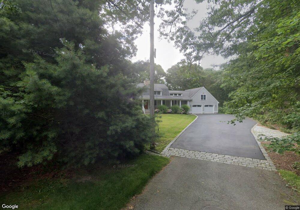
7 Hamlin Rd Mattapoisett, MA 02739
Estimated Value: $1,003,000 - $1,273,000
4
Beds
2
Baths
2,783
Sq Ft
$415/Sq Ft
Est. Value
About This Home
This home is located at 7 Hamlin Rd, Mattapoisett, MA 02739 and is currently estimated at $1,153,632, approximately $414 per square foot. 7 Hamlin Rd is a home located in Plymouth County with nearby schools including Center School, Old Hammondtown Elementary, and Old Rochester Regional High School.
Ownership History
Date
Name
Owned For
Owner Type
Purchase Details
Closed on
Aug 10, 2022
Sold by
Downey Diane F
Bought by
Diane F Downey Ret and Downey
Current Estimated Value
Purchase Details
Closed on
Jul 20, 2004
Sold by
Gordon Stanley M and Gordon Josephine L
Bought by
Downey Diane F
Create a Home Valuation Report for This Property
The Home Valuation Report is an in-depth analysis detailing your home's value as well as a comparison with similar homes in the area
Home Values in the Area
Average Home Value in this Area
Purchase History
We collect this data history from publicly available records. To have your information removed, we recommend requesting removal directly through your county’s website.
| Date | Buyer | Sale Price | Title Company |
|---|---|---|---|
| Diane F Downey Ret | -- | None Available | |
| Downey Diane F | $600,000 | -- | |
| Downey Diane F | $600,000 | -- |
Source: Public Records
Mortgage History
We collect this data history from publicly available records. To have your information removed, we recommend requesting removal directly through your county’s website.
| Date | Status | Borrower | Loan Amount |
|---|---|---|---|
| Previous Owner | Downey Diane F | $183,000 | |
| Previous Owner | Downey Diane F | $150,000 | |
| Previous Owner | Downey Diane F | $130,000 | |
| Previous Owner | Downey Diane F | $40,000 |
Source: Public Records
Tax History
| Year | Tax Paid | Tax Assessment Tax Assessment Total Assessment is a certain percentage of the fair market value that is determined by local assessors to be the total taxable value of land and additions on the property. | Land | Improvement |
|---|---|---|---|---|
| 2025 | $10,985 | $1,020,900 | $520,700 | $500,200 |
| 2024 | $11,059 | $1,052,200 | $552,000 | $500,200 |
| 2023 | $10,895 | $968,400 | $493,000 | $475,400 |
| 2022 | $10,768 | $868,400 | $387,600 | $480,800 |
| 2021 | $10,047 | $775,200 | $387,600 | $387,600 |
| 2020 | $10,615 | $786,900 | $435,200 | $351,700 |
| 2019 | $10,301 | $779,800 | $435,200 | $344,600 |
| 2018 | $10,412 | $799,700 | $441,500 | $358,200 |
| 2017 | $10,027 | $767,200 | $441,500 | $325,700 |
| 2016 | $9,422 | $713,800 | $395,400 | $318,400 |
| 2015 | $9,378 | $721,400 | $413,800 | $307,600 |
| 2014 | $8,961 | $704,500 | $413,800 | $290,700 |
Source: Public Records
Map
Nearby Homes
- 37 Neds Point Rd Unit 39
- 104 Ned's Point Rd
- 103 Ned's Point Rd
- 24 Pine Island Rd
- 23 Prospect Rd
- 78-82 Church St
- 8 Captains Ln
- 17 Island St
- 52 County Rd Unit 13
- 4 Beech Tree Ln
- 0 Harbor Acres Ln - Lot B
- 12 Noyes Ave
- 33 Pearl St
- 1 Starboard Way
- 41 Starboard Way
- 14 Chapel Rd
- 20 Split Rock Ln
- 1 Barlow Ln
- 91 North St
- 13 Park Place
- 7 Brierpatch Ln
- 5 Hamlin Rd
- 5 Brierpatch Ln
- 14 Winnatuxett Beach Rd
- 18 Winnatuxett Beach Rd
- 11 Brierpatch Ln
- 12 Winnatuxett Beach Rd
- 3 Hamlin Rd
- 6 Brierpatch Ln
- 16 Winnatuxett Beach Rd
- 3 Brierpatch Ln
- 8 Brierpatch Ln
- 10 Winnatuxett Beach Rd
- 4 Brierpatch Ln
- 1 Hamlin Rd
- 1 Brierpatch Ln
- 20 Winnatuxett Beach Rd
- 8 Winnatuxett Beach Rd
- 15 Winnatuxett Beach Rd
- 6 Holly Ln
Your Personal Tour Guide
Ask me questions while you tour the home.