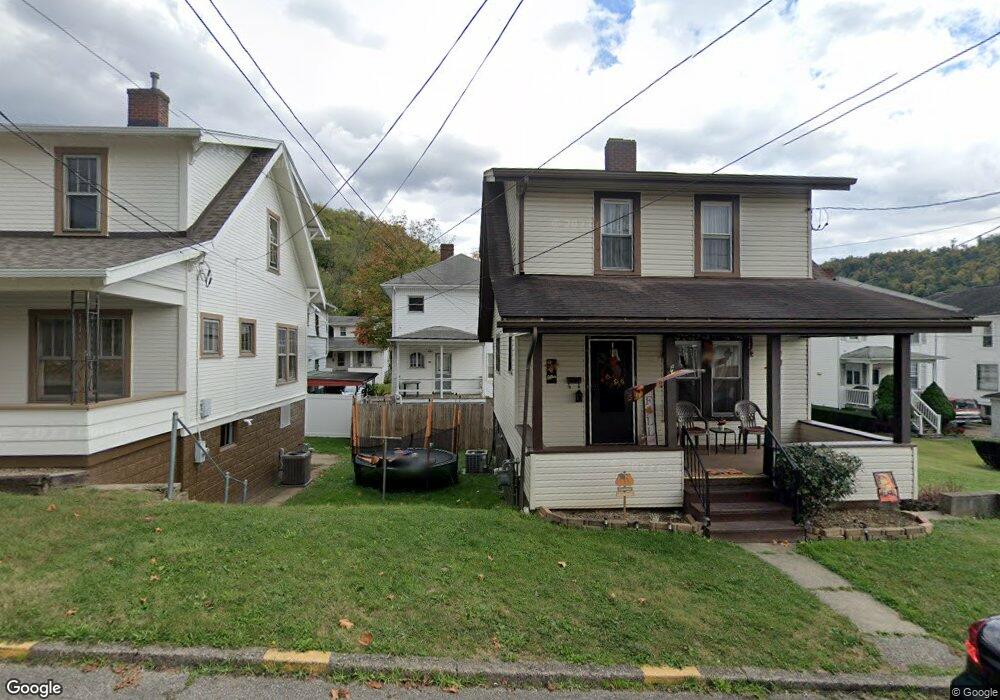
7 Locust Ave Bridgeport, OH 43912
Estimated Value: $93,401 - $191,000
3
Beds
1
Bath
1,364
Sq Ft
$96/Sq Ft
Est. Value
About This Home
This home is located at 7 Locust Ave, Bridgeport, OH 43912 and is currently estimated at $131,350, approximately $96 per square foot. 7 Locust Ave is a home located in Belmont County with nearby schools including Bridgeport Elementary School, Bridgeport Middle School, and Bridgeport High School.
Ownership History
Date
Name
Owned For
Owner Type
Purchase Details
Closed on
Apr 10, 2024
Sold by
Secretary/Housing & Urban Dev
Bought by
Brawner Lawrence
Current Estimated Value
Purchase Details
Closed on
Aug 25, 2023
Sold by
Pnc Bank National Association
Bought by
Secretary/Housing & Urban Dev
Purchase Details
Closed on
Jul 24, 2018
Sold by
Lorraine Linda
Bought by
Poland James Stephen
Purchase Details
Closed on
Jan 1, 1987
Sold by
Poland James S and Poland Linda L
Bought by
Poland James S and Poland Linda L
Create a Home Valuation Report for This Property
The Home Valuation Report is an in-depth analysis detailing your home's value as well as a comparison with similar homes in the area
Purchase History
| Date | Buyer | Sale Price | Title Company |
|---|---|---|---|
| Brawner Lawrence | $40,400 | None Listed On Document | |
| Secretary/Housing & Urban Dev | -- | None Listed On Document | |
| Secretary/Housing & Urban Dev | -- | None Listed On Document | |
| Poland James Stephen | -- | None Available | |
| Poland James S | -- | -- |
Source: Public Records
Tax History
| Year | Tax Paid | Tax Assessment Tax Assessment Total Assessment is a certain percentage of the fair market value that is determined by local assessors to be the total taxable value of land and additions on the property. | Land | Improvement |
|---|---|---|---|---|
| 2025 | $1,103 | $28,610 | $2,160 | $26,450 |
| 2024 | $1,084 | $28,610 | $2,160 | $26,450 |
| 2023 | $1,117 | $26,640 | $2,160 | $24,480 |
| 2022 | $1,116 | $26,638 | $2,156 | $24,482 |
| 2021 | $1,133 | $26,638 | $2,156 | $24,482 |
| 2020 | $976 | $23,010 | $1,880 | $21,130 |
| 2019 | $978 | $23,010 | $1,880 | $21,130 |
| 2018 | $872 | $23,010 | $1,880 | $21,130 |
| 2017 | $931 | $19,370 | $2,160 | $17,210 |
| 2016 | $999 | $19,370 | $2,160 | $17,210 |
| 2015 | $890 | $19,370 | $2,160 | $17,210 |
| 2014 | $929 | $19,710 | $1,970 | $17,740 |
| 2013 | $882 | $19,710 | $1,970 | $17,740 |
Source: Public Records
Map
Nearby Homes
- 4 Walnut Ave
- 13 Prospect St
- 836 Main St
- 26 Elm St
- 56316 National Rd
- 44 Mann St
- 1049 Buckeye St
- 56624 Boyd Ave
- 806 Howard St
- 822 W Bennett St
- 609 Whitely St
- 67457 Kirkwood Heights Rd
- 67471 Kirkwood Heights Rd
- 67478 Kirkwood Heights Rd
- 422 Whitely St
- 55935 Main St
- 413 Bennett St
- 67540 Kirkwood Heights Rd
- 308 Whitely St
- TBD Alexander Rd
Your Personal Tour Guide
Ask me questions while you tour the home.