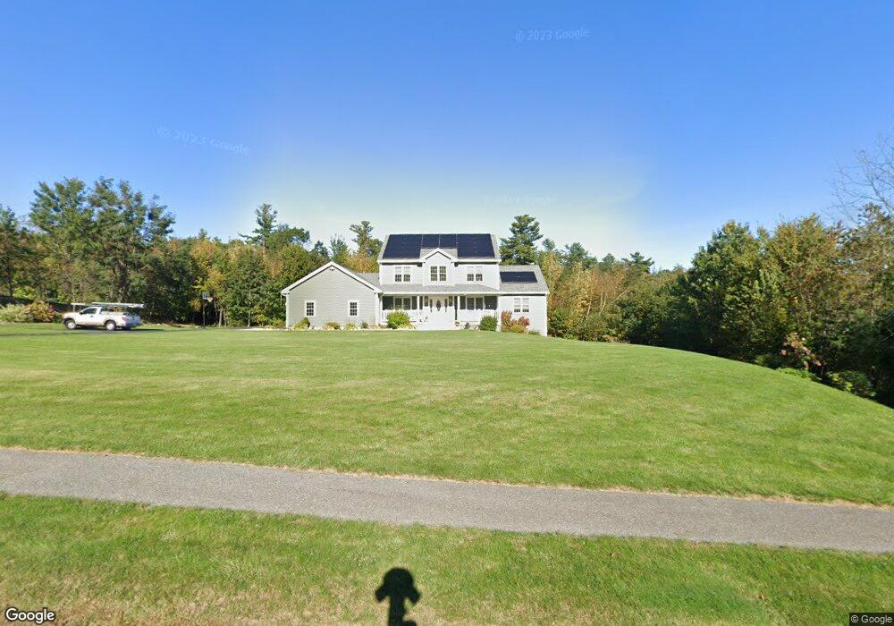
7 Lowry Ln Rutland, MA 01543
Estimated Value: $793,000 - $1,071,000
4
Beds
4
Baths
2,838
Sq Ft
$311/Sq Ft
Est. Value
About This Home
This home is located at 7 Lowry Ln, Rutland, MA 01543 and is currently estimated at $881,676, approximately $310 per square foot. 7 Lowry Ln is a home with nearby schools including Wachusett Regional High School.
Ownership History
Date
Name
Owned For
Owner Type
Purchase Details
Closed on
Aug 29, 2016
Sold by
Dillon 3Rd Gilbert F
Bought by
Dillon 3Rd Gilbert F and Dillon Amelia C
Current Estimated Value
Purchase Details
Closed on
Jun 2, 2004
Sold by
Dillon Gilbert and Dillon Joanne L
Bought by
Dillon Gilbert F
Create a Home Valuation Report for This Property
The Home Valuation Report is an in-depth analysis detailing your home's value as well as a comparison with similar homes in the area
Home Values in the Area
Average Home Value in this Area
Purchase History
| Date | Buyer | Sale Price | Title Company |
|---|---|---|---|
| Dillon 3Rd Gilbert F | -- | -- | |
| Dillon Gilbert F | -- | -- |
Source: Public Records
Tax History
| Year | Tax Paid | Tax Assessment Tax Assessment Total Assessment is a certain percentage of the fair market value that is determined by local assessors to be the total taxable value of land and additions on the property. | Land | Improvement |
|---|---|---|---|---|
| 2025 | $9,999 | $702,200 | $133,900 | $568,300 |
| 2024 | $10,291 | $693,900 | $125,800 | $568,100 |
| 2023 | $9,397 | $684,900 | $118,700 | $566,200 |
| 2022 | $8,749 | $554,100 | $99,100 | $455,000 |
| 2021 | $8,749 | $523,900 | $107,300 | $416,600 |
| 2020 | $8,111 | $460,600 | $96,500 | $364,100 |
| 2019 | $7,940 | $443,800 | $83,700 | $360,100 |
| 2018 | $7,464 | $411,700 | $83,700 | $328,000 |
| 2017 | $1,533 | $83,700 | $83,700 | $0 |
| 2016 | $1,430 | $82,300 | $82,300 | $0 |
| 2015 | $1,453 | $82,300 | $82,300 | $0 |
| 2014 | $1,408 | $82,300 | $82,300 | $0 |
Source: Public Records
Map
Nearby Homes
- 93 Glenwood Place
- 569 E County Rd
- 139 E County Rd Unit 139
- 139 E County Rd Unit 141
- 331 E County Rd
- 29 Grizzly Dr
- 4 Brintnal Dr
- 15 Skyline Dr
- 56 Hubbardston Rd
- 18 Prouty Ln
- 34 Marjorie Ln
- 511 E County Rd
- 42 Maple Ave
- 10 Soucy Dr
- 1 Highland Park Rd
- 85 Maple Ave Unit A
- 376 Elmwood Ave
- 45 Old Colony Rd
- 10 Fidelity Dr Unit 5
- 12 Fidelity Dr Unit 6
Your Personal Tour Guide
Ask me questions while you tour the home.