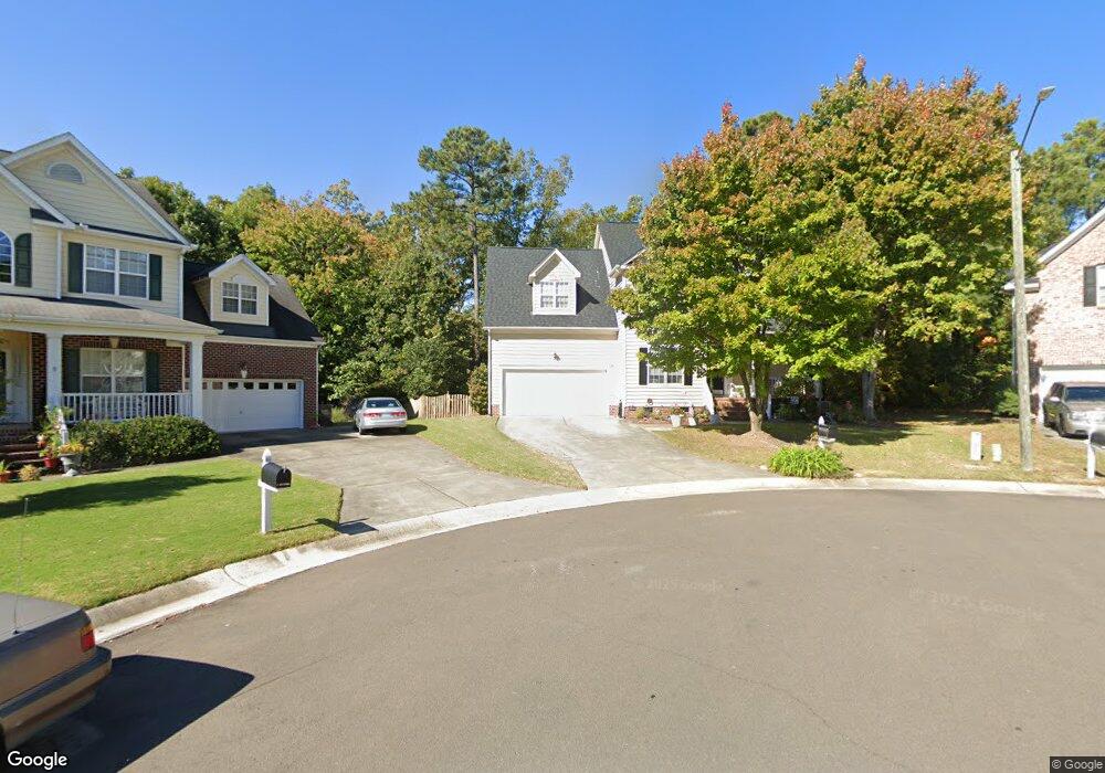
7 Mayflower Ct Durham, NC 27703
South Durham NeighborhoodEstimated Value: $476,000 - $537,436
3
Beds
3
Baths
2,276
Sq Ft
$223/Sq Ft
Est. Value
About This Home
This home is located at 7 Mayflower Ct, Durham, NC 27703 and is currently estimated at $507,859, approximately $223 per square foot. 7 Mayflower Ct is a home located in Durham County with nearby schools including Bethesda Elementary School, John W Neal Middle School, and Southern School of Energy & Sustainability.
Ownership History
Date
Name
Owned For
Owner Type
Purchase Details
Closed on
Mar 5, 2002
Sold by
Centex Homes
Bought by
Merrill Valerie Gay
Current Estimated Value
Home Financials for this Owner
Home Financials are based on the most recent Mortgage that was taken out on this home.
Original Mortgage
$216,300
Outstanding Balance
$80,388
Interest Rate
5.5%
Estimated Equity
$427,471
Create a Home Valuation Report for This Property
The Home Valuation Report is an in-depth analysis detailing your home's value as well as a comparison with similar homes in the area
Home Values in the Area
Average Home Value in this Area
Purchase History
| Date | Buyer | Sale Price | Title Company |
|---|---|---|---|
| Merrill Valerie Gay | $240,500 | -- |
Source: Public Records
Mortgage History
| Date | Status | Borrower | Loan Amount |
|---|---|---|---|
| Open | Merrill Valerie Gay | $216,300 |
Source: Public Records
Tax History
| Year | Tax Paid | Tax Assessment Tax Assessment Total Assessment is a certain percentage of the fair market value that is determined by local assessors to be the total taxable value of land and additions on the property. | Land | Improvement |
|---|---|---|---|---|
| 2025 | $5,451 | $549,910 | $159,600 | $390,310 |
| 2024 | $3,872 | $277,586 | $68,310 | $209,276 |
| 2023 | $3,636 | $277,586 | $68,310 | $209,276 |
| 2022 | $3,553 | $277,586 | $68,310 | $209,276 |
| 2021 | $3,536 | $277,586 | $68,310 | $209,276 |
| 2020 | $3,453 | $277,586 | $68,310 | $209,276 |
| 2019 | $3,453 | $277,586 | $68,310 | $209,276 |
| 2018 | $3,425 | $252,522 | $53,130 | $199,392 |
| 2017 | $3,400 | $252,522 | $53,130 | $199,392 |
| 2016 | $3,286 | $252,522 | $53,130 | $199,392 |
| 2015 | $3,702 | $267,427 | $57,088 | $210,339 |
| 2014 | $3,702 | $267,427 | $57,088 | $210,339 |
Source: Public Records
Map
Nearby Homes
- 2421 Bonnie Brae Rd
- 1713 Magnolia Oak Place
- 4514 Cottendale Dr
- 1251 Flyfish Ave
- 3309 Forest Grove Ct
- 2216 Jollay St
- 1016 Hollis Cir
- 111 Lang St
- 909 Wood Chapel Ln
- 814 Wood Chapel Ln
- 5024 Dragonfly Dr
- 1200 Bluewater Way
- 4415 Angier Ave
- 102 Kingsley Woods Dr
- 1946 Hinesley Dr
- 1937 Hinesley Dr
- 1939 Hinesley Dr
- 2217 S Miami Blvd
- 4213 Congleton Place
- 2512 Rolling Pines Ave
- 8 Mayflower Ct
- 5 Mayflower Ct
- 3 Mayflower Ct
- 6 Mayflower Ct
- 4 Mayflower Ct
- 1 Mayflower Ct
- 2417 Bonnie Brae Rd
- 2 Mayflower Ct
- 2411 Bonnie Brae Rd
- 1904 Carnation Dr
- 4508 Holloman Rd
- 4512 Holloman Rd
- 4504 Holloman Rd
- 1820 Carnation Dr
- 1820 Carnation Dr Unit na
- 1906 Carnation Dr
- 1901 Carnation Dr
- 2407 Bonnie Brae Rd
- 4518 Holloman Rd
- 1903 Carnation Dr
Your Personal Tour Guide
Ask me questions while you tour the home.