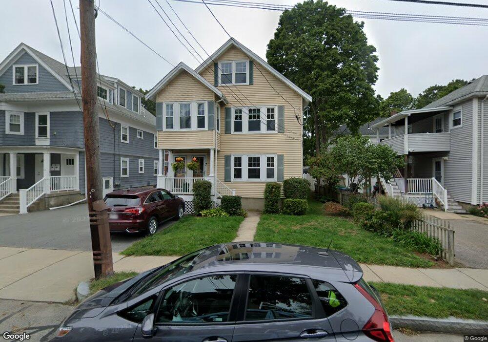
7 Perry Rd Auburndale, MA 02466
Auburndale NeighborhoodEstimated Value: $654,000 - $785,000
2
Beds
1
Bath
1,258
Sq Ft
$578/Sq Ft
Est. Value
About This Home
This home is located at 7 Perry Rd, Auburndale, MA 02466 and is currently estimated at $727,709, approximately $578 per square foot. 7 Perry Rd is a home located in Middlesex County with nearby schools including C.C. Burr, F.A. Day Middle School, and Newton North High School.
Ownership History
Date
Name
Owned For
Owner Type
Purchase Details
Closed on
Nov 25, 2002
Sold by
Dagostino Ft and Dagostino William P
Bought by
Testa M Christine
Current Estimated Value
Home Financials for this Owner
Home Financials are based on the most recent Mortgage that was taken out on this home.
Original Mortgage
$134,250
Outstanding Balance
$56,961
Interest Rate
6.07%
Mortgage Type
Purchase Money Mortgage
Estimated Equity
$670,748
Purchase Details
Closed on
Oct 28, 2002
Sold by
Dagostino Ft and Dagostino William P
Bought by
Thomas Arline A
Home Financials for this Owner
Home Financials are based on the most recent Mortgage that was taken out on this home.
Original Mortgage
$134,250
Outstanding Balance
$56,961
Interest Rate
6.07%
Mortgage Type
Purchase Money Mortgage
Estimated Equity
$670,748
Create a Home Valuation Report for This Property
The Home Valuation Report is an in-depth analysis detailing your home's value as well as a comparison with similar homes in the area
Home Values in the Area
Average Home Value in this Area
Purchase History
We collect this data history from publicly available records. To have your information removed, we recommend requesting removal directly through your county’s website.
| Date | Buyer | Sale Price | Title Company |
|---|---|---|---|
| Testa M Christine | $275,000 | -- | |
| Thomas Arline A | $275,000 | -- |
Source: Public Records
Mortgage History
We collect this data history from publicly available records. To have your information removed, we recommend requesting removal directly through your county’s website.
| Date | Status | Borrower | Loan Amount |
|---|---|---|---|
| Open | Testa M Christine | $134,250 | |
| Closed | Thomas Arline A | $134,250 |
Source: Public Records
Tax History
| Year | Tax Paid | Tax Assessment Tax Assessment Total Assessment is a certain percentage of the fair market value that is determined by local assessors to be the total taxable value of land and additions on the property. | Land | Improvement |
|---|---|---|---|---|
| 2025 | $5,875 | $599,500 | $0 | $599,500 |
| 2024 | $5,680 | $582,000 | $0 | $582,000 |
| 2023 | $5,594 | $549,500 | $0 | $549,500 |
| 2022 | $5,463 | $519,300 | $0 | $519,300 |
| 2021 | $5,271 | $489,900 | $0 | $489,900 |
| 2020 | $5,115 | $489,900 | $0 | $489,900 |
| 2019 | $4,970 | $475,600 | $0 | $475,600 |
| 2018 | $4,973 | $459,600 | $0 | $459,600 |
| 2017 | $4,822 | $433,600 | $0 | $433,600 |
| 2016 | $4,611 | $405,200 | $0 | $405,200 |
| 2015 | $4,480 | $385,900 | $0 | $385,900 |
Source: Public Records
Map
Nearby Homes
- 75 Auburn St Unit 77
- 288 Auburndale Ave Unit B
- 349 Auburndale Ave
- 440 Wolcott St
- 2031 Commonwealth Ave
- 284 Webster St
- 16 Ware Rd
- 1935 Commonwealth Ave Unit 1935
- 283 Melrose St
- 194 Auburn St Unit 2
- 90 Auburndale Ave
- 5 Rebecca Rd
- 101-103 Lexington St
- 209 Riverview Ave Unit 29
- 73 Auburn St Unit 75
- 267 River St
- 20-22 Greenough St
- 21 Rose Dr
- 32 Smith Ave
- 24 Mague Ave Unit 24
- 61-63 Newell Rd Unit 63B
- 61-63 Newell Rd Unit 63
- 61-63 Newell Rd Unit 61
- 63 Newell Rd Unit 63
- 63 Newell Rd Unit b
- 61 Newell Rd Unit 63
- 59 Newell Rd
- 77 Newell Rd
- 79 Newell Rd Unit 81
- 79 Newell Rd Unit 1
- 92 Washburn Ave
- 66 Newell Rd Unit 68
- 66 Newell Rd Unit 66
- 9 Perry Rd
- 58 Newell Rd
- 68 Washburn Ave
- 51 Newell Rd
- 70 Newell Rd Unit 72
- 90 Washburn Ave
- 88 Auburn St
Your Personal Tour Guide
Ask me questions while you tour the home.