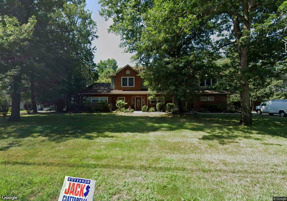
7 Soder Rd Caldwell, NJ 07006
Estimated Value: $1,214,152 - $1,419,000
Studio
--
Bath
4,033
Sq Ft
$332/Sq Ft
Est. Value
About This Home
This home is located at 7 Soder Rd, Caldwell, NJ 07006 and is currently estimated at $1,338,038, approximately $331 per square foot. 7 Soder Rd is a home located in Essex County with nearby schools including Grandview Elementary School, West Essex Middle School, and West Essex High School.
Ownership History
Date
Name
Owned For
Owner Type
Purchase Details
Closed on
Aug 7, 2020
Sold by
Asela Musibay 2016 Irrevocable Residence and Pennisi Ricky C
Bought by
Pennisi Alba
Current Estimated Value
Purchase Details
Closed on
Mar 8, 2016
Sold by
The Asela Muslbay 2014 Irrevocable Resid
Bought by
The Asela Muslbay 2016 Irrevocable Resid and Pennisi Alba
Purchase Details
Closed on
Nov 13, 2014
Sold by
Musibay Eric
Bought by
Pennisi Ricky
Create a Home Valuation Report for This Property
The Home Valuation Report is an in-depth analysis detailing your home's value as well as a comparison with similar homes in the area
Home Values in the Area
Average Home Value in this Area
Purchase History
| Date | Buyer | Sale Price | Title Company |
|---|---|---|---|
| Pennisi Alba | -- | None Listed On Document | |
| The Asela Muslbay 2016 Irrevocable Resid | -- | None Available | |
| Pennisi Ricky | -- | -- | |
| Pennisi Ricky Jr (Tr) | -- | -- |
Source: Public Records
Tax History
| Year | Tax Paid | Tax Assessment Tax Assessment Total Assessment is a certain percentage of the fair market value that is determined by local assessors to be the total taxable value of land and additions on the property. | Land | Improvement |
|---|---|---|---|---|
| 2025 | $20,094 | $889,900 | $376,000 | $513,900 |
| 2024 | $19,720 | $889,900 | $376,000 | $513,900 |
| 2022 | $19,391 | $889,900 | $376,000 | $513,900 |
| 2021 | $18,804 | $785,800 | $296,000 | $489,800 |
| 2020 | $18,663 | $785,800 | $296,000 | $489,800 |
| 2019 | $18,411 | $785,800 | $296,000 | $489,800 |
| 2018 | $18,537 | $785,800 | $296,000 | $489,800 |
| 2017 | $18,073 | $785,800 | $296,000 | $489,800 |
| 2016 | $17,665 | $785,800 | $296,000 | $489,800 |
| 2015 | $17,523 | $785,800 | $296,000 | $489,800 |
| 2014 | $17,350 | $785,800 | $296,000 | $489,800 |
Source: Public Records
Map
Nearby Homes
- 25 Stony Brook Dr
- 25 Stonybrook Dr
- 5 Robin Hill Rd
- 3 Harding Ave
- 368 Central Ave
- 33 Coolidge Ave
- 33 Laurel Place
- 28 Arbor Rd
- 451 Mountain Ave
- 66 Elmwood Terrace
- 5 Pin Oak Rd
- 116 Mountain Ave
- 122 Westover Ave
- 17 Brentwood Dr
- 98 Forest Ave
- 66 Park Ave
- 6 Colony Dr
- 51 Brookside Terrace
- 71 Schindler Way
- 34 Aspen Dr
- 9 Soder Rd
- 5 Soder Rd
- 21 Stonybrook Dr
- 11 Soder Rd
- 23 Stonybrook Dr
- 23 Stony Brook Dr
- 19 Stonybrook Dr
- 12 Andover Dr
- 13 Soder Rd
- 18 Stony Brook Dr
- 18 Stonybrook Dr
- 18 Stonybrook Cir
- 18 Stonybrook Dr Unit 2
- 18 Stonybrook Dr Unit 2
- 3 Soder Rd
- 8 Soder Rd
- 4 Soder Rd
- 17 Stonybrook Cir
- 11 Andover Dr
- 17 Stonybrook Dr
Your Personal Tour Guide
Ask me questions while you tour the home.