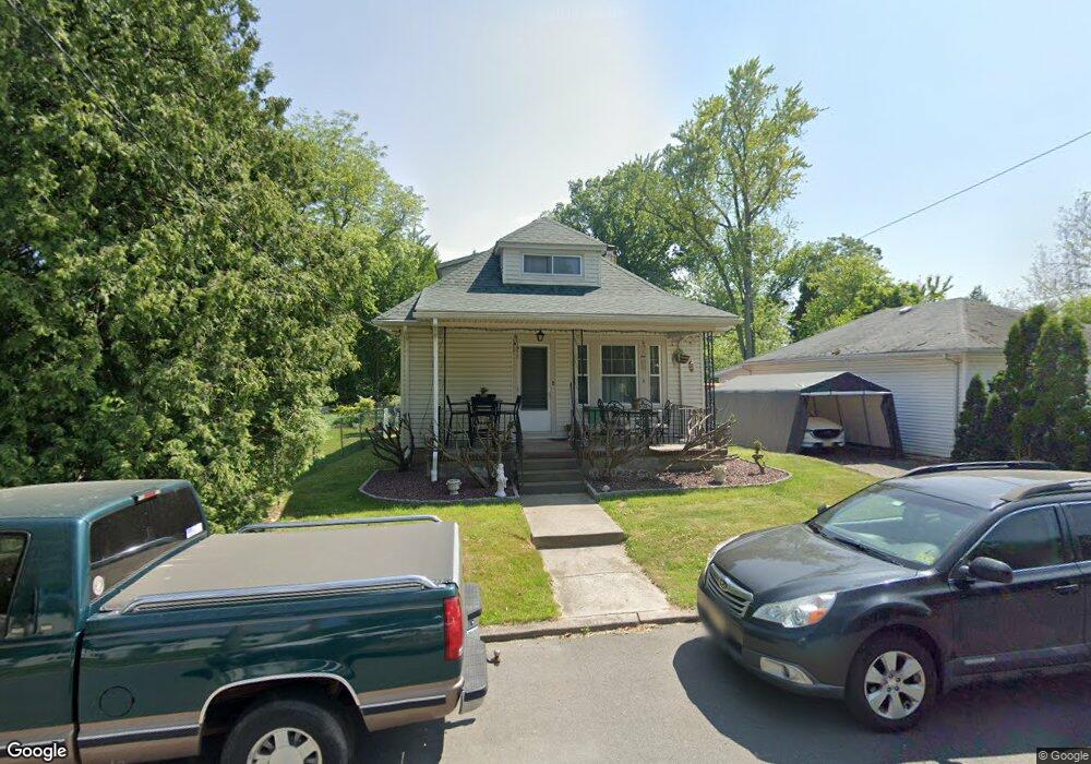
7 Stuart Ave Ewing, NJ 08638
Ewingville NeighborhoodEstimated Value: $275,817 - $417,000
Studio
--
Bath
928
Sq Ft
$397/Sq Ft
Est. Value
About This Home
This home is located at 7 Stuart Ave, Ewing, NJ 08638 and is currently estimated at $368,704, approximately $397 per square foot. 7 Stuart Ave is a home located in Mercer County with nearby schools including Ewing High School, Trenton Stem-To-Civics Charter School, and Guidepost Montessori at Lawrenceville.
Ownership History
Date
Name
Owned For
Owner Type
Purchase Details
Closed on
Aug 29, 2025
Sold by
Applebaum Marcia L and Fisher Marcia L
Bought by
Fisher Joseph V
Current Estimated Value
Purchase Details
Closed on
Mar 30, 1995
Sold by
Sonntag Nellie
Bought by
Applebaum Marcia
Home Financials for this Owner
Home Financials are based on the most recent Mortgage that was taken out on this home.
Original Mortgage
$110,000
Interest Rate
8.66%
Create a Home Valuation Report for This Property
The Home Valuation Report is an in-depth analysis detailing your home's value as well as a comparison with similar homes in the area
Home Values in the Area
Average Home Value in this Area
Purchase History
| Date | Buyer | Sale Price | Title Company |
|---|---|---|---|
| Fisher Joseph V | -- | None Listed On Document | |
| Applebaum Marcia | $122,500 | -- |
Source: Public Records
Mortgage History
| Date | Status | Borrower | Loan Amount |
|---|---|---|---|
| Previous Owner | Applebaum Marcia | $110,000 |
Source: Public Records
Tax History
| Year | Tax Paid | Tax Assessment Tax Assessment Total Assessment is a certain percentage of the fair market value that is determined by local assessors to be the total taxable value of land and additions on the property. | Land | Improvement |
|---|---|---|---|---|
| 2025 | $7,040 | $179,000 | $72,600 | $106,400 |
| 2024 | $6,618 | $179,000 | $72,600 | $106,400 |
| 2023 | $6,618 | $179,000 | $72,600 | $106,400 |
| 2022 | $6,439 | $179,000 | $72,600 | $106,400 |
| 2021 | $6,281 | $179,000 | $72,600 | $106,400 |
| 2020 | $6,192 | $179,000 | $72,600 | $106,400 |
| 2019 | $6,031 | $179,000 | $72,600 | $106,400 |
| 2018 | $6,275 | $118,800 | $49,000 | $69,800 |
| 2017 | $6,421 | $118,800 | $49,000 | $69,800 |
| 2016 | $6,334 | $118,800 | $49,000 | $69,800 |
| 2015 | $6,250 | $118,800 | $49,000 | $69,800 |
| 2014 | $6,233 | $118,800 | $49,000 | $69,800 |
Source: Public Records
Map
Nearby Homes
- 30 Upper Ferry Rd
- 27 Bayberry Rd
- 2148 Pennington Rd
- 13 Hickory Hill Dr
- 53 Carlton Ave
- 108 Susan Dr
- 20 Corey Dr
- 3 Beth Ann Way
- 2 Rockleigh Dr
- 34 Lopatcong Dr
- 41 Harding St
- 235 Masterson Ct
- 222 Masterson Ct
- 146 Masterson Ct
- 231 Masterson Ct
- 1247 Lower Ferry Rd
- 360 Hollowbrook Rd
- 2 Sparrow Ct
- 11 Metekunk Dr
- 19 van Saun Dr
- 31 Clement Ave
- 9 Stuart Ave
- 2070 Pennington Rd
- 2072 Pennington Rd
- 2068 Pennington Rd
- 2064 Pennington Rd
- 25 Clement Ave
- 2076 Pennington Rd
- 2062 Pennington Rd
- 2078 Pennington Rd
- 12 Stuart Ave
- 23 Clement Ave
- 2060 Pennington Rd
- 14 Stuart Ave
- 18 Stuart Ave
- 2080 Pennington Rd
- 17 Clement Ave
- 30 Clement Ave
- 34 Clement Ave
- 2082 Pennington Rd
Your Personal Tour Guide
Ask me questions while you tour the home.