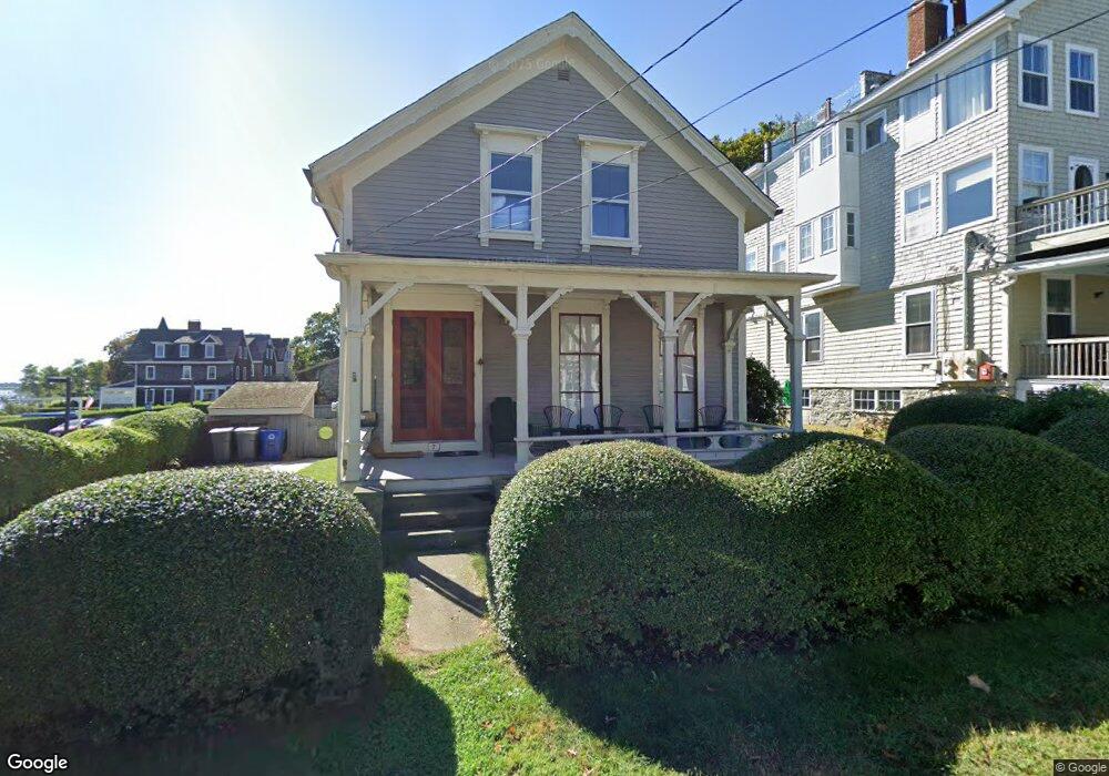
7 Union St Jamestown, RI 02835
Jamestown Village NeighborhoodEstimated Value: $1,337,000 - $1,422,000
About This Home
This home is located at 7 Union St, Jamestown, RI 02835 and is currently estimated at $1,376,496, approximately $703 per square foot. 7 Union St is a home located in Newport County with nearby schools including Melrose Avenue School and Lawn Avenue School.
Ownership History
We collect this data history from publicly available records. To have your information removed, we recommend requesting removal directly through your county’s website.
Purchase Details
Purchase Details
Home Values in the Area
Average Home Value in this Area
Purchase History
We collect this data history from publicly available records. To have your information removed, we recommend requesting removal directly through your county’s website.
| Date | Buyer | Sale Price | Title Company |
|---|---|---|---|
| -- | -- | ||
| -- | -- |
Mortgage History
We collect this data history from publicly available records. To have your information removed, we recommend requesting removal directly through your county’s website.
| Date | Status | Borrower | Loan Amount |
|---|---|---|---|
| Previous Owner | $100,000 | ||
| Previous Owner | $144,000 |
Tax History
We collect this data history from publicly available records. To have your information removed, we recommend requesting removal directly through your county’s website.
| Year | Tax Paid | Tax Assessment Tax Assessment Total Assessment is a certain percentage of the fair market value that is determined by local assessors to be the total taxable value of land and additions on the property. | Land | Improvement |
|---|---|---|---|---|
| 2025 | $7,039 | $1,248,000 | $823,000 | $425,000 |
| 2024 | $6,951 | $969,400 | $623,900 | $345,500 |
| 2023 | $6,766 | $969,400 | $623,900 | $345,500 |
| 2022 | $6,582 | $969,400 | $623,900 | $345,500 |
| 2021 | $6,494 | $784,300 | $486,000 | $298,300 |
| 2020 | $6,329 | $784,300 | $486,000 | $298,300 |
| 2019 | $6,314 | $784,300 | $486,000 | $298,300 |
| 2018 | $4,523 | $511,100 | $254,100 | $257,000 |
| 2017 | $4,426 | $511,100 | $254,100 | $257,000 |
| 2016 | $4,385 | $511,100 | $254,100 | $257,000 |
| 2015 | $4,363 | $496,900 | $282,200 | $214,700 |
| 2014 | $4,348 | $496,900 | $282,200 | $214,700 |
Map
- 30 Walcott Ave
- 78 Narragansett Ave
- 30 Standish Rd
- 3 Fowler St
- 48 Grinnell St
- 82 Clinton Ave
- 42 Windsor St
- 22 Southwest Ave
- 24 Southwest Ave
- 9 Spring St
- 38 Pierce Ave
- 65 Blueberry Ln
- 345 Highland Dr
- 150 Bay View Dr Unit 14
- 150 Bay View Dr Unit 8
- 150 Bay View Dr Unit 2
- 150 Bay View Dr Unit 4
- 150 Bay View Dr Unit 1
- 150 Bay View Dr Unit 9
- 150 Bay View Dr Unit 19
Ask me questions while you tour the home.