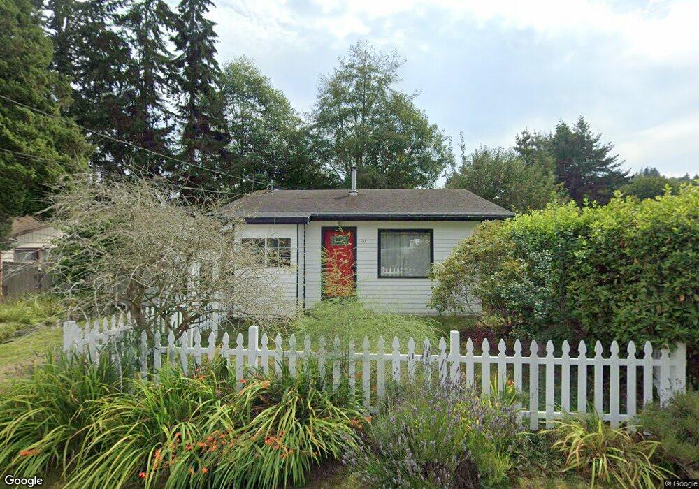
70 E Spruce St Port Ludlow, WA 98365
Estimated Value: $308,000 - $501,000
2
Beds
1
Bath
1,206
Sq Ft
$348/Sq Ft
Est. Value
About This Home
This home is located at 70 E Spruce St, Port Ludlow, WA 98365 and is currently estimated at $419,317, approximately $347 per square foot. 70 E Spruce St is a home located in Jefferson County with nearby schools including Chimacum Creek Primary School, Chimacum School Pi Program, and Chimacum Elementary School.
Ownership History
Date
Name
Owned For
Owner Type
Purchase Details
Closed on
Jun 28, 2007
Sold by
Brown Christi Lynn
Bought by
Pendleton John Eric and Wright Theresa Elizabeth
Current Estimated Value
Purchase Details
Closed on
Jul 18, 2005
Sold by
Rogers Michael P and Rogers Cathy C
Bought by
Brown Christi Lynn
Home Financials for this Owner
Home Financials are based on the most recent Mortgage that was taken out on this home.
Original Mortgage
$34,600
Interest Rate
5.56%
Mortgage Type
Stand Alone Second
Create a Home Valuation Report for This Property
The Home Valuation Report is an in-depth analysis detailing your home's value as well as a comparison with similar homes in the area
Purchase History
| Date | Buyer | Sale Price | Title Company |
|---|---|---|---|
| Pendleton John Eric | $219,000 | None Available | |
| Brown Christi Lynn | $173,000 | First American Title |
Source: Public Records
Mortgage History
| Date | Status | Borrower | Loan Amount |
|---|---|---|---|
| Previous Owner | Brown Christi Lynn | $34,600 |
Source: Public Records
Tax History
| Year | Tax Paid | Tax Assessment Tax Assessment Total Assessment is a certain percentage of the fair market value that is determined by local assessors to be the total taxable value of land and additions on the property. | Land | Improvement |
|---|---|---|---|---|
| 2025 | $2,467 | $301,369 | $71,925 | $229,444 |
| 2024 | $2,283 | $301,369 | $71,925 | $229,444 |
| 2023 | $1,030 | $282,514 | $63,500 | $219,014 |
| 2022 | $2,098 | $277,514 | $58,500 | $219,014 |
| 2021 | $2,223 | $223,998 | $43,200 | $180,798 |
| 2020 | $2,051 | $223,998 | $43,200 | $180,798 |
| 2019 | $1,950 | $199,536 | $39,600 | $159,936 |
| 2018 | $2,015 | $190,783 | $37,800 | $152,983 |
| 2017 | $1,966 | $175,075 | $36,000 | $139,075 |
| 2016 | $1,919 | $175,075 | $36,000 | $139,075 |
| 2015 | $1,891 | $170,474 | $31,000 | $139,474 |
| 2014 | -- | $170,474 | $31,000 | $139,474 |
| 2013 | -- | $170,475 | $31,000 | $139,475 |
Source: Public Records
Map
Nearby Homes
- 3740 Paradise Bay Rd
- 0 Hill St
- 15 White Rock Ln
- 54 Ship View Ct
- 212 Tala Shore Dr
- 877 Bywater Way
- 610 Tala Shore Dr
- 0 xxx E Tala Shore Dr
- 63 Red Cedar Ln
- 644 & 634 Bywater Way
- 11 McCartney Peak Ln Unit 78
- 31 McCartney Peak Ln
- 31 McCartney Peak Ln Unit 76
- 90 McCartney Peak Ln Unit 70
- 90 Mccartney Ln
- 80 McCartney Peak Ln Unit 69
- 80 McCartney Peak Ln
- 70 McCartney Peak Ln Unit 68
- 70 McCartney Peak Ln
- 60 McCartney Peak Ln Unit 67
- 90 E Spruce St
- 71 E Hemlock St
- 91 E Hemlock St
- 40 E Spruce St
- 30 E Spruce St
- 130 E Spruce St
- 51 E Spruce St
- 51 E Spruce St
- 50 E Alder St
- 141 E Hemlock St
- 60 E Hemlock St
- 50 E Hemlock St
- 21 E Spruce St
- 100 E Hemlock St
- 0 W Spruce St
- 120 E Alder St
- 30 E Hemlock St
- 21 E Hemlock St
- 214 Shore Dr
- 150 Shore Dr
Your Personal Tour Guide
Ask me questions while you tour the home.