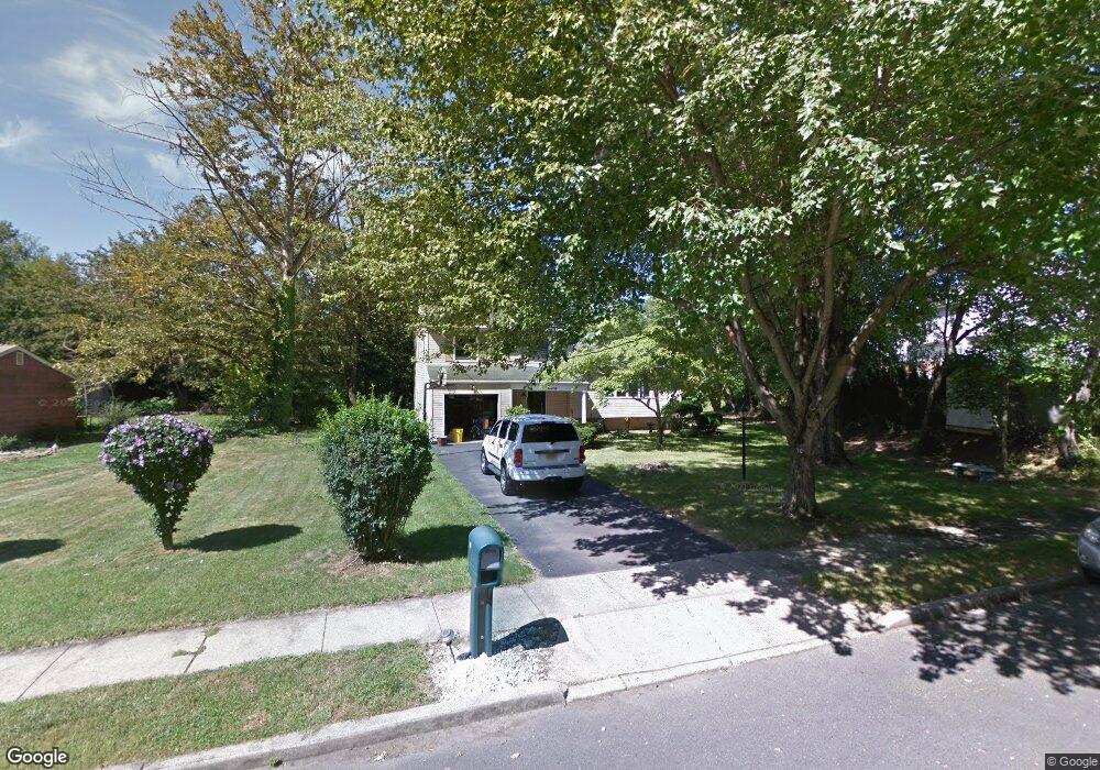
70 Maple Stream Rd East Windsor, NJ 08520
Estimated Value: $567,646 - $646,000
Studio
--
Bath
1,872
Sq Ft
$322/Sq Ft
Est. Value
About This Home
This home is located at 70 Maple Stream Rd, East Windsor, NJ 08520 and is currently estimated at $603,162, approximately $322 per square foot. 70 Maple Stream Rd is a home located in Mercer County with nearby schools including Melvin H. Kreps Middle School, Hightstown High School, and E Windsor Knowledge Beginnings.
Ownership History
Date
Name
Owned For
Owner Type
Purchase Details
Closed on
Jun 6, 2000
Sold by
Rizvi Nazar
Bought by
Clark Wayne and Clark Leslie
Current Estimated Value
Home Financials for this Owner
Home Financials are based on the most recent Mortgage that was taken out on this home.
Original Mortgage
$146,400
Outstanding Balance
$52,567
Interest Rate
8.48%
Estimated Equity
$550,595
Purchase Details
Closed on
Aug 22, 1996
Sold by
Mcguire John
Bought by
Rizvi Nazar and Nizvi Farah
Home Financials for this Owner
Home Financials are based on the most recent Mortgage that was taken out on this home.
Original Mortgage
$128,000
Interest Rate
8.18%
Purchase Details
Closed on
Jul 18, 1996
Sold by
Schneider Charles
Bought by
Mcguire John
Home Financials for this Owner
Home Financials are based on the most recent Mortgage that was taken out on this home.
Original Mortgage
$128,000
Interest Rate
8.18%
Create a Home Valuation Report for This Property
The Home Valuation Report is an in-depth analysis detailing your home's value as well as a comparison with similar homes in the area
Home Values in the Area
Average Home Value in this Area
Purchase History
We collect this data history from publicly available records. To have your information removed, we recommend requesting removal directly through your county’s website.
| Date | Buyer | Sale Price | Title Company |
|---|---|---|---|
| Clark Wayne | $183,000 | -- | |
| Rizvi Nazar | $142,500 | -- | |
| Mcguire John | $123,500 | -- |
Source: Public Records
Mortgage History
We collect this data history from publicly available records. To have your information removed, we recommend requesting removal directly through your county’s website.
| Date | Status | Borrower | Loan Amount |
|---|---|---|---|
| Open | Clark Wayne | $146,400 | |
| Previous Owner | Rizvi Nazar | $128,000 |
Source: Public Records
Tax History
| Year | Tax Paid | Tax Assessment Tax Assessment Total Assessment is a certain percentage of the fair market value that is determined by local assessors to be the total taxable value of land and additions on the property. | Land | Improvement |
|---|---|---|---|---|
| 2025 | $12,555 | $337,500 | $174,900 | $162,600 |
| 2024 | $11,887 | $337,500 | $174,900 | $162,600 |
| 2023 | $11,887 | $337,500 | $174,900 | $162,600 |
| 2022 | $11,580 | $337,500 | $174,900 | $162,600 |
| 2021 | $11,495 | $337,500 | $174,900 | $162,600 |
| 2020 | $11,509 | $337,500 | $174,900 | $162,600 |
| 2019 | $11,404 | $337,500 | $174,900 | $162,600 |
| 2018 | $11,256 | $337,500 | $174,900 | $162,600 |
| 2017 | $11,246 | $337,500 | $174,900 | $162,600 |
| 2016 | $11,087 | $337,500 | $174,900 | $162,600 |
| 2015 | $10,871 | $337,500 | $174,900 | $162,600 |
| 2014 | $10,743 | $337,500 | $174,900 | $162,600 |
Source: Public Records
Map
Nearby Homes
- 260 Dutch Neck Rd
- 20 Wilmor Dr
- 5 Charred Oak La
- 441 Dutch Neck Rd
- 454 Dutch Neck Rd
- 66 Chatham Ct
- 13 Chatham Ct
- 64 Cypress Dr
- 2 Wickham Ln
- 65 Allison Rd
- 102 Teal Ct
- 98 Winchester Dr
- 109 Pebble Rd
- 29 Allison Rd
- 33 Spyglass Ct
- 17 Vintage Dr
- 18 Geraldine Rd
- 138 the Orchards Unit C
- 121 The Orchard Unit I
- 116 I the Orchards Unit "I"
Your Personal Tour Guide
Ask me questions while you tour the home.