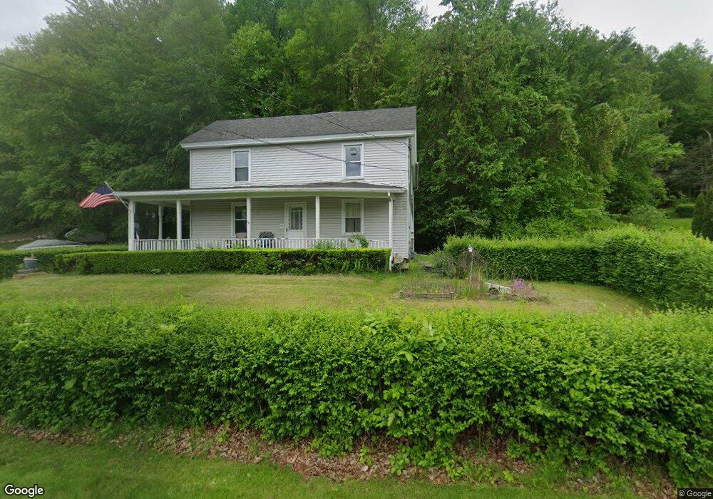
70 Whitaker Rd Westfield, MA 01085
Estimated Value: $332,000 - $416,000
5
Beds
2
Baths
2,256
Sq Ft
$162/Sq Ft
Est. Value
About This Home
This home is located at 70 Whitaker Rd, Westfield, MA 01085 and is currently estimated at $365,616, approximately $162 per square foot. 70 Whitaker Rd is a home located in Hampden County with nearby schools including Westfield High School and Saint Mary High School.
Ownership History
Date
Name
Owned For
Owner Type
Purchase Details
Closed on
Jan 13, 2012
Sold by
Kantos Peter
Bought by
Ekc Properties Llc
Current Estimated Value
Purchase Details
Closed on
Aug 11, 1995
Sold by
Sunnyside Corp
Bought by
Kantos Peter E
Home Financials for this Owner
Home Financials are based on the most recent Mortgage that was taken out on this home.
Original Mortgage
$109,250
Interest Rate
7.48%
Mortgage Type
Purchase Money Mortgage
Purchase Details
Closed on
Oct 14, 1994
Sold by
Krawczyk Joseph S and Krawczyk Priscilla B
Bought by
Sunnyside Corp
Home Financials for this Owner
Home Financials are based on the most recent Mortgage that was taken out on this home.
Original Mortgage
$95,000
Interest Rate
8.43%
Mortgage Type
Purchase Money Mortgage
Create a Home Valuation Report for This Property
The Home Valuation Report is an in-depth analysis detailing your home's value as well as a comparison with similar homes in the area
Home Values in the Area
Average Home Value in this Area
Purchase History
| Date | Buyer | Sale Price | Title Company |
|---|---|---|---|
| Ekc Properties Llc | -- | -- | |
| Kantos Peter E | $115,000 | -- | |
| Sunnyside Corp | $130,000 | -- |
Source: Public Records
Mortgage History
| Date | Status | Borrower | Loan Amount |
|---|---|---|---|
| Previous Owner | Sunnyside Corp | $145,000 | |
| Previous Owner | Sunnyside Corp | $109,250 | |
| Previous Owner | Sunnyside Corp | $95,000 |
Source: Public Records
Tax History
| Year | Tax Paid | Tax Assessment Tax Assessment Total Assessment is a certain percentage of the fair market value that is determined by local assessors to be the total taxable value of land and additions on the property. | Land | Improvement |
|---|---|---|---|---|
| 2025 | $4,756 | $313,300 | $137,200 | $176,100 |
| 2024 | $4,682 | $293,200 | $125,200 | $168,000 |
| 2023 | $4,465 | $267,300 | $118,800 | $148,500 |
| 2022 | $4,465 | $241,500 | $106,000 | $135,500 |
| 2021 | $4,325 | $229,100 | $100,000 | $129,100 |
| 2020 | $4,222 | $219,300 | $100,000 | $119,300 |
| 2019 | $4,133 | $210,100 | $95,600 | $114,500 |
| 2018 | $3,754 | $193,900 | $95,600 | $98,300 |
| 2017 | $3,725 | $191,800 | $96,800 | $95,000 |
| 2016 | $3,729 | $191,800 | $96,800 | $95,000 |
| 2015 | $3,688 | $198,900 | $96,800 | $102,100 |
| 2014 | $2,757 | $198,900 | $96,800 | $102,100 |
Source: Public Records
Map
Nearby Homes
- 0 Fox Hill Dr
- 12 Woodland Rd
- 324 Russell Rd Unit 204
- 324 Russell Rd Unit 109
- 26 Hayre St
- 42 Putnam Dr
- 180 Russell Rd
- 74 S Maple St
- 70 S Maple St
- 145 Honey Pot Rd
- 44 Llewellyn Dr
- 240 Hillside Rd
- 16 Squawfield Rd
- 25 Tannery Rd Unit 6A
- 32 Allen Ave
- 2 Sugar Maple Ln
- 44 Tannery Rd
- 112 Sunnyside Rd
- 42R Jefferson St
- 7 Washington St
- Lot 3 Whitaker Rd
- 71 Whitaker Rd
- 77 Whitaker Rd
- 84 Whitaker Rd
- 65 Whitaker Rd
- 64 Whitaker Rd
- 88 Whitaker Rd
- 83 Whitaker Rd
- 66 Whitaker Rd
- 97 Whitaker Rd
- 100 Whitaker Rd
- 69 City View Blvd
- 101 Whitaker Rd
- 36 Fox Hill Dr
- 37 Sackett Rd
- 37 Sackett Rd
- 61 Yankee Cir
- 75 City View Blvd
- 110 Whitaker Rd
- 89 City View Blvd
Your Personal Tour Guide
Ask me questions while you tour the home.