70 Williston Rd Brookline, MA 02445
Washington Square NeighborhoodEstimated Value: $2,848,000 - $3,290,000
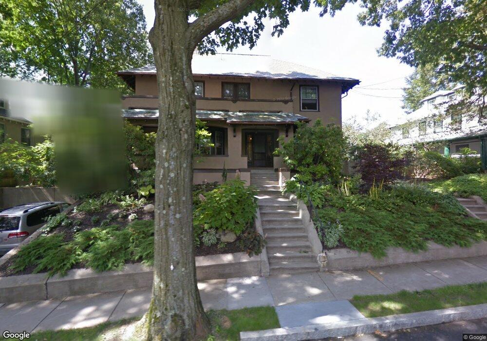
About This Home
This home is located at 70 Williston Rd, Brookline, MA 02445 and is currently estimated at $3,048,614, approximately $963 per square foot. 70 Williston Rd is a home located in Norfolk County with nearby schools including Michael Driscoll, Brookline High School, and Boston Green Academy Horace Mann Charter School.
Ownership History
We collect this data history from publicly available records. To have your information removed, we recommend requesting removal directly through your county’s website.
Purchase Details
Purchase Details
Home Values in the Area
Average Home Value in this Area
Purchase History
We collect this data history from publicly available records. To have your information removed, we recommend requesting removal directly through your county’s website.
| Date | Buyer | Sale Price | Title Company |
|---|---|---|---|
| -- | None Available | ||
| $1,348,700 | -- |
Mortgage History
We collect this data history from publicly available records. To have your information removed, we recommend requesting removal directly through your county’s website.
| Date | Status | Borrower | Loan Amount |
|---|---|---|---|
| Previous Owner | $710,000 | ||
| Previous Owner | $500,000 | ||
| Previous Owner | $831,500 | ||
| Previous Owner | $817,000 | ||
| Previous Owner | $821,000 | ||
| Previous Owner | $164,700 | ||
| Previous Owner | $160,000 |
Tax History
We collect this data history from publicly available records. To have your information removed, we recommend requesting removal directly through your county’s website.
| Year | Tax Paid | Tax Assessment Tax Assessment Total Assessment is a certain percentage of the fair market value that is determined by local assessors to be the total taxable value of land and additions on the property. | Land | Improvement |
|---|---|---|---|---|
| 2025 | $30,340 | $3,074,000 | $1,561,600 | $1,512,400 |
| 2024 | $28,903 | $2,958,300 | $1,501,500 | $1,456,800 |
| 2023 | $27,793 | $2,787,700 | $1,387,400 | $1,400,300 |
| 2022 | $27,054 | $2,655,000 | $1,321,300 | $1,333,700 |
| 2021 | $25,018 | $2,552,900 | $1,270,500 | $1,282,400 |
| 2020 | $22,873 | $2,420,400 | $1,155,000 | $1,265,400 |
| 2019 | $21,599 | $2,305,100 | $1,100,000 | $1,205,100 |
| 2018 | $18,375 | $1,942,400 | $774,600 | $1,167,800 |
| 2017 | $18,104 | $1,832,400 | $730,800 | $1,101,600 |
| 2016 | $16,658 | $1,598,700 | $569,100 | $1,029,600 |
| 2015 | $15,827 | $1,481,900 | $531,900 | $950,000 |
| 2014 | $16,554 | $1,453,400 | $483,600 | $969,800 |
Map
- 29 Mount Hood Rd Unit 8
- 45 Bartlett Crescent Unit 202
- 45 Bartlett Crescent Unit 201
- 45 Bartlett Crescent Unit 203
- 45 Bartlett Crescent Unit 104
- 45 Bartlett Crescent Unit 105
- 35 Mount Hood Rd Unit 7
- 1762 Beacon St Unit 4
- 9 Bartlett Crescent Unit 1
- 1774 Beacon St Unit 6
- 1778 Beacon St Unit 302
- 84 Westbourne Terrace Unit 84
- 1650 Commonwealth Ave Unit 304
- 1650 Commonwealth Ave Unit 605
- 1650 Commonwealth Ave Unit 302
- 1650 Commonwealth Ave Unit 505
- 1731 Beacon St Unit 520
- 1731 Beacon St Unit 202
- 1731 Beacon St Unit 119
- 1731 Beacon St Unit 508
Ask me questions while you tour the home.