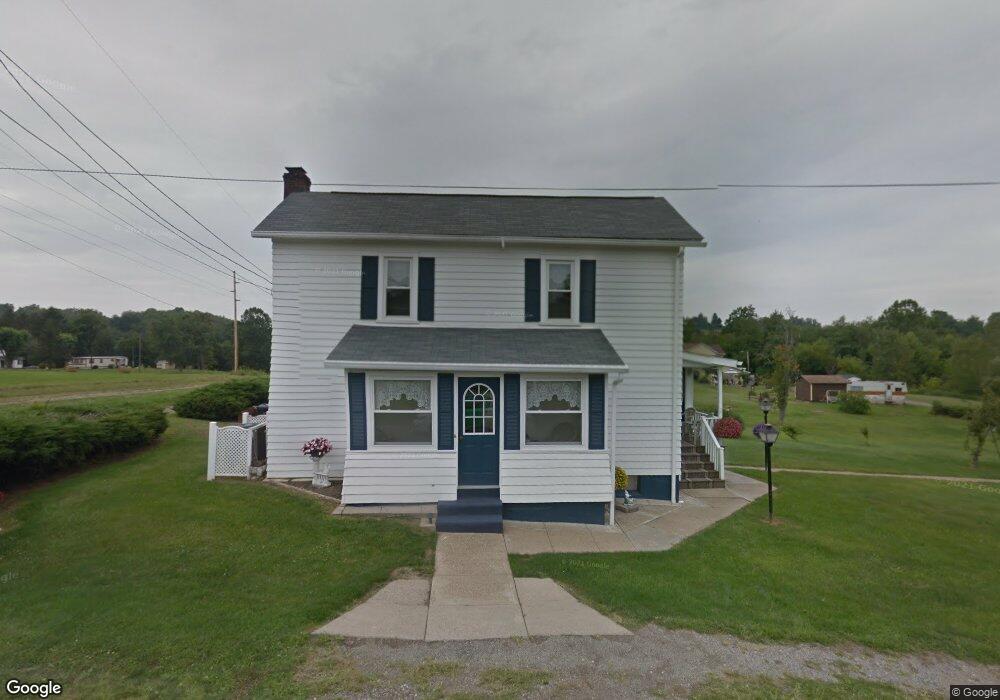
70002 2nd St Flushing, OH 43977
Estimated Value: $73,000 - $119,000
3
Beds
1
Bath
1,358
Sq Ft
$69/Sq Ft
Est. Value
About This Home
This home is located at 70002 2nd St, Flushing, OH 43977 and is currently estimated at $93,520, approximately $68 per square foot. 70002 2nd St is a home with nearby schools including Union Local Elementary School, Union Local Middle School, and Union Local High School.
Ownership History
Date
Name
Owned For
Owner Type
Purchase Details
Closed on
Jan 20, 2026
Sold by
Burlenski Edward L
Bought by
Burlenski Robert A
Current Estimated Value
Purchase Details
Closed on
Dec 14, 2020
Bought by
Kelsay Breann Garvin
Home Financials for this Owner
Home Financials are based on the most recent Mortgage that was taken out on this home.
Interest Rate
2.71%
Purchase Details
Closed on
Apr 12, 2018
Sold by
Burlenski Chester and Burlenski Alberta M
Bought by
Burlenski Chester
Purchase Details
Closed on
Jan 1, 1987
Sold by
Burlenski Chester and Burlenski Al
Bought by
Burlenski Chester and Burlenski Al
Create a Home Valuation Report for This Property
The Home Valuation Report is an in-depth analysis detailing your home's value as well as a comparison with similar homes in the area
Purchase History
| Date | Buyer | Sale Price | Title Company |
|---|---|---|---|
| Burlenski Robert A | -- | None Listed On Document | |
| Kelsay Breann Garvin | $125,000 | -- | |
| Burlenski Chester | -- | None Available | |
| Burlenski Chester | -- | -- |
Source: Public Records
Mortgage History
| Date | Status | Borrower | Loan Amount |
|---|---|---|---|
| Previous Owner | Kelsay Breann Garvin | -- |
Source: Public Records
Tax History
| Year | Tax Paid | Tax Assessment Tax Assessment Total Assessment is a certain percentage of the fair market value that is determined by local assessors to be the total taxable value of land and additions on the property. | Land | Improvement |
|---|---|---|---|---|
| 2025 | $520 | $16,270 | $2,410 | $13,860 |
| 2024 | $512 | $16,270 | $2,410 | $13,860 |
| 2023 | $598 | $18,210 | $1,790 | $16,420 |
| 2022 | $598 | $18,214 | $1,792 | $16,422 |
| 2021 | $303 | $18,221 | $1,795 | $16,426 |
| 2020 | $237 | $15,840 | $1,560 | $14,280 |
| 2019 | $240 | $15,840 | $1,560 | $14,280 |
| 2018 | $231 | $15,840 | $1,560 | $14,280 |
| 2017 | $222 | $15,090 | $1,560 | $13,530 |
| 2016 | $227 | $15,090 | $1,560 | $13,530 |
| 2015 | $233 | $15,090 | $1,560 | $13,530 |
| 2014 | $257 | $15,660 | $1,420 | $14,240 |
| 2013 | $242 | $15,660 | $1,420 | $14,240 |
Source: Public Records
Map
Nearby Homes
- 19 acres Saffell Rd
- 15 acres Saffell Rd
- 35 acres Saffell Rd
- 70090 Main St
- 68895 Lloydsville Bannock Rd
- 0 Moriah Dr Unit 5177567
- 44701 Springbrook Dr
- 67174 Pancoast Rd S
- 44290 Denise Ln
- 41152 Black Oak Rd
- INLOT 19 Havenwood
- 117 A&B High St
- 0 Watson Rd Unit 5068291
- 125 Chaplins Ln
- 39775 Rosemary Camp Rd
- 66164 Belmont Morristown Rd
- 67137 Airport Rd
- 67755 W Almar Ln
- Lot 78/79 Mills Rd
- 70331 Provident Fairpoint Rd
- 70005 Second St
- 70009 2nd St
- 43218 Front St
- 70031 First St
- 70031 1st St
- 43238 Front St
- 43238 Front St
- 70010 First St Lafferty
- 70042 First St
- 43248 Front St
- 70058 1st St
- 43038 Pine St
- 43038 Pine St
- 43128 Pine St
- 43106 Pine St
- 43106 Pine St
- 43126 Mount Hope Rd
- V/L Twp 394
- 43140 Mt Hope Rd
- 43140 Mount Hope Rd
Your Personal Tour Guide
Ask me questions while you tour the home.